
THE Flood Warning for North Morecambe Bay coast - including Roosebeck, Canal Foot, East Plain Farm and Arnside - is no longer in force.
Police have said that the B5282 in the area of Storth is now open, after being closed earlier due to high tides.
Flood alerts are still in place for the coast at Barrow-in-Furness, North Morecambe Bay, the Duddon Estuary, Silloth to St. Bees and Gretna to Silloth.
Cumbria County Council’s highways maintenance teams have managed to reopen some of the roads affected by severe weather yesterday but some require more major clear-up work and remain closed.
The combination of exceptionally strong winds, severe rainfall and high tides has left tonnes of debris on some roads, with council engineers currently assessing the level of damage.
Dubmill Point to Silloth remains closed and needs a full structural inspection due to the damage caused - it will remain closed until at least Monday.
Sandside Road is closed both ways due to debris on the road and flooding between Black Dyke Road and A6 Church Street / B6384 Main Street.
Hardknott Pass and Wrynose Pass remain closed due to ice and snow.
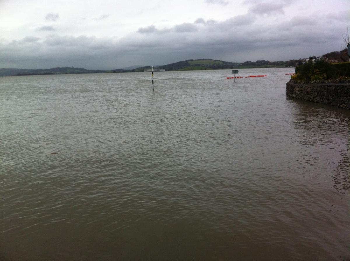
Yesterday, strong winds and high tides saw roads flooded and promenades breached as South Lakeland, Cumbria and North Lancashire were lashed by heavy rain.
At Roa Island near Barrow, the afternoon's high tide breached the causeway connecting the island to Rampside - sending a boat onto the road.
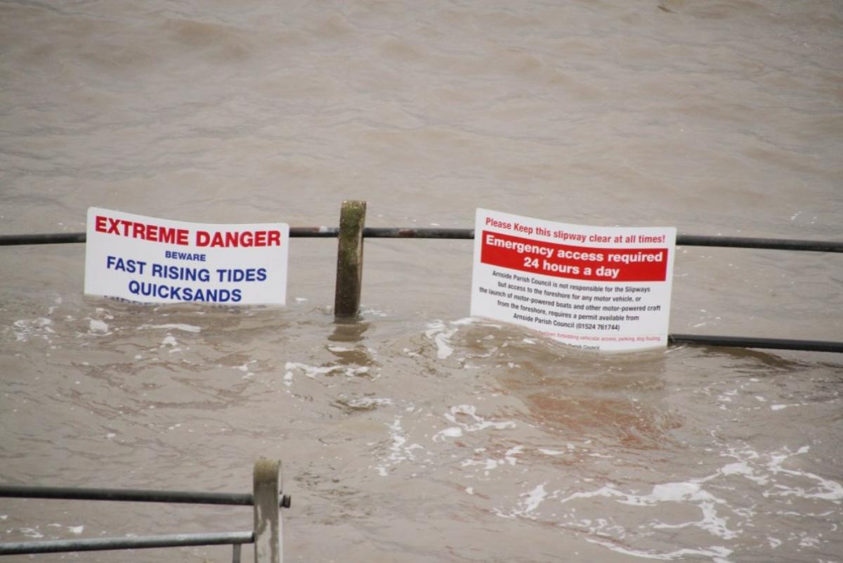
At Grange-over-Sands, debris was washed on to the promenade while at Arnside parts of the Promenade were breached by strong waves and Sandside was again overtopped by water.
For the Lake District, the Met Office expects that between now and February 5, there is a high chance of storm force winds, gales, severe chills, and persistent and extensive hill fog on the fells.
The risk of blizzards on the fells is said to be medium and the risk of heavy persistent rain is low.
Flood warnings in our region
FLOOD ALERT
- Coastline at Barrow-in-Furness
- Coast from Silloth to St Bees
- Coastline from Gretna to Silloth
- Coast at North Morecambe Bay
- Duddon Estuary
WARNINGS NO LONGER IN FORCE
• Gretna to Silloth including Port Carlisle, Skinburness and Rockcliffe
- North Morecambe Bay including Roosebeck, Canal Foot, East Plain Farm, Arnside
- Silloth to St Bees including Maryport, Flimby, Workington and Whitehaven
- Barrow-in-Furness including West Shore Park, Biggar Bank Road, Tummer Hill Marshes, Rampside and Roa Island, Vickerstown and Cavendish Dock
- St Bees Head to Millom including Seascale, Ranenglass, Saltcoats and Haverigg
- Coastline from Heysham to Carnforth
- Coastal roads and promenades, sewage works and a large number of properties in the eastern side of Lytham and in Saltcotes and Warton


Comments: Our rules
We want our comments to be a lively and valuable part of our community - a place where readers can debate and engage with the most important local issues. The ability to comment on our stories is a privilege, not a right, however, and that privilege may be withdrawn if it is abused or misused.
Please report any comments that break our rules.
Read the rules here