

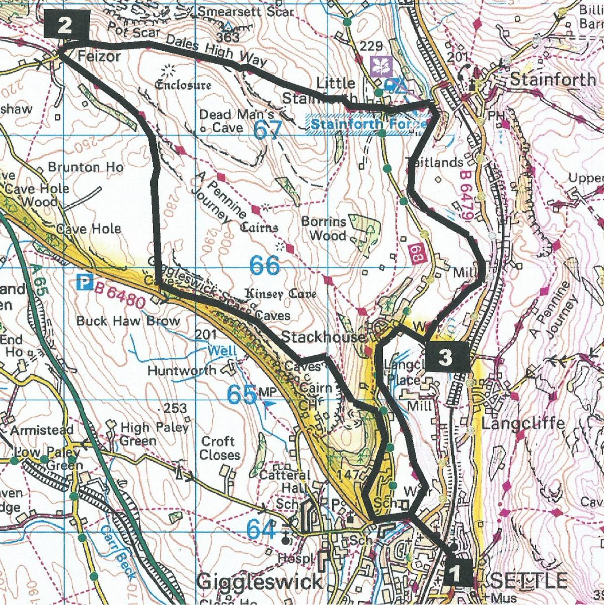
Giggleswick Scar by John Edmondson
An advantage of being in the Kendal area is that it provides easy access to a wide range of countryside; in particular with the Lake District to the west and the Yorkshire Dales to the east. This walk goes from Settle in North Yorkshire, ascends Giggleswick Scar and visits the hamlet of Feizor, where there is an opportunity to visit a popular tearoom before returning across the fells to Stainforth and alongside the attractive River Ribble. Start from the town car park next to the filling station on Church Street (grid reference SD 819 638).
Information:
Distance: 8 miles, ascent: 1,100 feet
Time: 5 hours
Terrain: rough footpaths and some open moorland
Map: OS Explorer OL2
Route
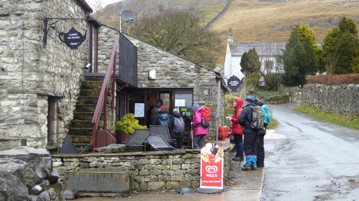
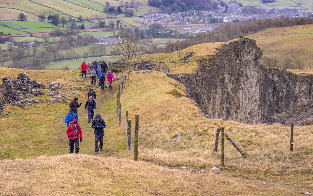
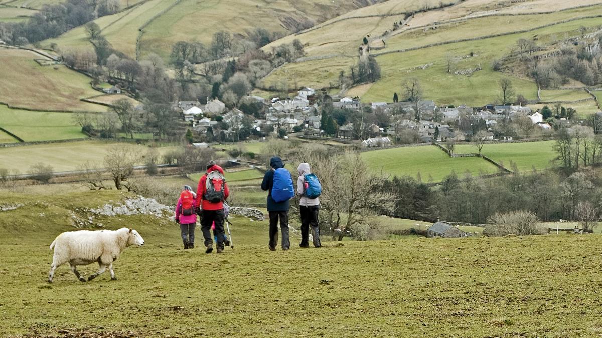
1 From the car park turn left, go under the railway bridge and past the swimming pool. Turn right onto The Mains, continuing along the uphill footpath, through woodland, a metal field gate and into open limestone country. The main path goes left but turn right and walk up a grassy path; the River Ribble is visible on the right and the path becomes rocky, ascending to the fenced edge of Giggleswick quarry on the left. Closed in 2009, the quarry is impressive in size but not in beauty although it is being restored by natural regeneration supported by planting native trees and wildflower seeds. After passing the quarry keep left and walk below Giggleswick Scar. The high point is marked by a huge cairn called Schoolboys’ Tower, named after a tradition where graduating students from nearby Giggleswick School would each put a rock on the cairn to celebrate the end of their time at school. The B6480 road is visible on the left. Those who drove on the A65 before the bypass opened in December 1988 may recall the long slow crawl out of Settle along this stretch of road. Climb through two gated wall stiles and through a wicket gate signed (in the opposite direction), Giggleswick 1.5 miles. Continue along the footpath through three wicket gates and a field gate to a three-way fingerpost in the direction signed, Feizor half a mile. The village of Austwick beyond Feizor is visible ahead in the distance. A track on bedrock leads down to Feizor via a field gate. The village name derives from a landowner’s name, Fech, and Old Norse for upland pastures. It is reported that ancient boundaries of Lawkland and Giggleswick once passed through a house in Feizor. A dying man wanted to be buried in Giggleswick but his room was in Lawkland, so he was carried into an adjoining room in Giggleswick parish, where he probably died with a smile. At the road turn right at the sign Pennine Bridleway Little Stainforth. The popular Elaine’s Tea Rooms on the left welcomes walkers and is open every day except over Christmas.
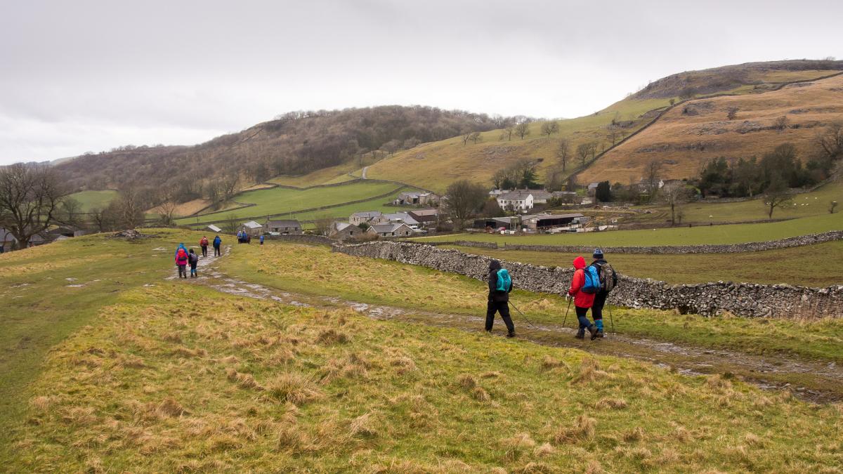
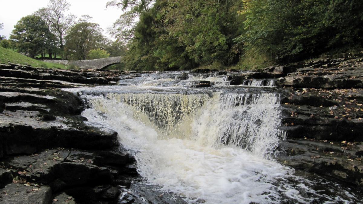
2 Walk onto the path over the car park opposite the tearoom, past the farm and through a metal field gate. Go uphill alongside the wall on the right and cross the wall by a ladder stile then continue to the brow along a grassy path, across two ladder stiles and past a fingerpost signed Stainforth. After passing over the brow begin descending towards the valley ahead over a wall stile on the left of a metal gate. Walk downhill to a track and gated step stile on the right of a wooden field gate into Little Stainforth. Cross over the road and walk along the lane signed Pennine Bridleway Stainforth three quarters of a mile, passing the Knights Table café and tearoom and a white house with a sundial dated 1724. Walk down the lane past the caravan site and just before the 17th Century packhorse bridge over the River Ribble turn right onto the footpath signed Stackhouse 1.25 miles. Pause to inspect the attractive Stainforth Force then continue along the riverside path, which is rocky in parts.
3 On reaching a weir turn right onto the footpath signed Stackhouse. Turn left onto the road then left onto the footpath signed Ribble Way Settle Bridge three quarters of a mile. Follow the riverside footpath towards the football pitch and at the road turn left to return to Settle.
Next week:


Comments: Our rules
We want our comments to be a lively and valuable part of our community - a place where readers can debate and engage with the most important local issues. The ability to comment on our stories is a privilege, not a right, however, and that privilege may be withdrawn if it is abused or misused.
Please report any comments that break our rules.
Read the rules here