
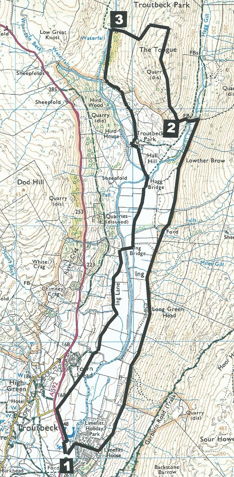
AT AN ALTITUDE of 1,194 feet, Troutbeck Tongue is a modest Wainwright fell and a worthwhile destination for a short walk, writes JOHN EDMONDSON. This route avoids a long trek over the boggy northern section but includes a stroll past pretty waterfalls and an attractive packhorse bridge. An option to omit climbing the Tongue offers a fairly flat 4.2-mile circuit that is also a good route for runners.
The walk starts from the entrance off the A592 to Limefitt Holiday Park (grid reference NY 414 030, postcode LA23 1PA). There is a bus stop at the entrance (508 service, summer months only) and small lay-bys about 200 yards in both directions.
Information:
Distance: 6 miles with 1,100 feet of ascent.
Time: 3 hours
Terrain: stony track, open fell and tarmacked lane
Map: OS Explorer OL7
Route
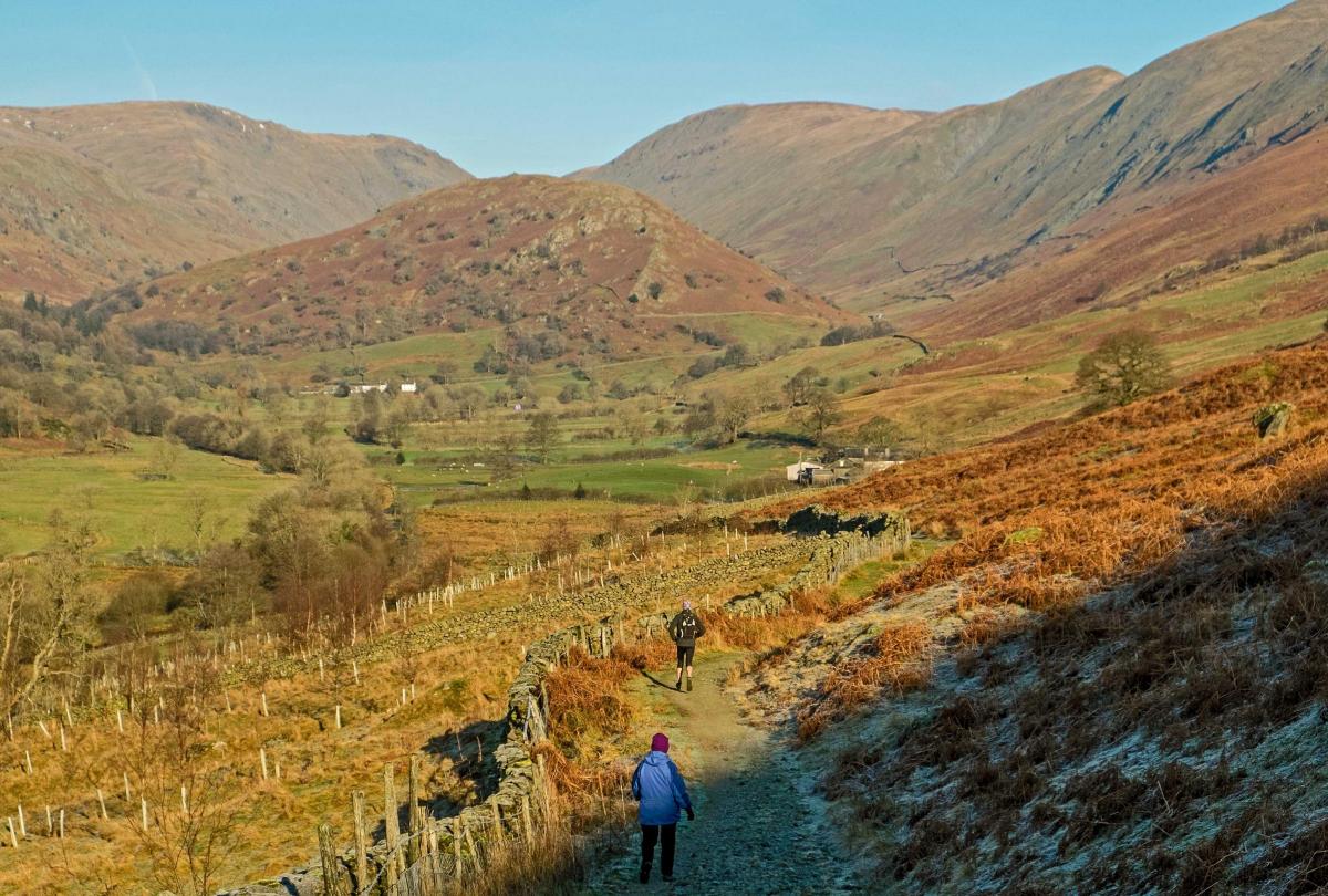
1 Walk down the entrance road to Limefitt Holiday Park, cross the bridge over Trout Beck and continue up to the right of the Haybarn Inn. The bridleway goes to the left behind the inn and the stony track ascends above woodland. Keep left and head northwards. Beyond the woods on the left is the site where International Grass Ski Festivals were held the early 1970s. Continue along the track for two miles to the edge of the Tongue. Go through a gate, back through a second one and cross Hagg Gill via a wooden footbridge. Hagg Gill comes from Old Norwegian meaning a ravine with a stream where timber has been felled. Ascend to a gate over a stony path. Runners and those who choose to avoid a steep climb may turn left and descend to Hagg Bridge for their return journey.
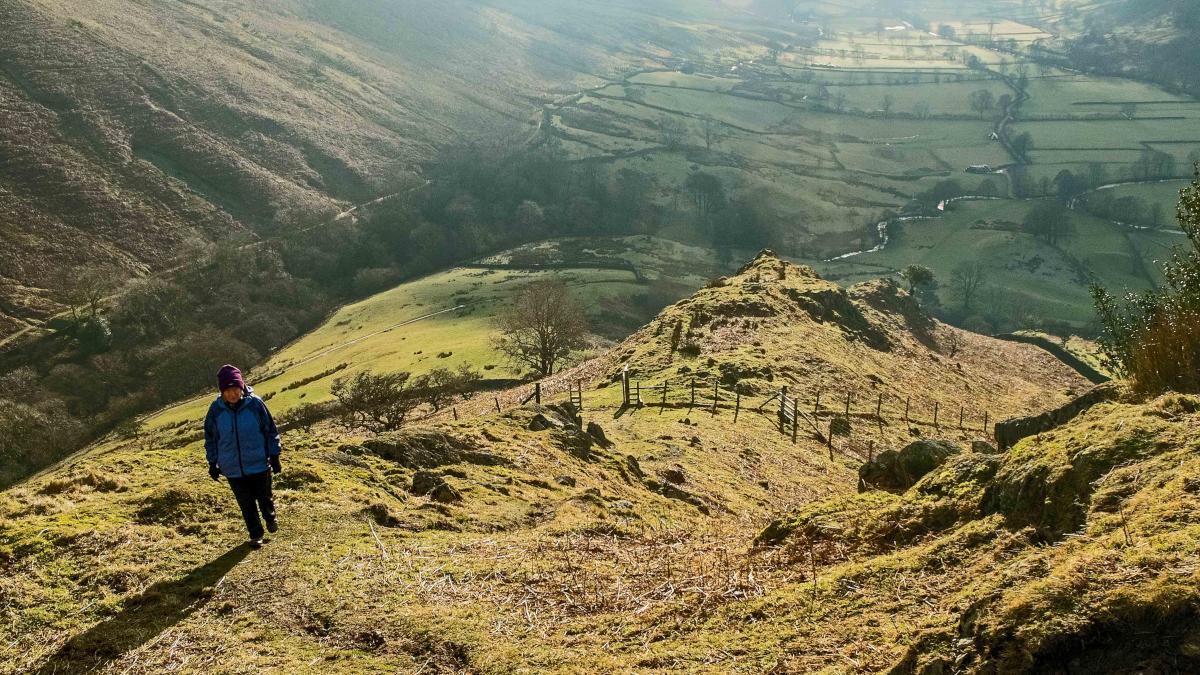
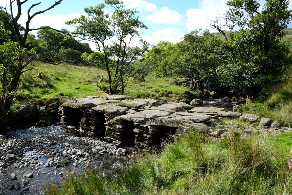
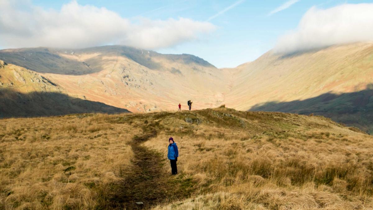
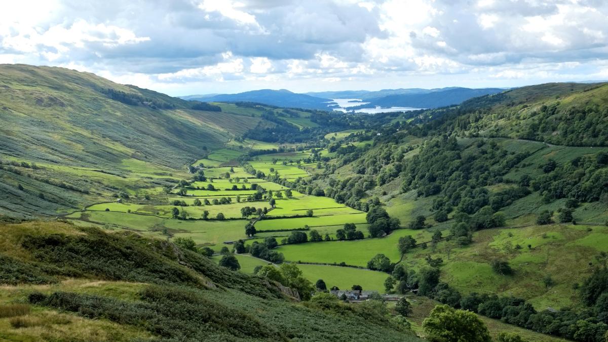
2 Go through the gate up to a fence stile on a steep grassy path, initially following the line of the wall on the left, before striking up to the right past trees to a gate with a stile. Continue ascending through rocky outcrops to the summit marked by a stone cairn and enjoy views of the Troutbeck Valley and Windermere to the south and of Threshthwaite Mouth to the north. Descend northwards along a grassy path for 300 yards to where a huge rock outcrop appears on the left and opposite a disused quarry over the valley on the right. Leave the path and descend over bracken to the left of the huge rock. There is a walled shelter below it. Walk to the left along the line of the fence below. At a point above a solitary tree where the strand of barbed wire has been removed, step over the fence and continue descending past the tree. Continue descending steeply to the right side of the wood to meet Trout Beck near an attractive slate packhorse bridge.
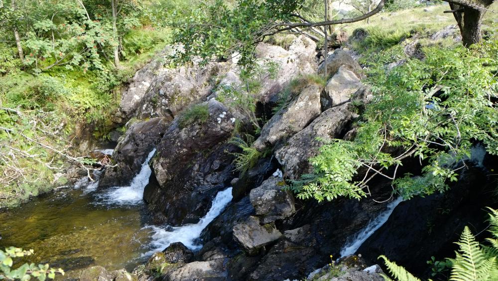
3 Stay on the left side of the beck and follow the footpath beside pretty waterfalls through the woods. After passing through three gateways the path becomes a stony track and goes round the right of Troutbeck Park Farm. Turn left to pass the front of the house and continue along the tarmacked lane over Hagg Bridge and Ing Bridge. The name Ing comes from ‘eng’ meaning meadow in Old Norwegian. Where the lane bends right towards Town Head go straight on along a stony track signed Truss Lane. Immediately before the track meets the A592 turn left along a permitted field path beside the road to a metal kissing gate (just past a lay-by on the opposite side of the road) then continue for 200 yards along the roadside to where the walk began.
NB: restrictions on space mean that this article provides a general summary of the route. It is advisable for anyone who plans to follow the walk to take a copy of the relevant Ordnance Survey map.


Comments: Our rules
We want our comments to be a lively and valuable part of our community - a place where readers can debate and engage with the most important local issues. The ability to comment on our stories is a privilege, not a right, however, and that privilege may be withdrawn if it is abused or misused.
Please report any comments that break our rules.
Read the rules here