
BAG five Wainwrights (Shipman Knotts, Kentmere Pike, Harter Fell, Branstree and Selside Pike) and enjoy fantastic views of the fells above Kentmere and Haweswater, then see the lovely Swindale and Mosedale valleys, writes JOHN EDMONDSON.
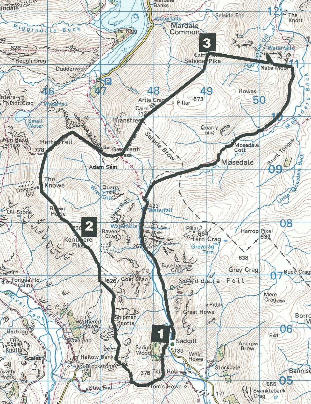
Much of the route follows walls and fences, which simplify navigation, but this is a long, hard walk, so start early if the days are short. Park at Sadgill, which is at the end of the Longsleddale road, map reference NY 483 056, postcode LA8 9BE.
INFORMATION
Distance: 12.5 miles with 3,500 feet of ascent
Time: 7 hours
Terrain: fell paths and tracks, boggy in parts
Map: OS Explorer OL7
ROUTE
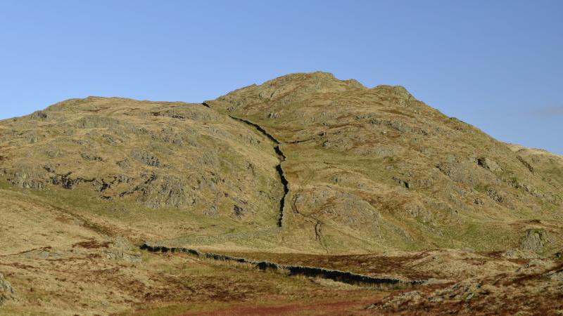
1 Cross Sadgill bridge and turn left onto the public byway for Stile End and Kentmere. Keep right and ascend the twisting stone-pitched roadway. After the track starts to descend go through a gate then turn right onto a mainly grassy footpath. Ascend Wray Crag beside a wall on the right and continue to the summit of Shipman Knotts (which means shepherd’s rocky hills). Climb over a steep ladder stile and stay by the fence on the right to visit the summit of Goat Scar. Alternatively, follow the main path on the left to Kentmere Pike, marked by a trig point just across the wall.
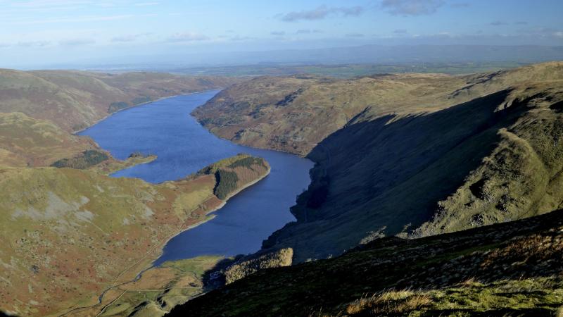
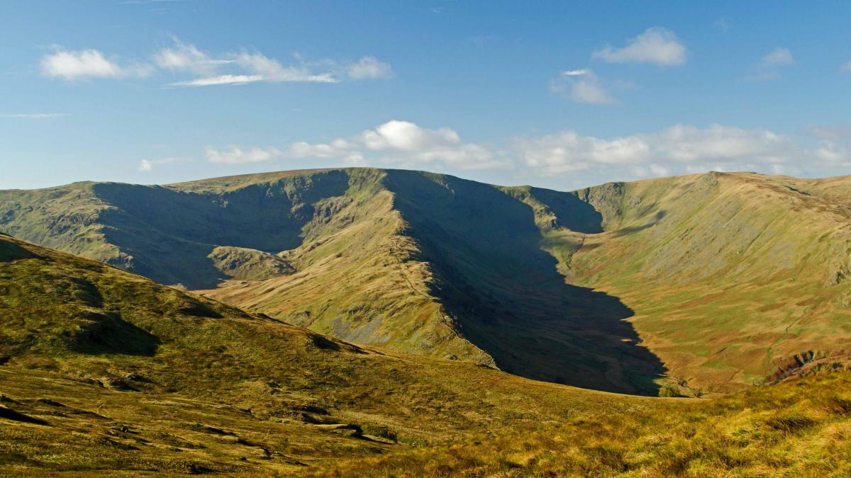
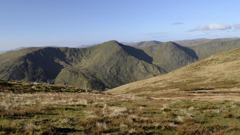
2 Continue along the wall/fence-side path to the stone and metal cairn marking the top of Harter Fell then follow the path round to the right. Haweswater and Small Water appear on the left. The path bends right, keeping alongside the fence, then veers left, descending to the Gatescarth Pass. Cross the track, skirting to the left of a boggy area, and follow the grassy path by the fence to Branstree (whose name translates to steep path). The summit - marked by the base of a trig point - is to the left. Continue along the line of the fence on the right passing two stone pillars then descending to Captain Whelter Beck. It’s named after the leader of Kendal archers who, in 1336, ambushed Scottish raiders below Castle Crag on the opposite side of Haweswater. Climb to the summit of Selside Pike. Walk to the left for better views over Haweswater, Penrith and Shap, then return to the cairn.
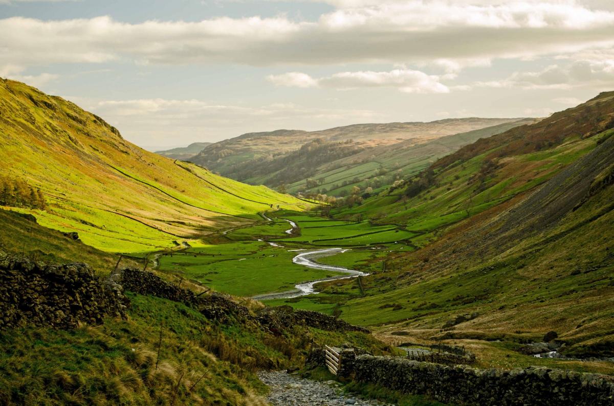
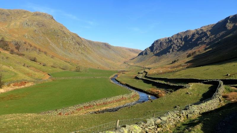
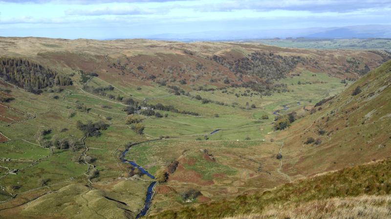
3 Continue beside the fence turning 90 degrees to the right down to the bottom of a hanging valley. Cross the charmingly named Hobgrumble Gill and ascend the other side of the valley. At the top make a 200-yard excursion to the left to view the lovely Swindale valley. Return to the fence and descend into Mosedale. Turn right, go through a metal gate and follow the grassy path along the edge of the valley (partly along the line of an ancient wall). Keep to the right of the valley and merge with a stony track leading to Mosedale Cottage, a shelter maintained by the Mountain Bothies Association. If by this stage of the walk you are exhausted, it is dark, or the weather turns foul, it could be wise to stay here: you still have more than three miles to walk and probably no mobile signal. Pass to the left of the building and continue walking up the valley along a grassy path for about three quarters of a mile. Here in particular, it is clear how Mosedale got its name, which means the valley with a bog. Go through a fence gate and descend Brownhowe Bottom towards the disused Wrengill quarry. Ford the beck then turn left onto the Gatescarth Pass and follow the stony track back to where the walk began.
Next week: an easy stroll to the Meaburns and Lyvennet
NB: restrictions on space mean that this article provides a general summary of the route. It is advisable for anyone who plans to follow the walk to take a copy of the relevant Ordnance Survey map.


Comments: Our rules
We want our comments to be a lively and valuable part of our community - a place where readers can debate and engage with the most important local issues. The ability to comment on our stories is a privilege, not a right, however, and that privilege may be withdrawn if it is abused or misused.
Please report any comments that break our rules.
Read the rules here