
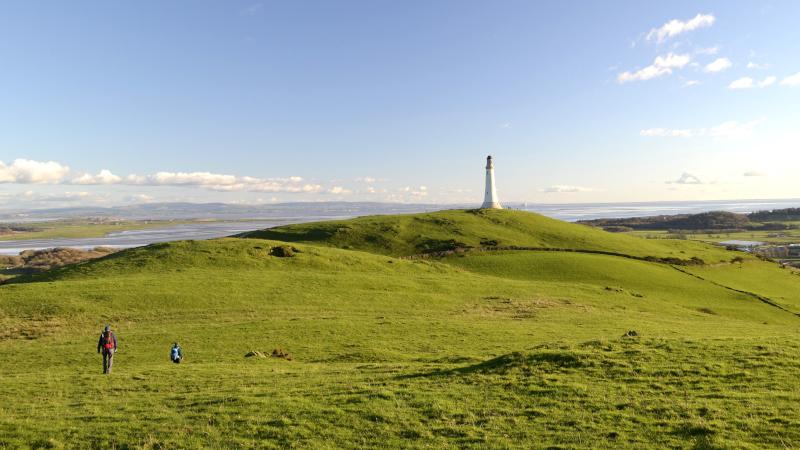
THIS linear walk offers spectacular views of the southern Lake District fells and visits the Hoad Monument above Ulverston, writes JOHN EDMONDSON.
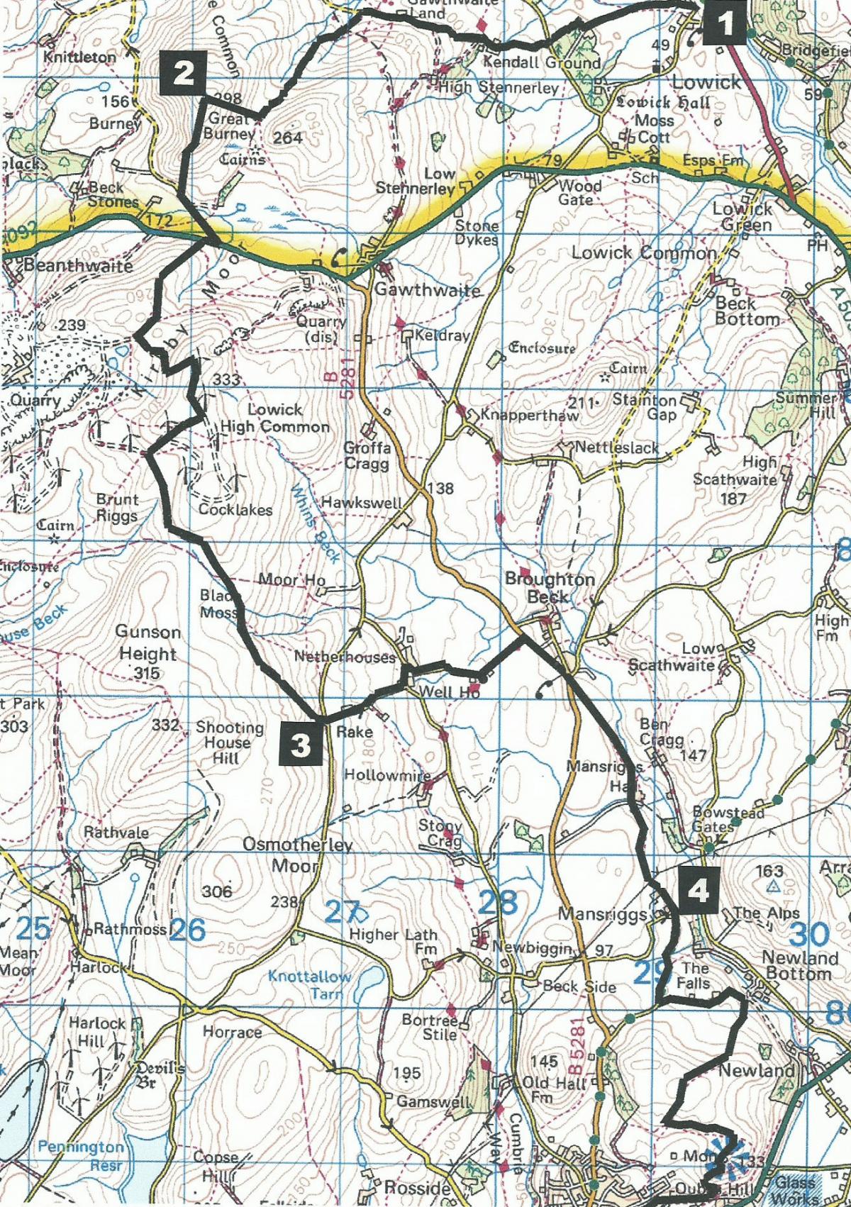
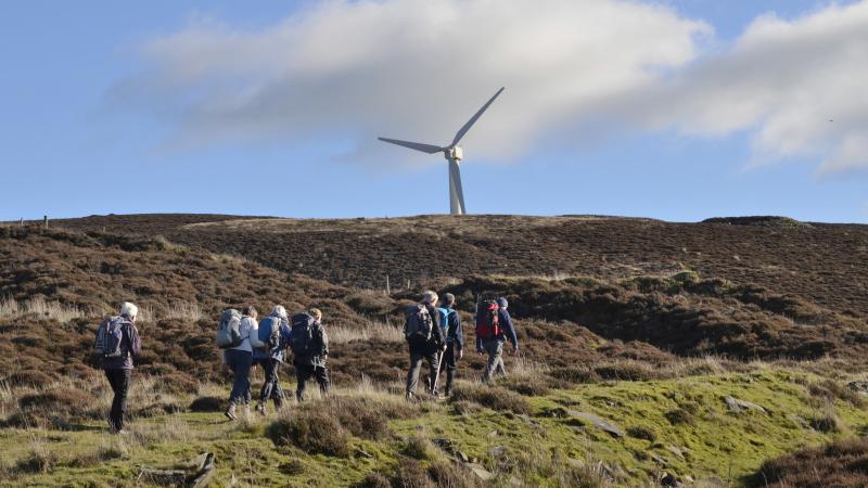
On the way you pass Kirkby Moor Wind Farm. You can use the X12 (Coniston) bus from Ulverston to Lowick Bridge at 8.45am Saturday and school holidays or, on longer days, the 10.50am, Monday to Friday. The walk starts from the Red Lion at Lowick Bridge, map reference SD 292 865, postcode LA12 8EF.
INFORMATION
Distance: 11 miles with 2,000 feet of ascent
Time: 6 hours
Terrain: quiet roads and grassy paths
Map: OS Explorer OL5 and OL6
ROUTE
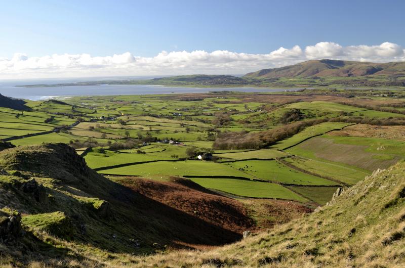
1 Walk past the Red Lion and the farm then turn right along the footpath signed Everard Lodge. If the path is still closed (unsafe bridge) continue along the road, passing entrances to Lowick Hall where Arthur Ransome, author of Swallows and Amazons, lived from 1948 to 1950. At the junction turn right and after 0.4 mile (where the footpath from Everard Lodge meets the road) turn left. Follow the road ahead, past Kendall Ground farm and continuing over a cattle grid into open countryside. After passing the modern barn conversion of Birch Lands, turn left onto a signed footpath. Follow the path up the valley to a stone cairn. Turn right and climb to the summit of Great Burney and enjoy spectacular views from over Duddon Sands in the west to the fells to the north.
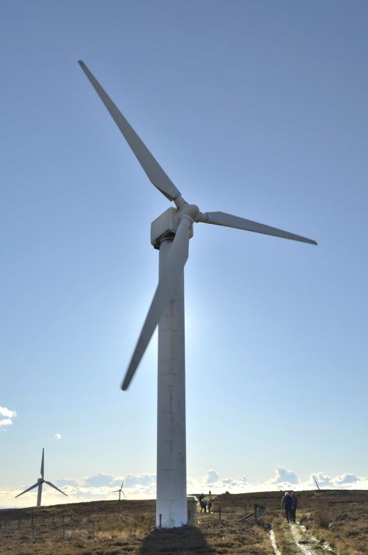
2 Turn left (southwards) down to a minor road and up to the A5092. Turn right and after 100 yards left onto the footpath next to a notice about Kirkby Moor Wind Farm. Follow the grassy track past a rocky notch to a larger track near quarry ponds. Turn left going uphill bending right at the top beside a wind turbine. After the second turbine and aerial at the top of the ridge turn left to a wall corner, descending to its right. At the bottom of the slope turn left through a gate and follow a walled track (the Cumbria Way), going straight on at the crossroads.
3 At Netherhouses turn left then right and past St John’s Church. At the main road turn right towards Ulverston to a junction on the left. Join the footpath signed Low Mansriggs, following the course of Newland Beck on the left. Go through a gate to the right of Mansriggs Hall farm and across the lane to a gate beside a metal barn. Walk along the track, through a gateway and over a gated stile in the wall on the right. Continue along the other side of a wall. Pass to the left of the farm to meet a road and continue ahead.
4 After three quarters of a mile turn left onto the track signed The Falls. Turn right through a waymarked gate in front of a house, descending towards the valley bottom. Before reaching the valley bottom turn right immediately after a waymarked gate to go up a steep bank and uphill beside a wall on the right. Go over a ladder stile and continue uphill in the same direction. The Hoad appears ahead. Bear right and keep going uphill through a kissing gate then downhill to join a track up to The Hoad. Descend towards Ulverston to a metal gate, turn right along the walled footpath, then left in front of St Mary’s Hospice to the town centre.
Next week: Beetham, Fairy Steps and Deer Park
NB: Restrictions on space mean that this article provides a general summary of the route. It is advisable for anyone who plans to follow the walk to take a copy of the relevant Ordnance Survey map.


Comments: Our rules
We want our comments to be a lively and valuable part of our community - a place where readers can debate and engage with the most important local issues. The ability to comment on our stories is a privilege, not a right, however, and that privilege may be withdrawn if it is abused or misused.
Please report any comments that break our rules.
Read the rules here