
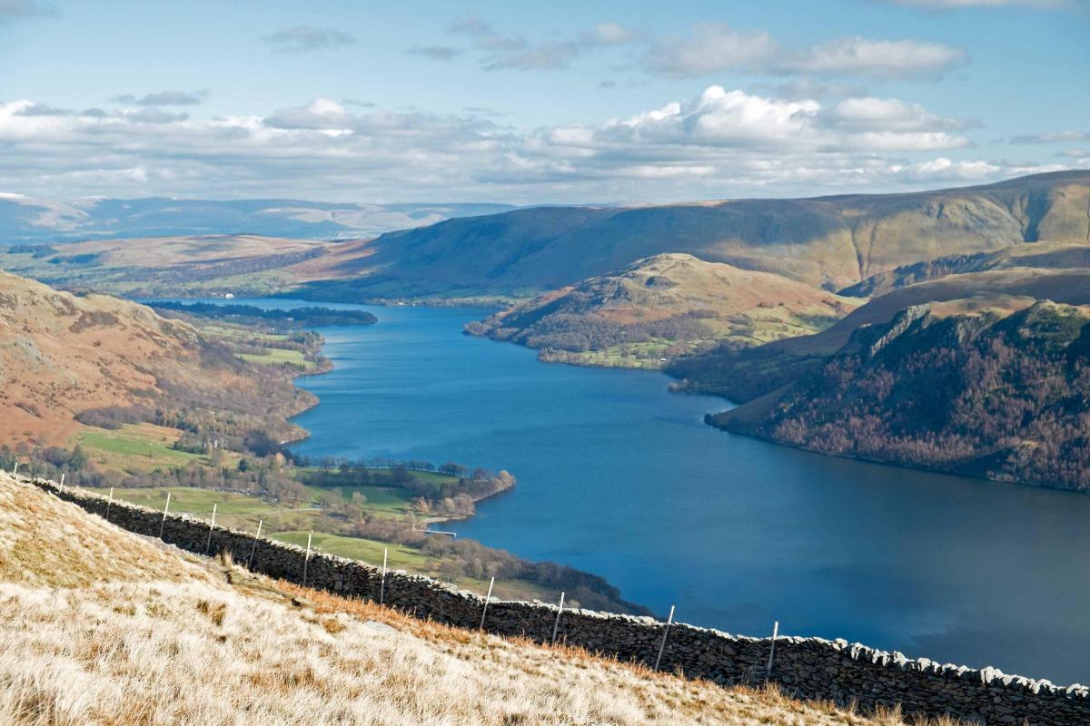
THIS horseshoe walk offers splendid views and the achievement of climbing the significantly high fell of Hart Side, writes JOHN EDMONDSON. The name Glencoyne may have been derived from old Irish 'cdin,' meaning beautiful, and it inspired Wordsworth to write one of his most famous poems, Daffodils. The walk passes Seldom Seen, an aptly named place because relatively few walkers visit this lovely area: so like the poet you might well wander 'lonely as a cloud.'
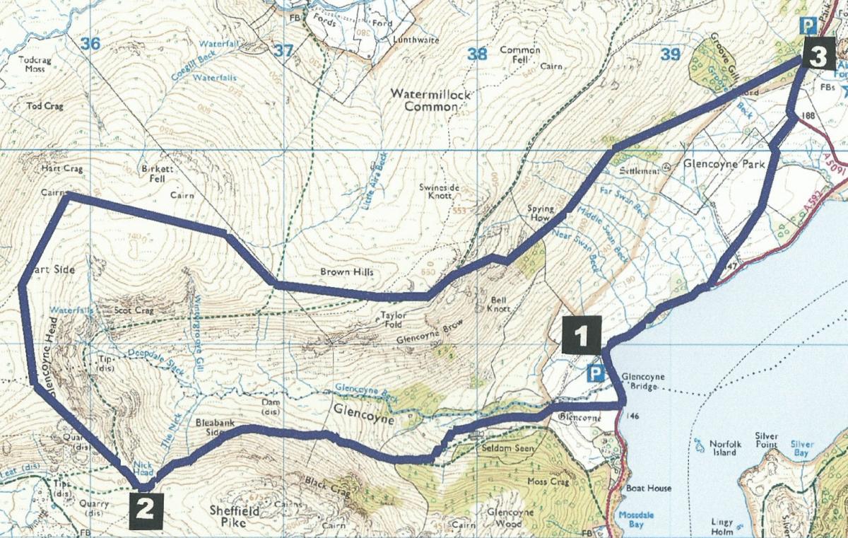
Start from Glencoyne Bay National Trust car park, grid reference NY 387 188, postcode CA11 0QT.
INFORMATION
Distance: seven miles with 2,500 feet of ascent
Time: four hours
Terrain: fell paths with some steep slopes.
Map: OS Explorer OL5
ROUTE
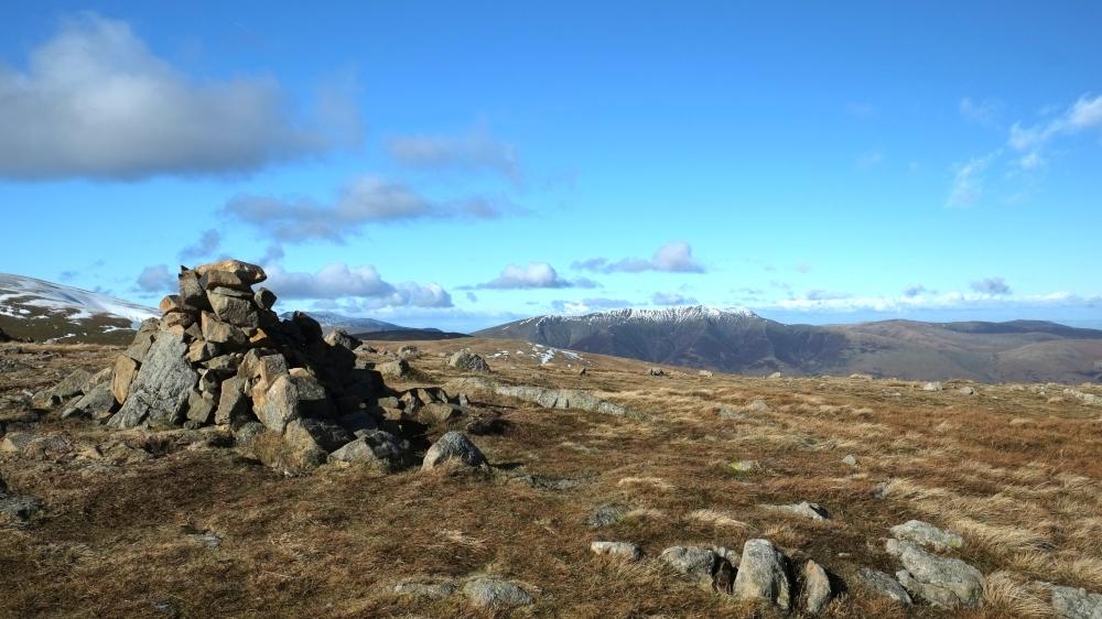
1 From the car park walk southwards (towards Glenridding) along the off-road path. Turn right onto the farm track and join a footpath going to the left of the white cottage, through its garden and uphill. Glencoyne Beck is on the right and Seldom Seen cottages to the left. Seldom Seen was formerly a row of mine workers cottages and are now holiday rental properties. Follow the waymarker showing a branch to the left, ascending a steeper climb to a wooden field gate. Go through the gate and follow the path on the left side of a wall to a wicket gate. The fell path climbs up the valley side to Nick Head. A magnificent view of Catstye Cam and Helvellyn appears ahead with old mine workings in the foreground.
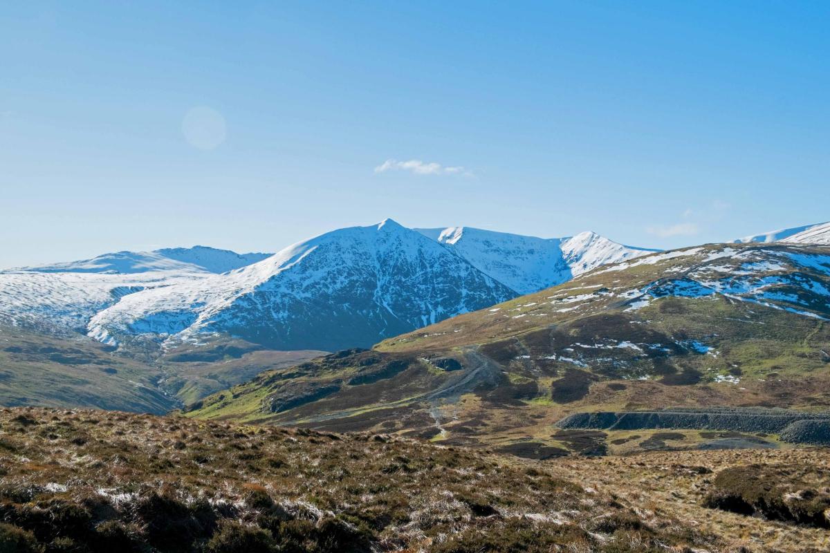
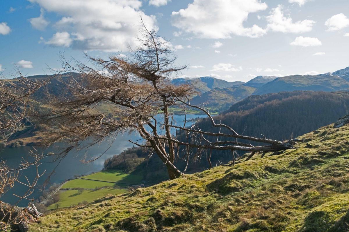
2 Turn right and ascend the ridge, but before reaching the top, veer right to walk above the head of Glencoyne valley. Head northwards onto a faint quad track leading to a cairn marking the summit of Hart Side. At 2,481 feet, this is the highest point of the walk. A grand view of Blencathra can be seen to the north. Now turn right to head eastwards (to the right of Birkett Fell) above Glencoyne, and descending towards Ullswater. Meet a wall angling in from the left and continue descending on the right of the wall. Go over a wall stile, continue along the other side of the wall for a few yards then angle left, keeping on the right side of Brown Hills, and descend to another wall on the right. From here enjoy splendid views the length of Ullswater. Continue along the left of the wall to go through a wicket gate and descend on the path, passing larch trees and then a beech wood. Go through a field gate and continue along the gradually descending path, crossing numerous little becks (including Near, Middle and Far Swan Becks). The path meets the A5091 opposite Park Brow Aira Force car park.
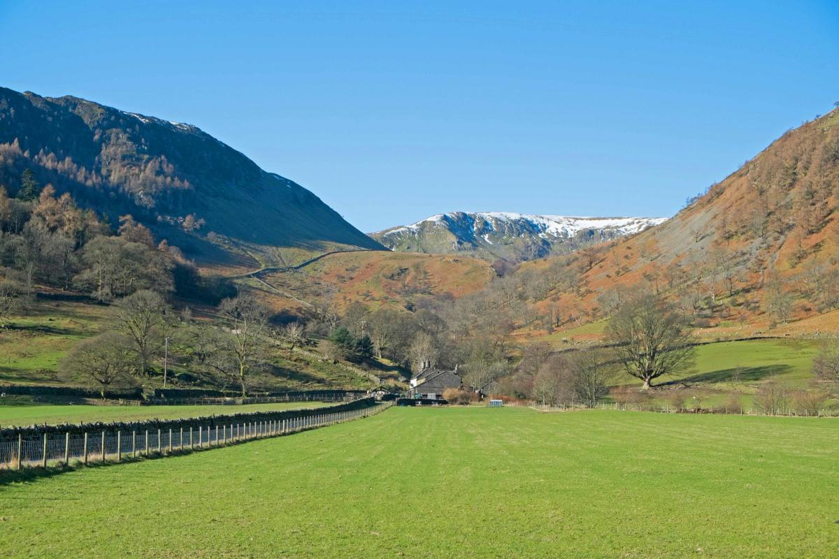
3 Turn right, go down the road for half a mile and then turn right to join the footpath signed Lake Road Half Mile. Cross a wooden footbridge then go left of a fence, through two gates and onto a grassy farm track. The track bends left; then just before meeting the A592 turn right over a wooden footbridge and follow the Ullswater Way path back to Glencoyne car park. Alternatively from Park Brow, you could cross the A5091, stroll along the paths around Aira Force, perhaps visit the café and join the Ullswater Way from there. This would add about one mile to the walk.
Next week: Scorton, Nicky Nook and Grize Dale.
NB: restrictions on space mean that this article provides a general summary of the route. It is advisable for anyone who plans to follow the walk to take a copy of the relevant Ordnance Survey map.


Comments: Our rules
We want our comments to be a lively and valuable part of our community - a place where readers can debate and engage with the most important local issues. The ability to comment on our stories is a privilege, not a right, however, and that privilege may be withdrawn if it is abused or misused.
Please report any comments that break our rules.
Read the rules here