
written by John Edmondson
Stockdale Horseshoe
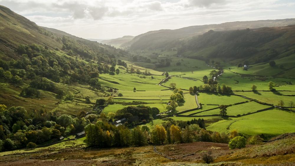
THIS is a wild walk around a valley that is even more remote than the lonely and unfrequented fells described in Wainwright’s book of the Far Eastern Fells, writes John Edmondson. In 1957 Wainwright said that "solitary walkers will enjoy the area immensely, but they must tread circumspectly and avoid accident." An equal amount of vigilance is required today in this area where few people roam. On a clear day, the walk offers a unique opportunity to view huge vistas over the eastern side of Cumbria, and possibly beyond; but if visibility is poor it’s not worth attempting. Careful navigation by map and compass is essential; using features such as fences and fell tops as waymarks.
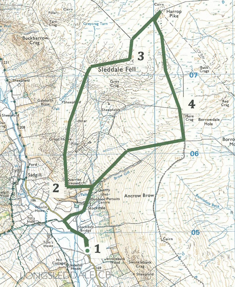
To reach the start, wend along Longsleddale and park near a bench by the entrance to Toms Howe. (GR NY491 047).
Information:
Distance: five miles, ascent: 2,700 feet
Time: 3.5 hours
Terrain: rough fell, boggy in parts.
Map: OS Explorer OL7
Route
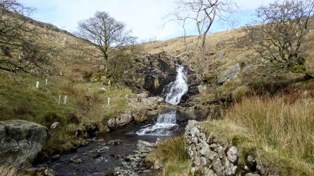
1 Walk along the road northwards to a public footpath on the right opposite Tills Hole and follow the walled path to Stockdale. Go through a metal gate, past a fine example of a lime kiln, and ascend alongside Brow Gill, admiring the waterfalls in the woods on the right. The Haweswater aqueduct emerges from the five-mile tunnel under Branstree here. When it was built in 1941 this was the longest tunnel in Britain, requiring 250 tons of gelignite for the blasting work. Just before reaching a metal gate turn left through a wooden gate with an Access Land sign on it. Go to the right alongside a new fence uphill and across tumbled walls to a disused slate quarry.
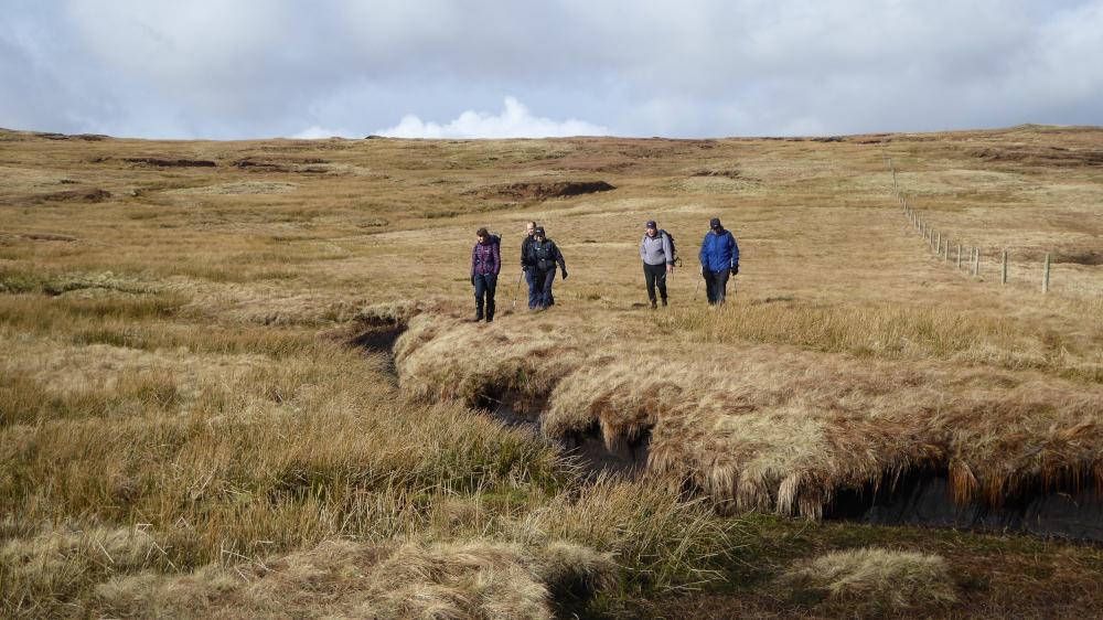
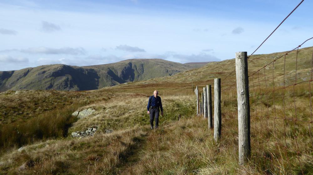
2 Head up the steep fellside to above a rocky outcrop. Continue uphill passing ruined buildings to a boggy wall gap. This is Great Howe. The stone pillars there were built for surveying the aqueduct. Pause to enjoy the view of Longsleddale then continue climbing in a north-north easterly direction on a more gradual climb along a rounded ridge to the right of Galeforth Gill. Follow a quad track that becomes a path leading to a fence directly ahead. Walk along the fence to the right and cross the fence via a step-over stile in the top fence corner. The path continues at right angles to the fence then bears right past rocky crags and leads to a cairn marking the summit of Grey Crag and Sleddale Fell. Splendid views can be seen to the north, east and west to as far as the Coniston fells; part of Windermere is also visible.
3 Now head due north to Harrop Pike, which is topped by a pillar, going along the right side of a fence. Step over the fence to visit the pike to enjoy great views to the north over Shap and further to the west. Harrop Pike is indicated on the map to be one metre lower than Grey Crag but this seems to be the highest point of the walk. Go back over the fence and follow it southwards, picking the best route to avoid the worst of the bog. Cross the fence directly ahead using the two wooden gates in the fence on the left if easier than stepping over. Enjoy splendid views to the east over Mere Crag.
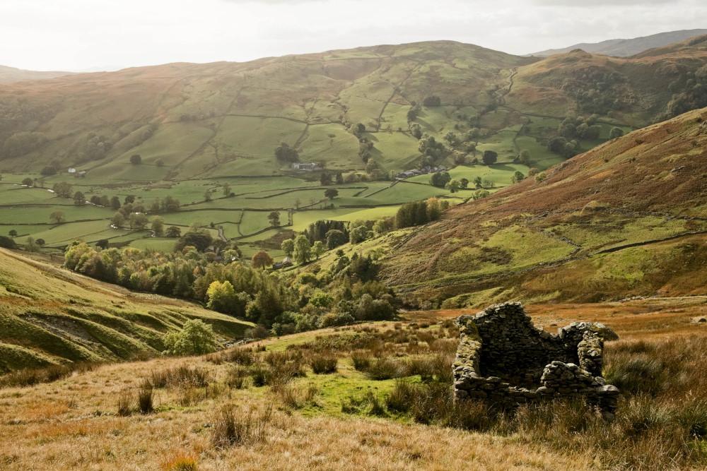
4 Descend steeply into the head of the valley then turn right to go down the right (northern) side of the valley. Pass through a field gate through a wall then follow the shoulder of the fell downwards with Brow Gill on the left, going past a barn ruin. Walk to the right of Stockdale Woods, through a new field gate and cross the gill just below its attractive waterfalls. Go through the gate ahead and return alongside the gill by the way the walk began.


Comments: Our rules
We want our comments to be a lively and valuable part of our community - a place where readers can debate and engage with the most important local issues. The ability to comment on our stories is a privilege, not a right, however, and that privilege may be withdrawn if it is abused or misused.
Please report any comments that break our rules.
Read the rules hereLast Updated:
Report this comment Cancel