

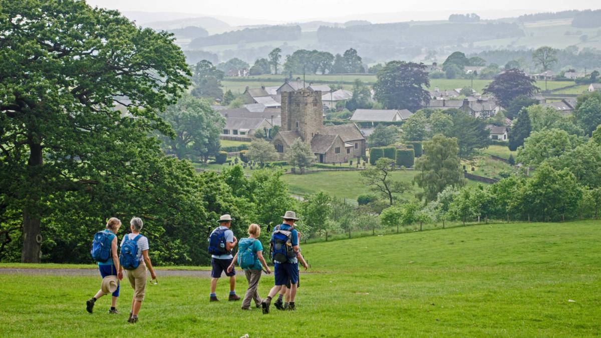
THIS is a varied walk circling Barbon Low Fell along lanes, fell paths and valleys, writes John Edmondson. It goes from Barbon village, three miles north of Kirkby Lonsdale, which has a charming shop, country pub and impressive church. The walk starts nearby the highly rated Churchmouse village store, which is a cafe and delicatessen rolled in to one.
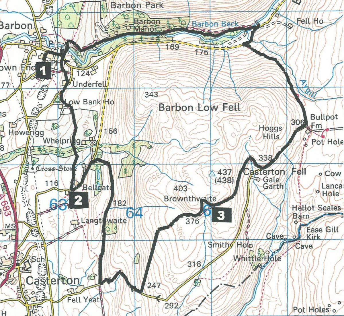
Park in Barbon Village Hall car park (grid reference SD 628 824, postcode LA6 2NN) and make a donation in the honesty (post) box by the main door.
Information:
Distance: 9 miles, ascent: 1,700-feet
Time: 4.5 hours
Terrain: good footpaths and tracks over gently rolling countryside.
Map: OS Explorer OL2
Route
1 From the village hall turn left then right at the war memorial and past the Barbon Inn. Immediately after passing the church turn right over a stile onto a footpath signed Underfell. Cross a field to a stile, turn left then right through a field gate and onward to the gravel driveway of Park House. Walk to the left of the house and go straight ahead on the tarmacked lane. Turn left onto a gated gap stile signed Fell Garth and go along the edge of a field to a wicket gate at the edge of a wood, through a metal field gate then diagonally left (behind Low Bank House) through a gap stile then left to a metal field gate (with a Beware Bull sign) and on a track to a metal gate. Bear left then go to the right above a marshy area and diagonally up the field past some fine oak trees to below the wall of Whelprigg House, a neo-Jacobean country house for group holidays and for special events. Cross the stile next to a metal gate and walk across the hall driveway, over a fence stile and across three fields. Go around sheep pens to Bellgate Farm and turn left on the tarmacked lane.
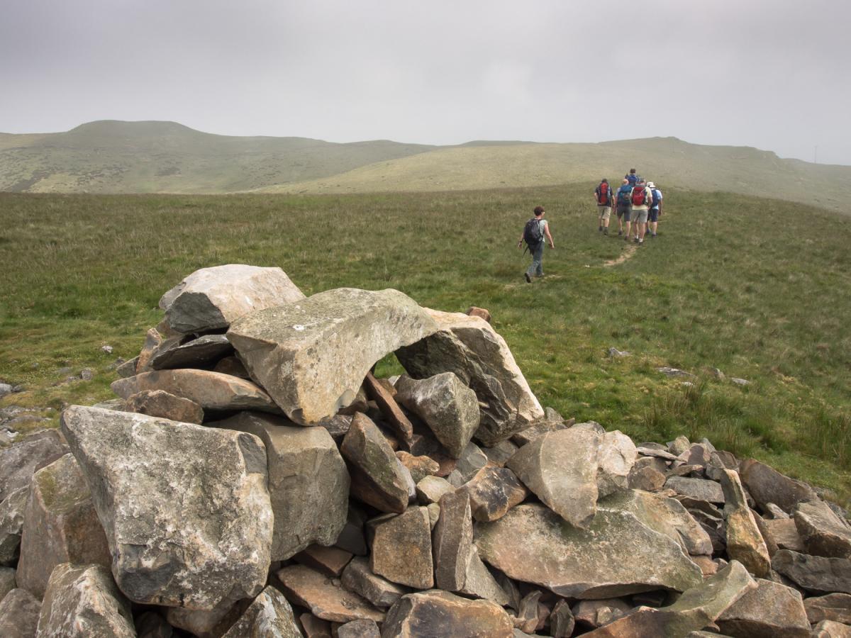
2 After a quarter of a mile turn right up a wooded stony track signed Walldales Lane: the track goes uphill then bends to the right onto Fellfoot Road with its strange sheepfolds, each containing a large boulder, created by Andy Goldsworthy as a Millennium project. At the next road turn left, go up the steep hill and after half a mile turn left onto the track with a footpath fingerpost. After going through a metal gate at the top of the slope the track bends to the right and the summit of Brownthwaite appears ahead and to the left. Climb to the top of the fell marked by a cairn and stone shelter or if you prefer stay on the track. From the summit continue downhill on the path ahead to meet the track again and go through a field gate.
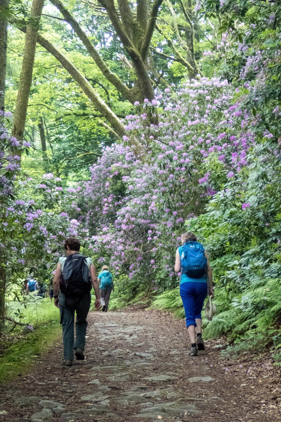
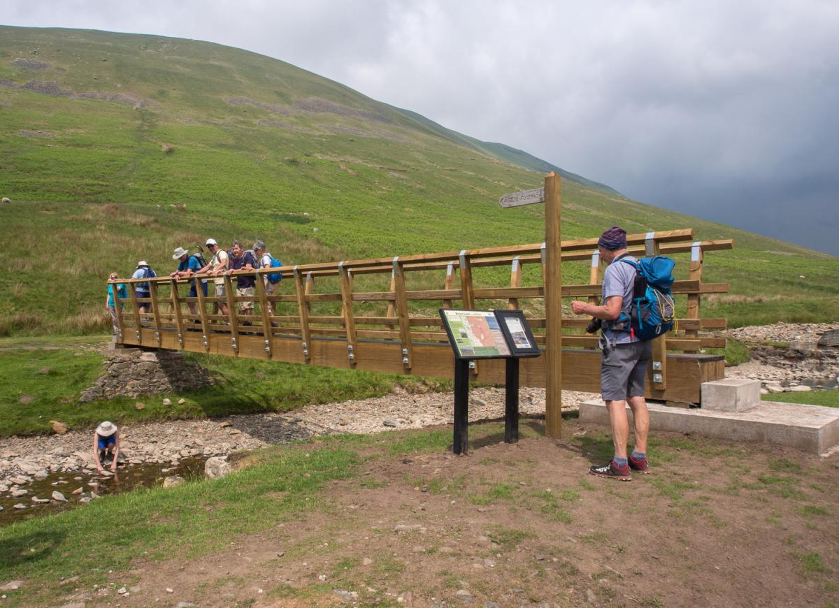
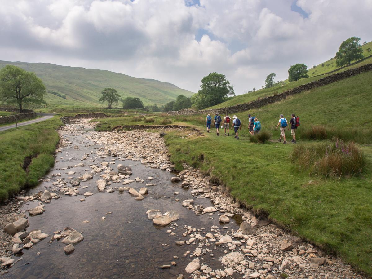
3 Follow the track downhill to a quiet road in the valley bottom and turn left down into the valley to near Bullpot Farm, the hub of the Red Rose Cave and Pothole Club and a base for exploring the many caves of the Yorkshire Dales. East of here is Casterton Fell, gateway to Britain’s longest cave: the Ease Gill System. Turn left onto the bridleway signed Barbondale and follow the stony track to a gate then a grassy track downhill below power cables to meet a road at Barbondale. Turn right, cross the road bridge, then cross the footbridge on the left that was opened in June 2016 after December’s floods. Walk down the right hand side of Barbon Beck and into Barbon Manor Estate Woods that contains many rhododendrons. Keep left but stay on the right of the river (avoid crossing a bridge) and emerge into a field via a gate. Follow the tarmacked lane to the left into Barbon. This is the site of the 738-yard short Barbon Hill climb (held on June 11 and July 2). A course record of 20.08 seconds at an average speed 90.66 mph was set in 2015. After passing the church turn right at the junction then left at the war memorial to return to the village hall.
NB: restrictions on space mean that this article provides a general summary of the route. It is advisable for anyone who plans to follow the walk to take a copy of the relevant Ordnance Survey map.


Comments: Our rules
We want our comments to be a lively and valuable part of our community - a place where readers can debate and engage with the most important local issues. The ability to comment on our stories is a privilege, not a right, however, and that privilege may be withdrawn if it is abused or misused.
Please report any comments that break our rules.
Read the rules here