
High Light Haw from Colton
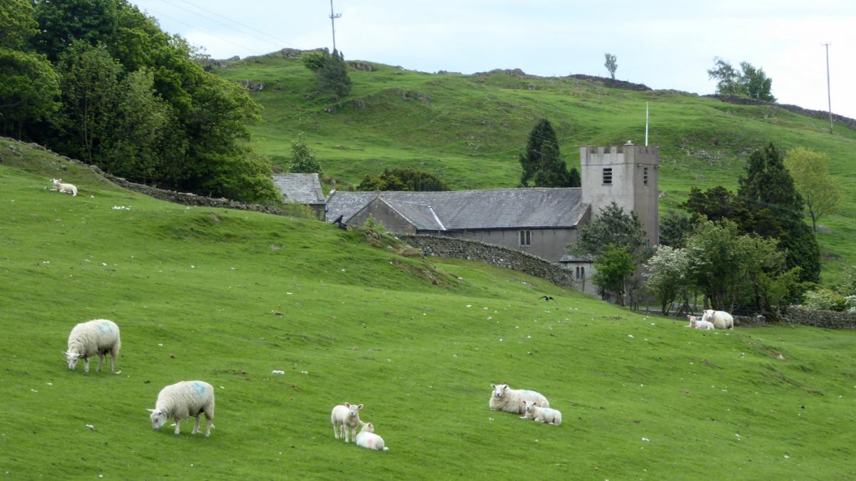
From green pastures to open fells, this walk offers an interesting variety of scenery and excellent views. It goes from the peaceful area of Colton, which is approached along narrow lanes a mile northeast of Spark Bridge. As well as enjoying the natural scenery, further interest might be found in spotting various pieces of abandoned old farm machinery. Park in the car park opposite the 16th Century Holy Trinity Church, Colton (map ref SD 318 860, postcode SD 318 860).
Information:
Distance: 8 miles, ascent: 1,100 feet
Time: 5 hours
Terrain: grassy paths and open fell
Map: OS Explorer OL7
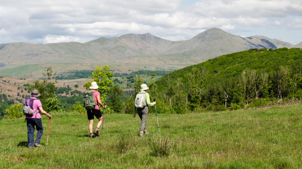
Route
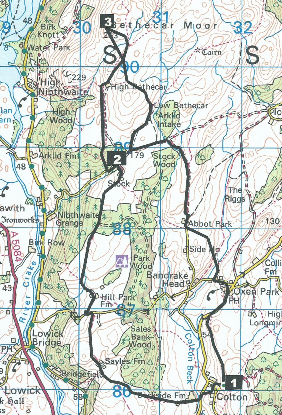
1 Walk down the slope near gates after passing the footpath on the right. Pass St Cuthbert’s Well, turn left on the road then go up a slope to the right (signed Beckside) and down to the valley bottom road. Turn left then right onto the lane signed 'Public Footpath Lowick Bridge,' over a bridge and up on a stony track through two gates. Keep on the grassy track beside a wood on the right up to the top corner and through a gate with a waymarker. Go down to the farm on the bridleway signed Bessy Bank Lane, through Sayles Farm area and past a vintage tractor and disused cars. Follow a rutted track heading towards the distant fells to two adjacent metal gates. Bear right towards a farm and go through a metal roadside gate, turn left then right onto a bridleway to Hill Park Farm. The path goes left after passing a black barn and along a hedged track. Bear right in front of a wall to go past a solitary hawthorn tree. After passing through a gateway bear left to a wooden gate at the top of a field and on to a gate into new woodland. Walk past the top of a tall conifer wood, through a gate signed Blatherbarrow Lane, past Stock Farm and left down a tarmacked lane.
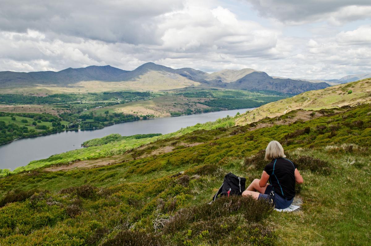
2 Turn right onto a Forestry Commission road signed 'No Access' and follow a waymarked path northwards through the conifer woods. Leave the woods via a wall stile and cross a field towards High Bethacar farm. Walk along the farm track to a wooden gate and stile just before the farm, turn left to go up the field to a wicket gate and right to go round the back of the farm. Walk up a shallow valley past a water tank to a gated stile, heading towards the hill ahead and bear left at a waymarked footpath junction. Go left after crossing a tiny beck over a bilberry-covered mound, across a wet area and up to a cairn marking High Light Haw. Enjoy views over Coniston Water.
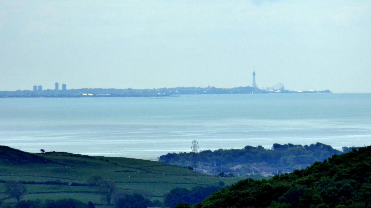
3 Head back due south to the way you came. Pass the waymarker then walk along the left side of a wall, past a kissing gate and down a grassy path then through a gate with stile. This is Low Bethacar and Blackpool Tower can sometimes be picked out from the view over Morecambe Bay to the south. Walk downhill past a barn and along a track to a gate, after which turn left onto a stony track, crossing a beck to a gate. Turn right onto a different track and pass a farm with a new barn and an old tractor. Turn left through a gateway by a modern toilet building then left through a wicket gate signed Oxen Park. Climb three wall stiles, cross a grassy track then walk through bracken following waymarks carefully, keeping right to avoid continuing down a stony beck. The path descends a steeply stepped path, goes across the valley bottom and along a track to the right. Dog owners are warned to keep their dog on a lead because adders have been seen in this area. Cross the beck ford, go uphill to a road and turn left to pass the green Oxen Park Reading Room. Keep right and at the road opposite the Manor House pub, turn right. Walk along the road for a quarter of a mile mile then turn left onto a signed footpath. Follow the path around the edges of fields, passing through an unusual kissing gate made from slate, to Colton Church.
NB: Restrictions on space mean that this article provides a general summary of the route. It is advisable for anyone who plans to follow the walk to take a copy of the relevant Ordnance Survey map.


Comments: Our rules
We want our comments to be a lively and valuable part of our community - a place where readers can debate and engage with the most important local issues. The ability to comment on our stories is a privilege, not a right, however, and that privilege may be withdrawn if it is abused or misused.
Please report any comments that break our rules.
Read the rules here