
ONE of the most beautiful parts of the Lake District, especially in autumn colours, has to be around Rydal Water and Grasmere, writes JOHN EDMONDSON. Wordsworth must have felt that way too because this is where he spent most of his life. Despite its popularity, it’s easy to enjoy this area without having to share it with many other visitors. This moderate walk offers what must be the best views of Rydal Water and visits a peaceful upland tarn using fell, woodland and lakeside paths.
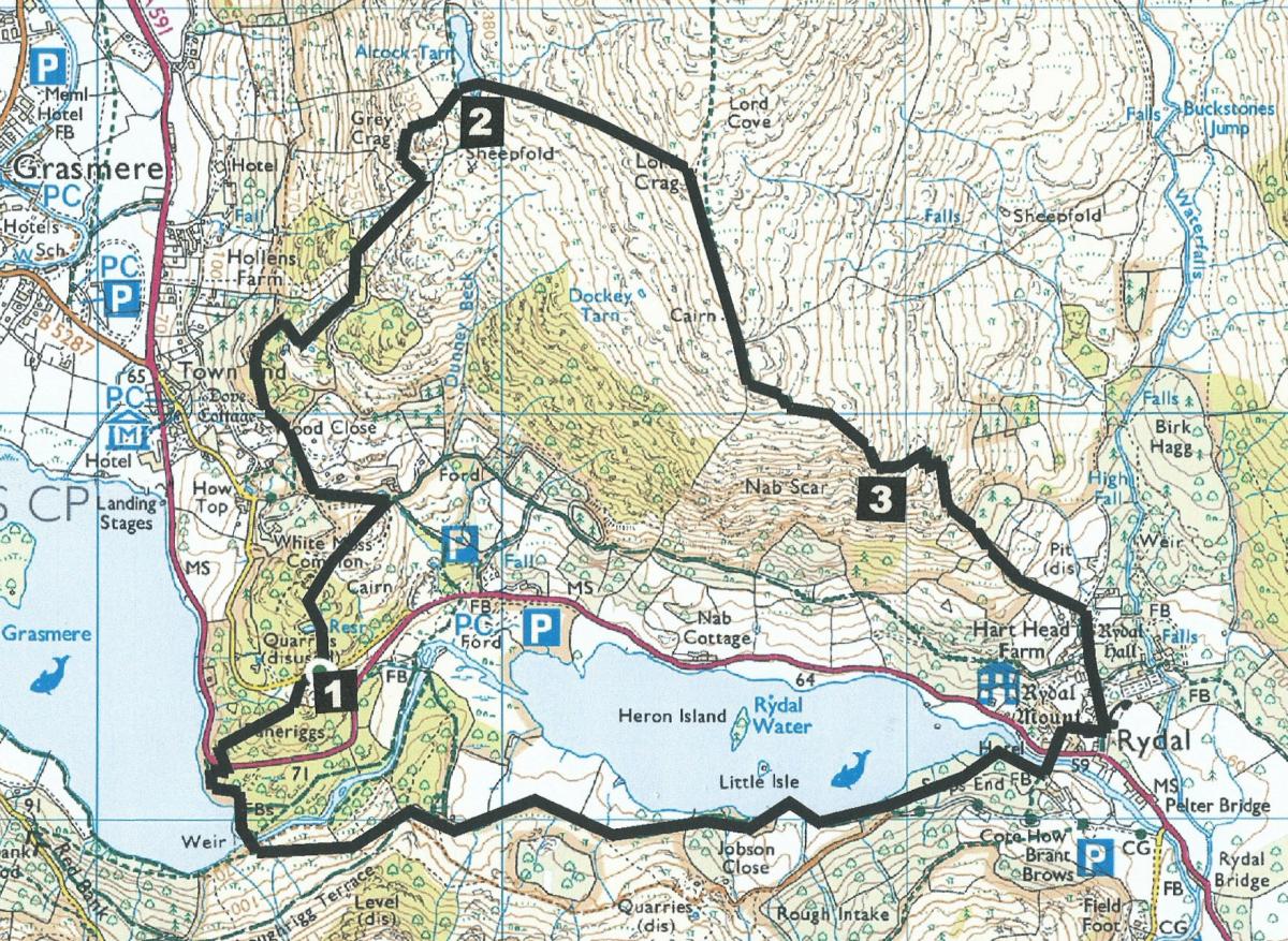
Start from the free parking area at the top of the back road between White Moss car park and Grasmere (map reference NY 345 063).
Information:
Distance: 5.5 miles, ascent: 1,600 feet
Time: 3.5 hours
Terrain: fell paths, and stony tracks.
Map: OS Explorer OL7
Route:
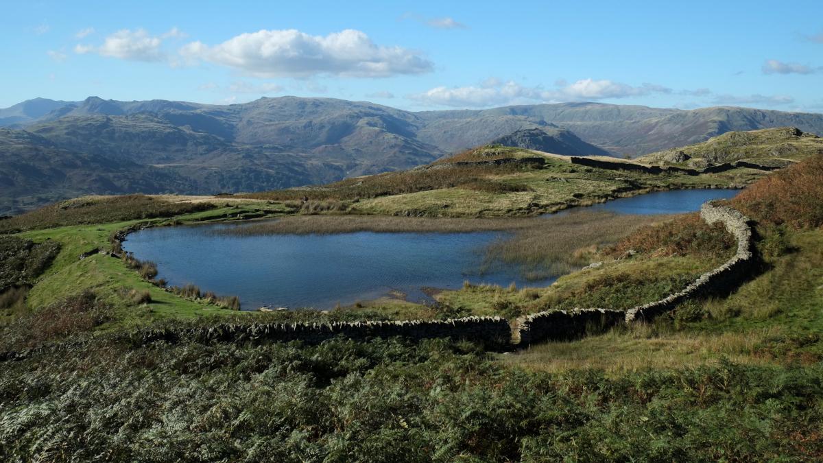
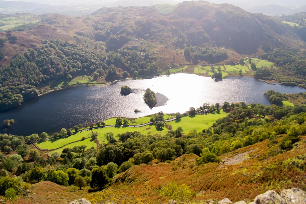
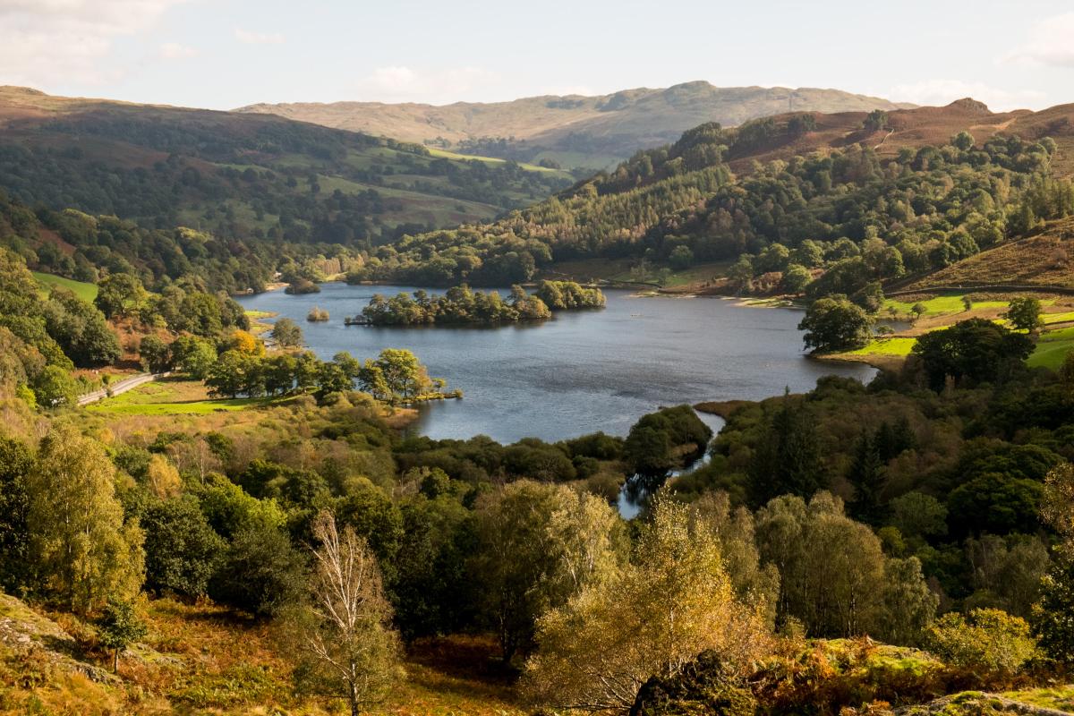
1 Directly across the road from the parking area at the top of the hill, walk uphill past a memorial bench and a fallen tree to a pond fenced with iron railings. Continue following an indistinct path to the top of White Moss Common. Although only 466-feet above sea level this modest viewpoint affords an unrivalled view of Rydal Water plus good views of Grasmere to the west and Helm Crag to the north. Descend in a northerly direction along a faint path around the edge of a bog then through bracken around a craggy mound and past a memorial bench. Meet a road near a junction and turn left to pass the overgrown White Moss Tarn also known as Skater's or Wordsworth's Tarn. At the top of the rise turn right onto a footpath signed Alcock Tarn 1.25 miles. The path merges with a stony track and goes through a gate into Bracken Fell signed Path to Alcock Tarn. A wide track through woodland leads to a metal gate. Keep to the right on the uphill footpath (avoid the left permitted path) to pass an ornamental pond on the right. The stony path winds uphill passing a bench with splendid views over Grasmere village, then goes through a gate signed Alcock Tarn, across a stone bridge over a tumbling beck, through a wall gap and along a grassy path to the tarn. Alcock Tarn was once called Butter Crag Tarn after the crag to the north. It was renamed in 1850 after local hotelier Ralph Henry Alcock enlarged the tarn by damming the southern end and stocking it with trout for the benefit of hotel guests.
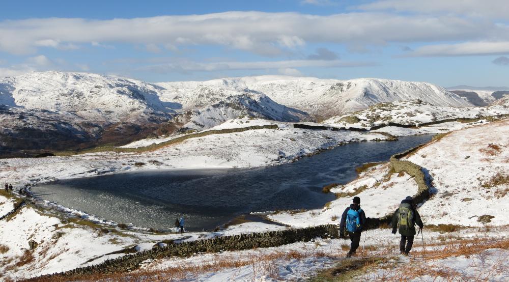
2 Cross the dam, climb over a metal bar through a wall gap and bear right, going eastwards. Along the ridge at Lord Crag are remains of an ancient drystone wall that was built in 1277 following a dispute between two landowners of deer parks on opposite sides of the ridge. Continue in a southerly direction along the ridge and over a wall stile: a view of Windermere appears ahead. Continue downhill to Nab Scar, with its panoramic views of Rydal Water below.
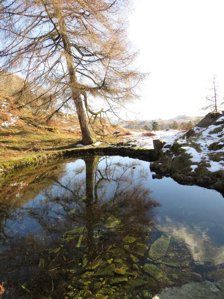
3 Descend via a steep twisting path, which is stepped for much of the way. Keen walkers will recognise this path as the start (or end) of the Fairfield Horseshoe route. At the bottom go through a kissing gate then down a concrete road past Rydal Mount and Rydal Hall. Turn right to walk past St Mary’s Church and through a kissing gate into Dora’s Field. Descend to the A591, cross with care, turn right along the pavement then left to cross the new footbridge. Turn right onto the path signed Rydal Water and Grasmere, through the woods then along the main path beside Rydal Water. Continue on the main path avoiding gates into woods on the right. At the top of the uphill path bear right and descend alongside a wall towards the bottom end of Grasmere. Cross the footbridge below the weir (signed Rydal 2 miles, Ambleside 3 miles) then turn left. Keep left and go along the boardwalk path signed Grasmere. Just before meeting the A591 turn right and after 100 yards, left through a gap stile. Cross the A591 to the layby opposite and go through a metal gate on the right into Baneriggs Wood. Follow the path to the left, initially back along the road, then upwards through the woods to a gate beside a minor road. Turn right and return to where the walk began at the top of the slope.
Next week: Settle
NB: Restrictions on space mean that this article provides a general summary of the route. It is advisable for anyone who plans to follow the walk to take a copy of the relevant Ordnance Survey map.


Comments: Our rules
We want our comments to be a lively and valuable part of our community - a place where readers can debate and engage with the most important local issues. The ability to comment on our stories is a privilege, not a right, however, and that privilege may be withdrawn if it is abused or misused.
Please report any comments that break our rules.
Read the rules here