
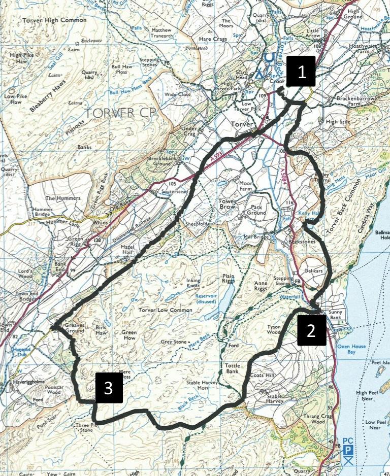
RAMBLE around the three commons of Torver - High, Back and Low - with an impressive backdrop of the Coniston Fells for the whole way, writes JOHN EDMONDSON. Visit the little known Kelly Hall Tarn and enjoy great views of Coniston Water. This peaceful area feels like miles from anywhere. The walk is best enjoyed in spring but can be difficult in late summer when the bracken grows high.
Start from the lay-by on the A593 from Coniston after the Torver place name sign, grid reference SD 286 945; nearest postcode LA21 8AY.
INFORMATION
Distance: 7 miles with 1200 feet of ascent.
Time: 4 hours
Terrain: Mainly along little used footpaths.
Map: OS Explorer OL6
ROUTE
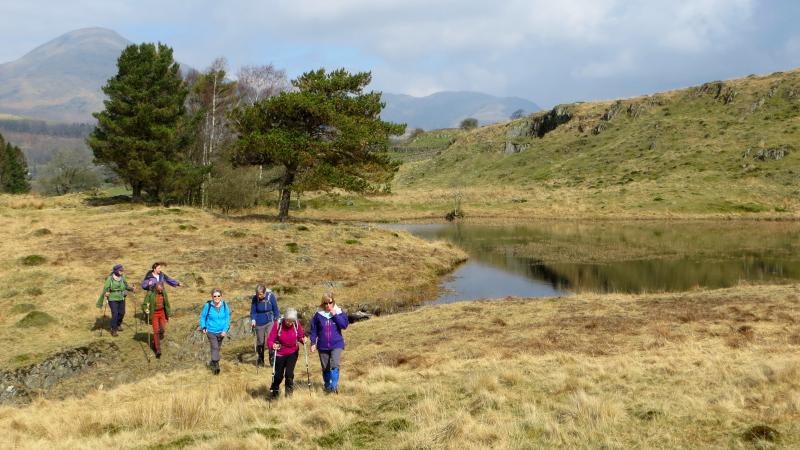
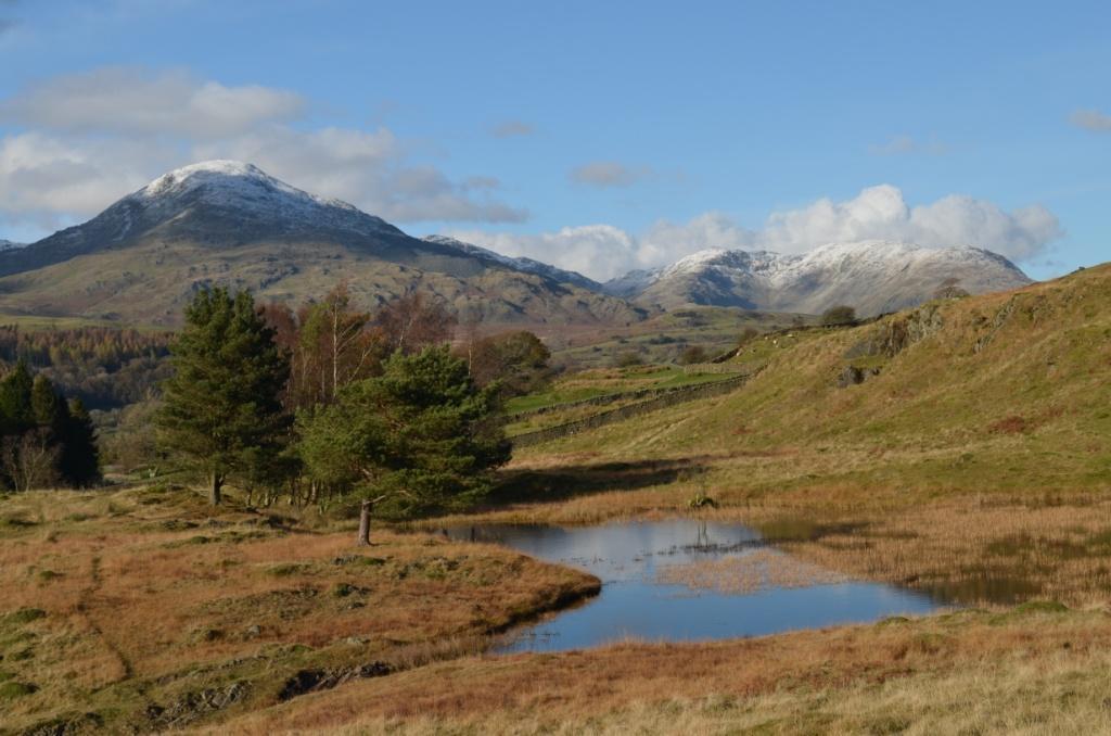
1 Walk towards Torver and turn left on to the footpath immediately after the driveway to Brigg House. Cross the railway path and at the road turn right. Turn left on the A5084 for 50 yards then go through a gate on the left. Climb a steep slope then bend round to the left to go through a wooden gate. Turn right and follow an uphill path through a fence gate then alongside a wall on the right and continuing along the grassy path. Just after the Lakeland Land Rover garage appears ahead the path bends left and Kelly Hall Tarn appears ahead. Walk past the right of the tarn and continue ahead across a small beck and up a slope. A splendid view of Coniston Water appears ahead. Follow the grassy track descending roughly parallel to a wall on the right. On meeting the Cumbria Way turn right then descend to the left and go through a kissing gate in the lower corner. Walk alongside a wall on the left to the A5084, turn left and descend to cross Sunny Bank Bridge.
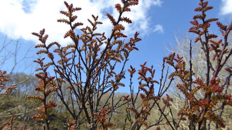
2 Immediately after the bridge turn right on to the signed footpath through Hougun Manor Estate. Follow the uphill path alongside a wall on the left to join a tarmacked lane by the gateway to Stable Harvey Farm. After 50 yards turn right on to the Cumbria Way. Just before the main path crosses a beck near a craggy mound turn right on to a minor path through bracken. Follow the path around the edge of the Common, keeping right where it approaches a prominent birch tree. The path then goes 100 yards to the right of a large solitary conifer then ascends gently to the side of Mere Moss valley. The acid wetland supports bog myrtle, a shrub whose leaves produce a resinous fragrance when rubbed. In spring, each plant bears either orange (male) or red (female) catkins. Cross the valley to meet a path on the other side.
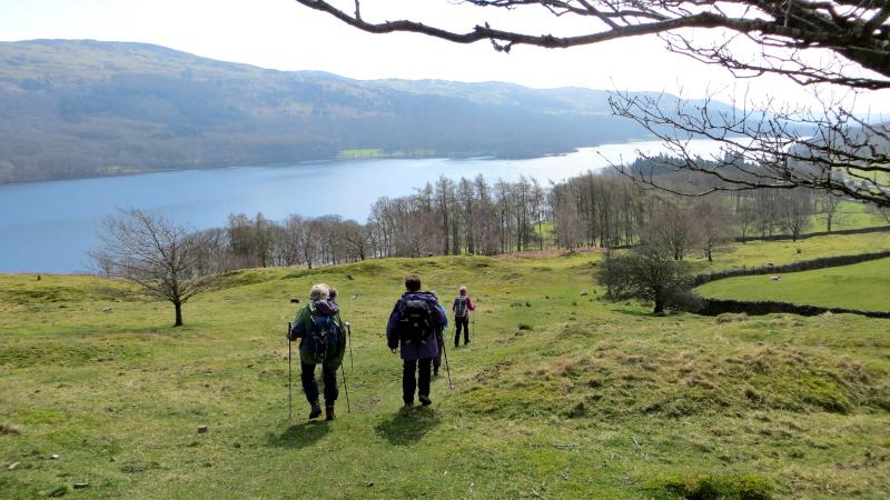
3 Turn left on to the path bending to the right between two birch trees then descending into an attractive valley beside a wall on the left. Keep following the path by the wall, go through a gate and descend to the farm at Greaves Ground. Walk past the farm to a road and turn sharp right. Follow the quiet road for 1.3 miles to the A593. The line of the former railway to Coniston can be seen on the left. Cross the A593 turning right then left and walk along Back Lane to Torver. Cross the A593 near the Wilson Arms on to the A5084 and turn left on to the path/cycleway. After a quarter of a mile turn left onto the path where the walk began and return to the A593 next to Brigg House driveway.
Next week: Yealand Conyers from Tewitfield
NB: restrictions on space mean that this article provides a general summary of the route. It is advisable for anyone who plans to follow the walk to take a copy of the relevant Ordnance Survey map.


Comments: Our rules
We want our comments to be a lively and valuable part of our community - a place where readers can debate and engage with the most important local issues. The ability to comment on our stories is a privilege, not a right, however, and that privilege may be withdrawn if it is abused or misused.
Please report any comments that break our rules.
Read the rules here