
Loughrigg Fell, Tarn and Falls
LOUGHRIGG Fell is one of the most popular Wainwrights: understandably so because its ascent is a proper fell climb without being excessively demanding, the views are magnificent and it’s central to the Lakes. This walk combines an ascent of the fell with visits to the beautiful Loughrigg Tarn and the impressive Skelwith Falls.
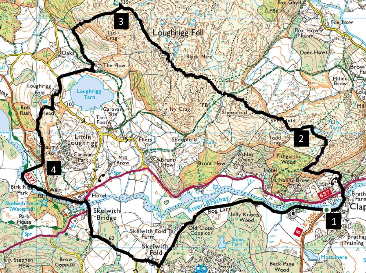
Start from Clappersgate, near Ambleside, grid reference NY 365 033, nearest postcode LA22 0HP. Travel there by bus (service 505) or park by the B5286 next to the River Brathay.
INFORMATION
Distance: 6 miles with 1,800 feet of ascent.
Time: 4 hours
Terrain: fell paths
Map: OS Explorer OL7
ROUTE
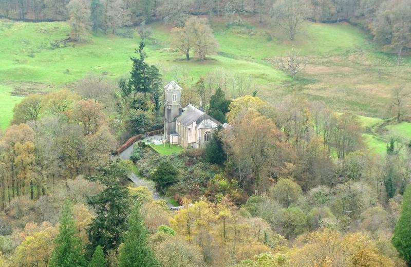
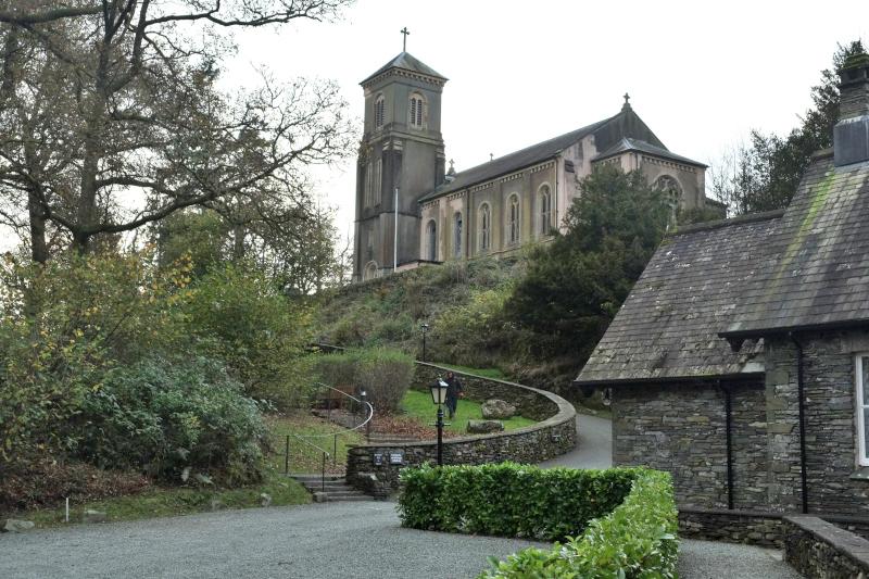
1 From the bridge over the River Brathay walk up to the A593 and cross the road with care. Follow the footpath starting directly opposite the junction with the B5286 going uphill through woods. Go through a gate and continue past a lovely viewpoint above Holy Trinity Church. Turn right before a gate by a bench seat and continue up the path leading to a small pond. Go up the slope beyond the pond to above Lily Tarn.
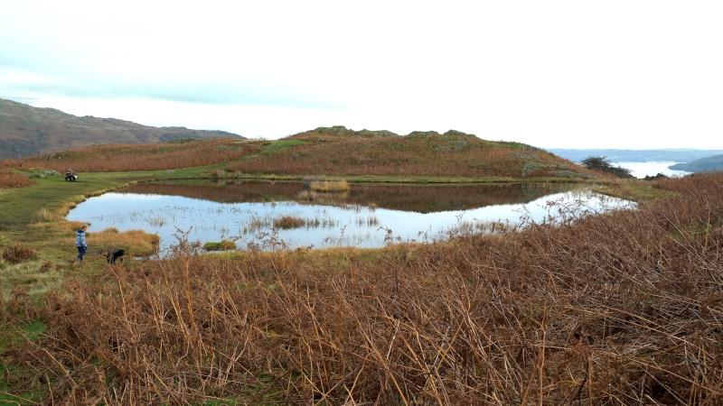
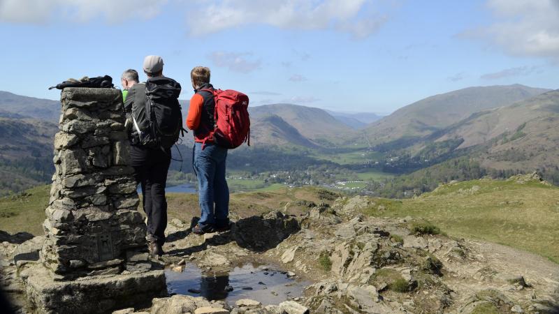
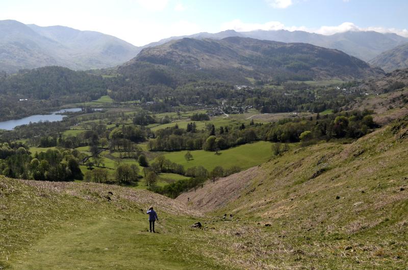
2 Go along the path that follows a wall on the left. Cross a small beck then turn right and cross the main stony track. Follow an uphill path passing Ivy Crag on the left. An optional excursion to the top of Ivy Crag is rewarded by splendid views over Windermere and Great Langdale. Follow the main path turning left between two marshy tarns, up a slope, keeping left beside another small (10 yards long) tarn and continuing parallel to a wall on the left. Follow the cairned path through a valley with scree sides then up a stepped path. The summit of Loughrigg appears ahead. AW pointed out that Loughrigg has more paths to the square mile than any other fell. If you deviate from the route to the summit head in a north westerly direction and aim high! Walk past a cairn and complete the ascent to the 1,099-feet summit, the highest point on the walk.
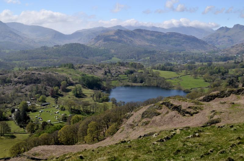
3 Descend back to near the cairn and turn right (westerly), descending towards Elterwater along a bracken-covered valley. At the edge of Intake Wood turn left and go through the gate by a wall. Follow the path keeping right to meet the track that goes around Loughrigg Tarn. Turn left on to the track left then right, descending towards the tarn, then turn right and follow the grassy footpath right of the tarn. At the road turn left and after 150 yards right on to a footpath passing Loughrigg Fold cottage on the right. After passing a cottage on the left turn right to go over Crag Head and follow the path leading to Silverdale car park.
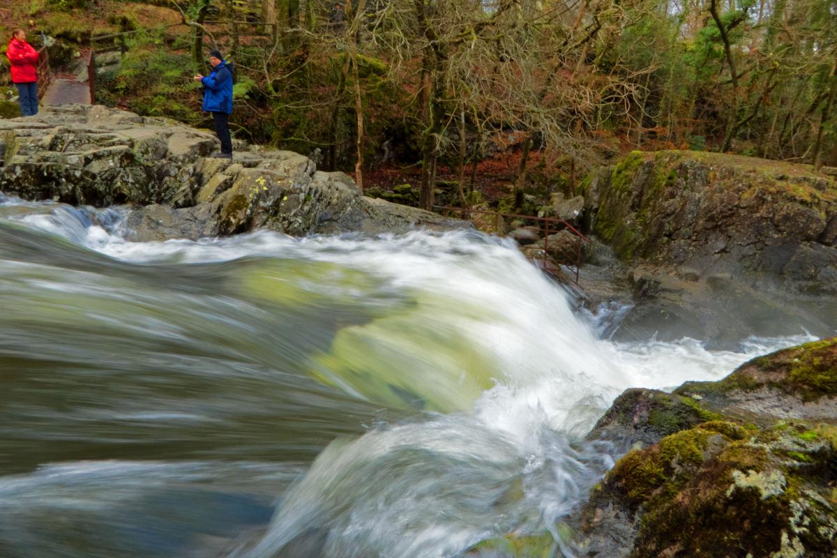
4 Cross the B5343 on to a footpath towards the River Brathay and turn left on the riverside path. Pass the footbridge, view Skelwith Force waterfall then continue along the path on the left side of the River Brathay to Skelwith Bridge. Turn right on to the A593, cross the road bridge then keep straight on to the minor road to Skelwith Fold. In this pretty hamlet turn left by the village noticeboard (the turning is easy to miss). From there, it's a mile and a quarter along a quiet road back to the start. You can bypass a small hill by following a short footpath going through woodland beside the river on the left. Holy Trinity Church is passed a quarter of a mile before the end.
Next week: Rosthwaite to Wythburn via Eagle Crag (travelling by bus to the start)
NB: restrictions on space mean that this article provides a general summary of the route. It is advisable for anyone who plans to follow the walk to take a copy of the relevant Ordnance Survey map.


Comments: Our rules
We want our comments to be a lively and valuable part of our community - a place where readers can debate and engage with the most important local issues. The ability to comment on our stories is a privilege, not a right, however, and that privilege may be withdrawn if it is abused or misused.
Please report any comments that break our rules.
Read the rules here