
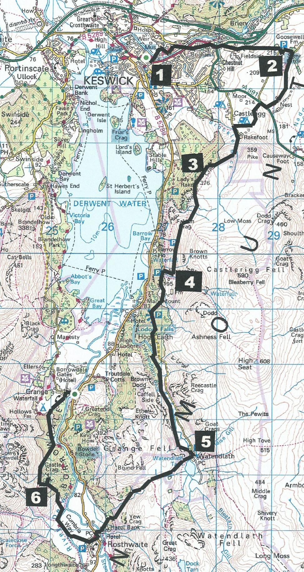
THE reopening of the A591 at Dunmail Raise makes this walk a little more accessible to those in the South Lakes area, writes John Edmondson. This challenging expedition visits six 'must see' icons, combining history and fantastic views. It’s a long, hilly walk starting from Keswick town centre and returning from Grange in an open-topped bus. Start from Moot Hall in the town centre.
Information:
Distance: 12 miles, ascent: 2,750 feet
Time: 6.5 hours
Terrain: mixed surfaces, including steep climbs, wet underfoot in parts.
Map: OS Explorer OL4
Route
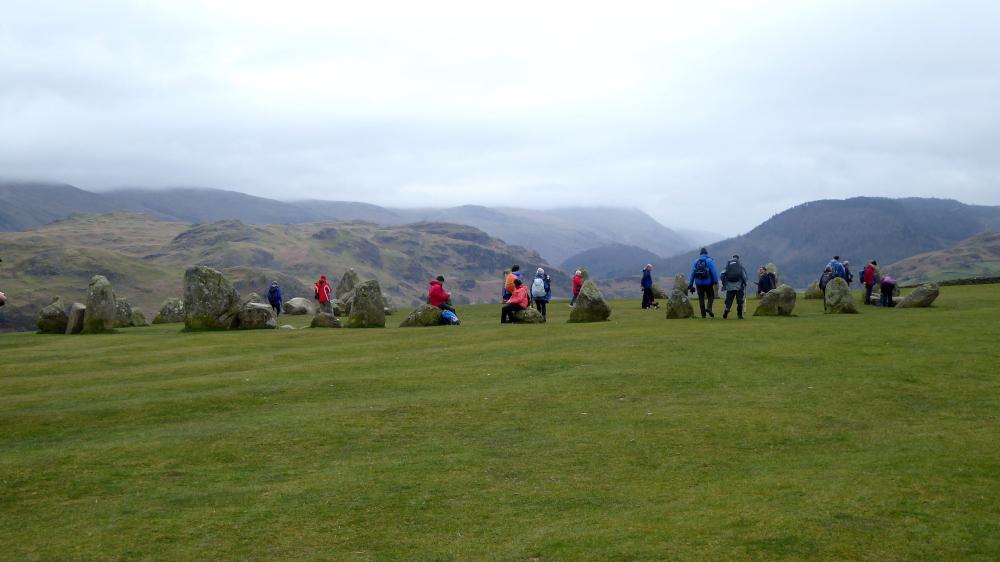
1 From Moot Hall head northeast to Station Road, across the River Greta and past Fitz Park. Turn right onto Brundholme Road and right to go up onto the railway path. Walk along the path for half a mile and after passing under a concrete bridge leave to the left to meet the A5271 next to Travis Perkins. Turn left beside the A591 then cross the road to bear right up the minor road called Eleventrees and signed Castlerigg Stone Circle. It’s a steady uphill climb for three-quarters of a mile to Castlerigg Stone Circle on the right. This 100-feet diameter ring of about 40 stones was built more than 4,500 years ago and whatever its original purpose, the impressive location now attracts thousands of visitors.
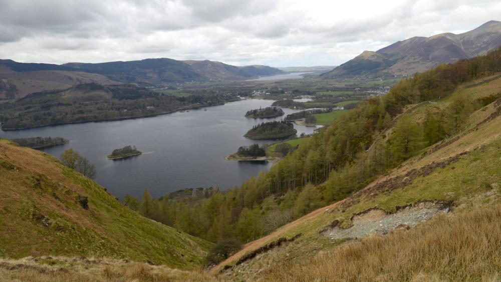
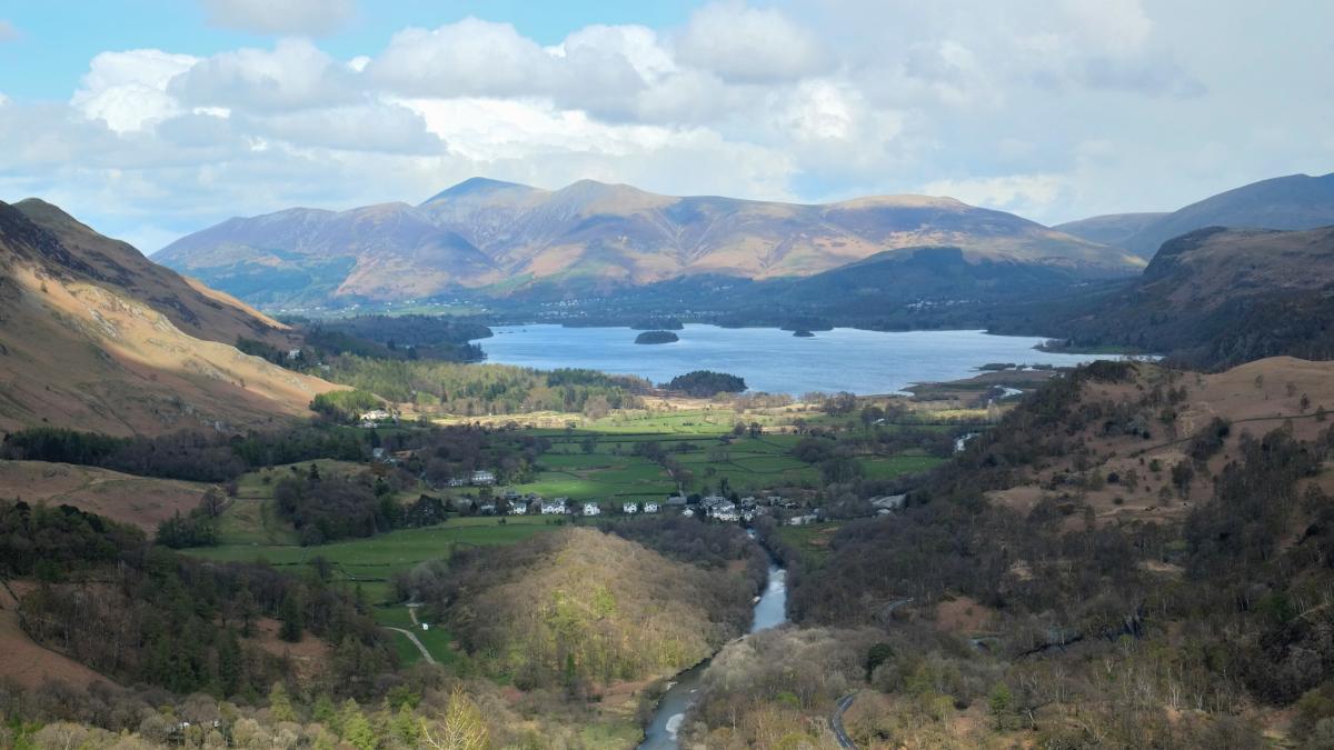
2 Go back to the road and turn right then right onto the footpath signed High Nest A591. Follow the footpath to the A591. Cross the road, turn right and after 125 yards left onto a footpath signed Walla Crag. The path bends to the right around a wall, passing a campsite on the right. Turn left on the road and keep ahead where it is signed Walla Crag. Turn right over the footbridge or ford to go uphill and through a gate. Walk up the steep path with a wall on the right and views of Blencathra behind. After passing a wood turn right through a kissing gate and follow a narrow path round the edge of a steep drop to the top of Walla Crag. Enjoy splendid views over Keswick, Bassenthwaite Lake, Derwent Water and the fells beyond.
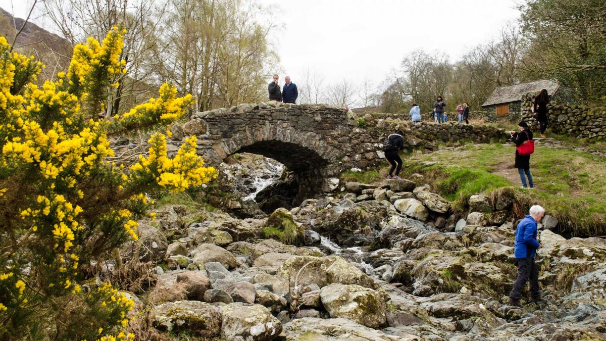
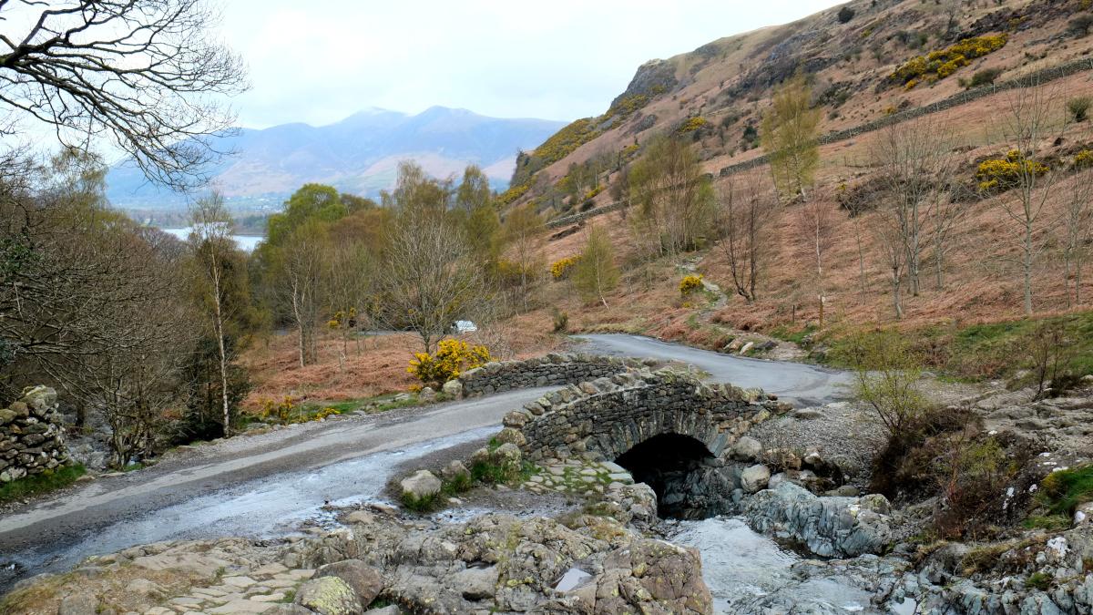
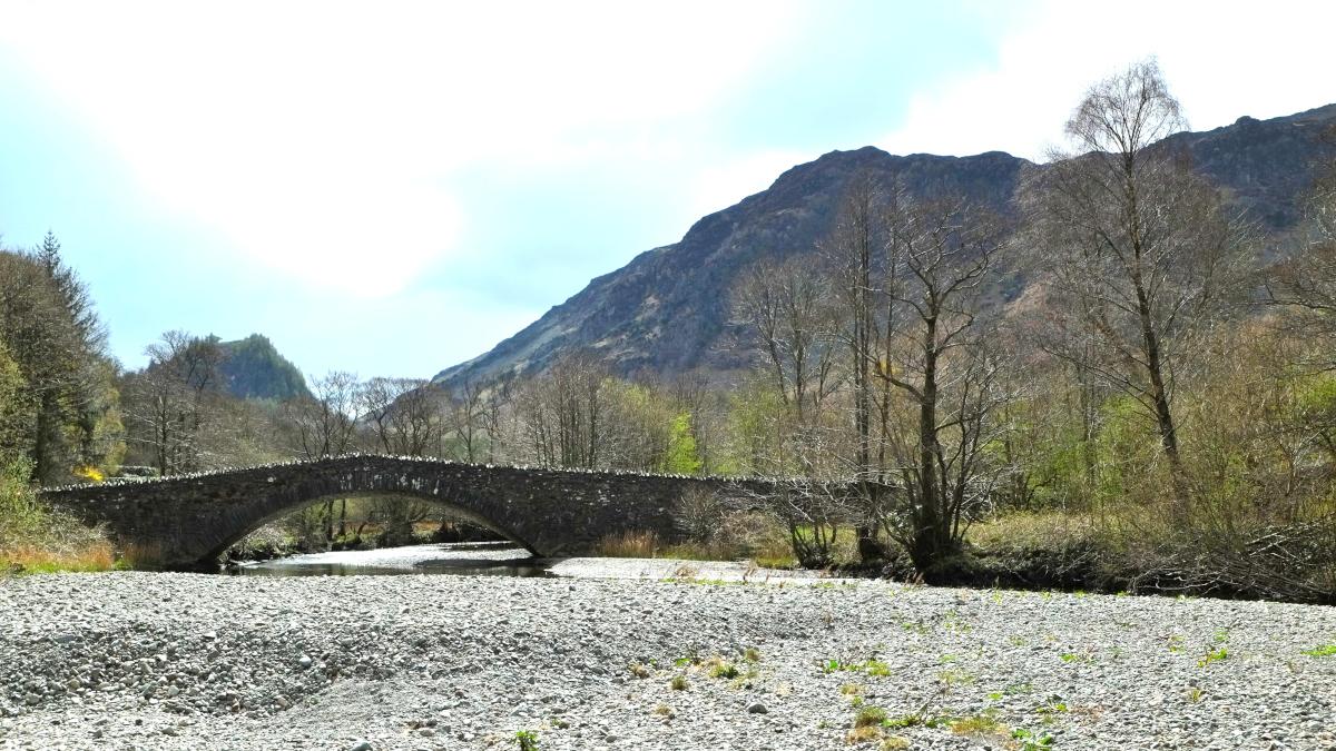
3 Walk down 100 yards to a wooden stile on the left of a larch wood. Follow the path ahead but bear right to circle the edge of the fell and cross a gulley at the top of Cat Gill. The path descends southwards towards the end of the lake along a stony downhill path then through a wicket gate. Turn right just before the beck and go along the path signed Ashness Bridge 150m. Ashness Bridge is one of the most photographed structures in the area so the challenge here is to find a viewpoint different from everyone else’s. Check the water level in the beck to help decide the next stage of the walk.
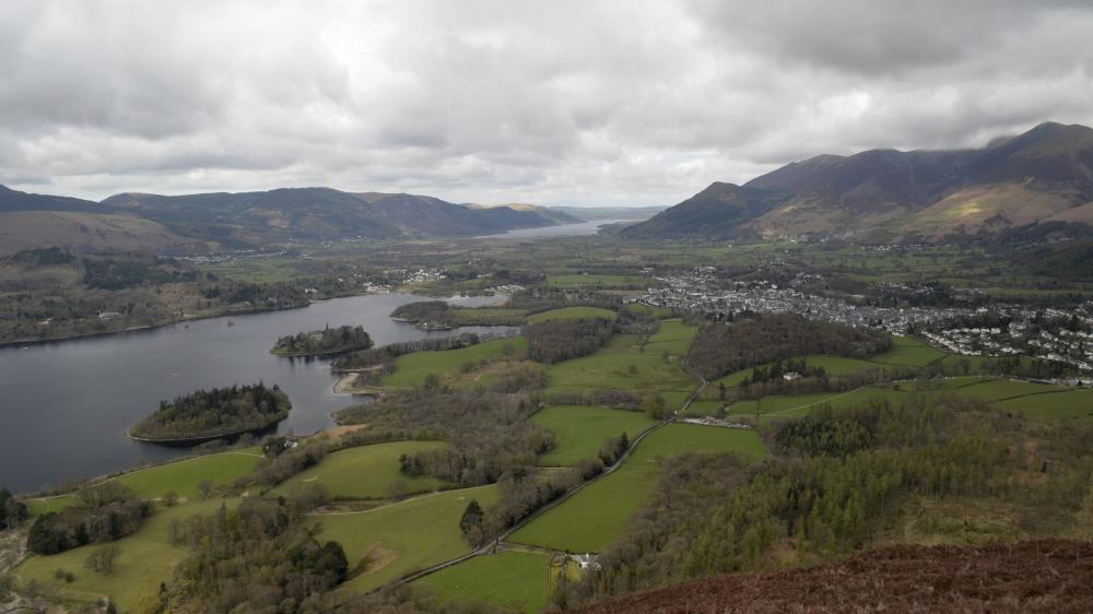
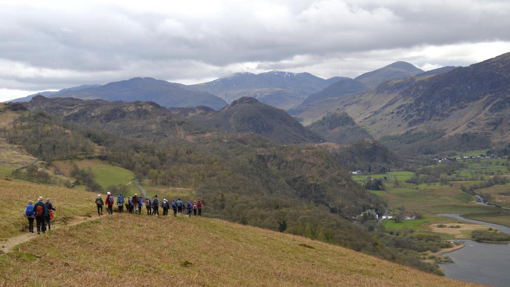
4 Turn left and follow the road up to Surprise View. Admire the sight over Derwent Water then continue up the road for a further quarter of a mile to a footpath on the right, signed Watendlath. If the water level at Ashness Bridge is low follow this path down to Watendlath Beck then up the beck-side path to Watendlath. The flood-damaged footbridge is impassable but the wide ford is easy to cross after dry weather. If the water level is high continue along the road to Watendlath.
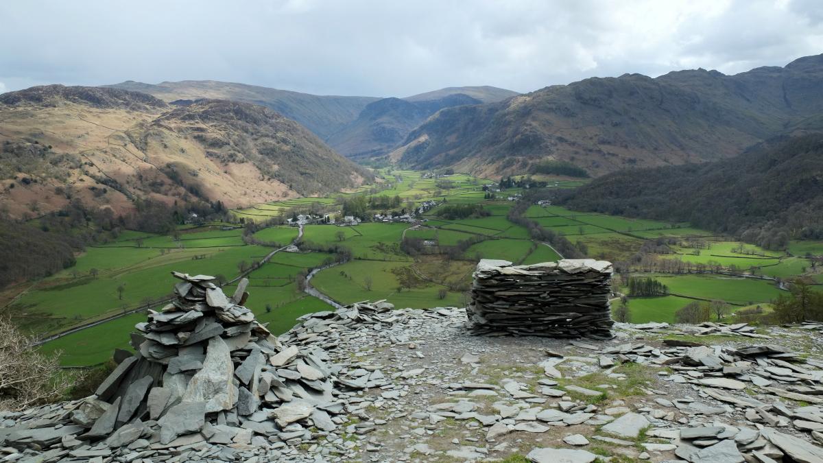
5 From the temporary bridge at Watendlath walk past the end of the tarn and up the stony track to the top of Puddingstone Bank. Descend straight ahead through a gate, down a stony path then through a gate on the right, signed Rosthwaite. Cross Rosthwaite Bridge and at the road turn left then right to Yew Tree Farm, past toilets and a car park. Walk along the walled lane then alongside the River Derwent. Cross the bridge and turn right to continue following the river downstream. Shortly after the main path bears away from the riverbank, turn left over a stile and follow the well-made path towards Castle Crag. Go over a ladder stile and climb the zigzag path up the slate pile to the top of the crag. The short steep climb is well rewarded by views both south and north.
6 Go back down to near the ladder stile then turn right and descend to a main stony track. Turn right and follow the track that revisits the river, passes a campsite and leads to Grange. At the road turn right to go through the village with its two cafes and cross the two bridges. The bus stop for Keswick is on the right. Open top buses pass on the hour during weekdays and every half hour at weekends.
NB: Restrictions on space mean that this article provides a general summary of the route. It is advisable for anyone who plans to follow the walk to take a copy of the relevant Ordnance Survey map.


Comments: Our rules
We want our comments to be a lively and valuable part of our community - a place where readers can debate and engage with the most important local issues. The ability to comment on our stories is a privilege, not a right, however, and that privilege may be withdrawn if it is abused or misused.
Please report any comments that break our rules.
Read the rules here