
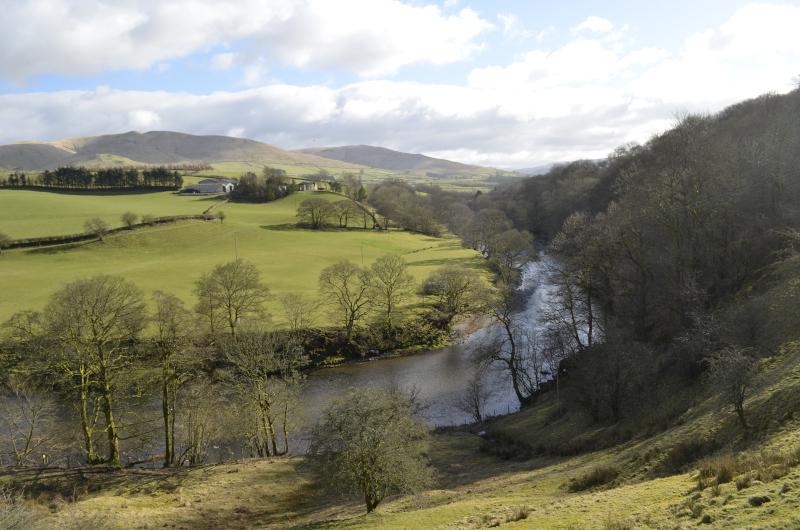
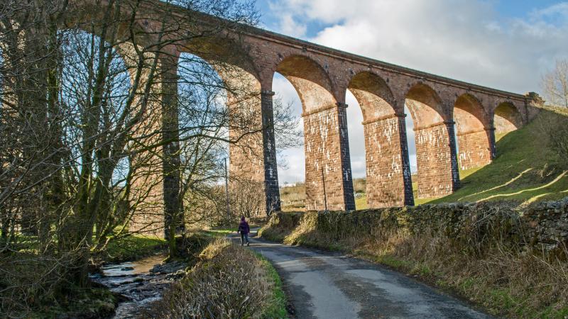
SEEN from the M6 south of Tebay, the Lowgill viaduct looks impressive as it curves across the valley of the River Lune, writes JOHN EDMONDSON. This former railway masterpiece makes a good starting place for an easy walk that goes over a quirky bridge and beside a picturesque reach of the River Lune along part of the Dalesway long distance path.
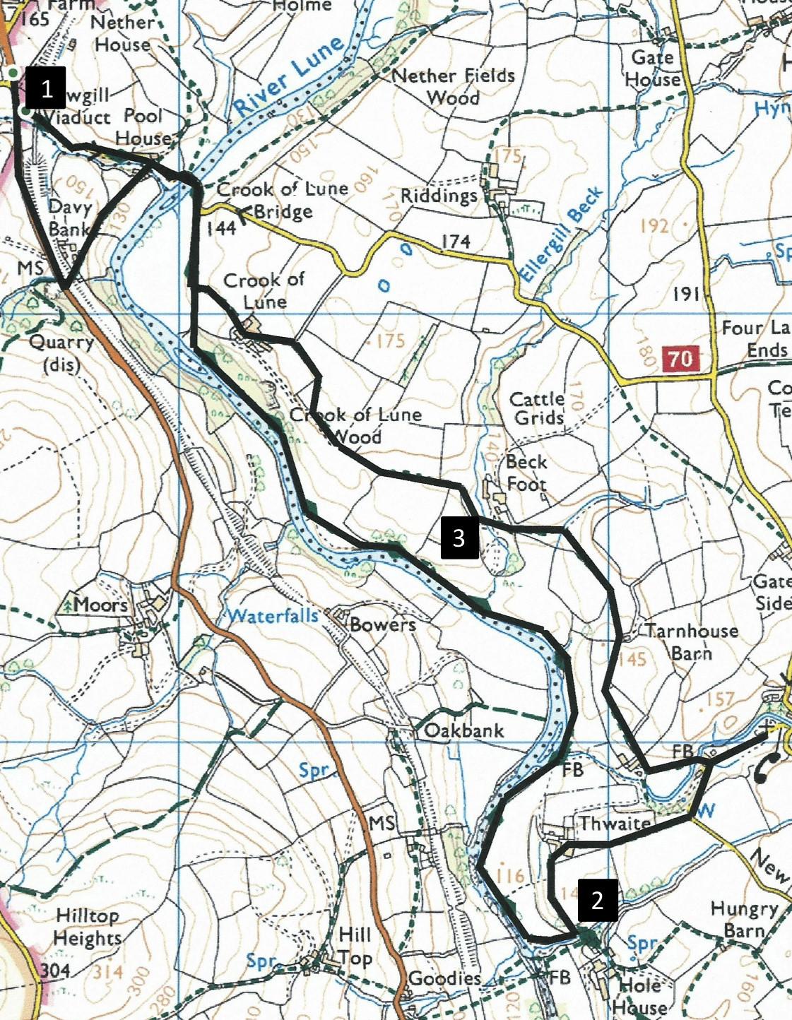
Start from beside the B6257 (Grayrigg to Sedbergh) road near the Lowgill viaduct, grid reference SD 616 965, postcode LA8 0BL.
INFORMATION
Distance: 4.5 miles
Time: 2.5 hours
Terrain: grassy footpaths
Map: OS Explorer OL19
ROUTE
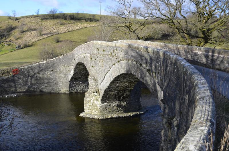
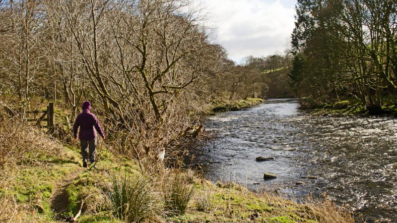
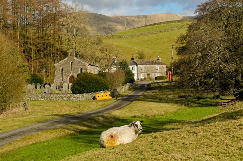
1 Walk up the road in the direction of Sedbergh. Beyond the viaduct turn left through a bridge under the railway embankment to Davy Bank Farm. Turn right through a gate before the house onto a grassy track directly above the bend (or crook) in the River Lune (or Loyne as it was once known). Good views appear ahead and over the Howgills. Descend to a gate, pass the houses and turn right on the road to cross the quirky Crook of Lune Bridge. This sturdy yet graceful 16th Century construction was built as a crossing for packhorses and drovers but its narrow width makes it a tricky manoeuvre for today’s vehicles. Continue up to a bend and turn right onto the footpath signed Thwaite - Dales Way. At a waymarker post bear right and descend to the riverside. Follow the bank of the delightful River Lune for the next 1.3 miles. A large farm building appears ahead and the path bends to the left to go beside a small beck on the right. Cross a stile then turn sharp left at a fingerpost signed Thwaite to leave the Dales Way onto a steep uphill narrow path.
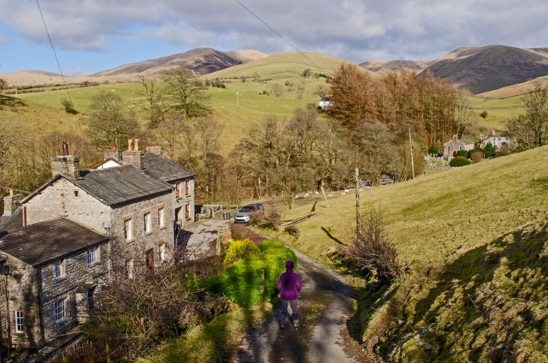
2 Turn right over a stile beside a barn then walk through a farmyard and along the farm track. On reaching a cattle grid go through the gate and turn left to follow the road into Thwaite. Make an excursion to visit the pretty Holy Trinity chapel then return to a footpath (signed Crook of Lune) going by the side the white cottage. Cross the footbridge behind the cottage then walk along the path leading to a wall stile in front of a white farmhouse. Go through the gate on the right of the house and along a farm track across a meadow then through a wooden gate beside Tarnhouse Barn. Cross the field to a fence corner by a tree and walk by the fence on the left along a farm track. Where the track approaches a wall turn left at a waymarker then right through a wicket gate towards Beck Foot farm. Turn left, cross a footbridge, then turn right along a stony track up to a gateway.
3 Go straight on then through a gate on the right and continue along the line of the fence on the left. Cross a dip to below power lines, go through a gate then immediately turn right through a second gate and left alongside the hedge on the left. A view of the viaduct appears ahead. Go up to the right outside corner of a wall and continue along the wall to a tarmacked lane. Turn left downhill and go straight through the Crook of Lune farmyard. Pass through two metal gates and alongside a wall on the right to meet the road where the walk came out on. Walk back over the Crook of Lune bridge then stay on the road to pass under the viaduct back to where the walk began.
From 1861 to 1964 the viaduct's 11, 100-feet high arches carried trains from main line just south of Tebay to Clapham via Sedbergh, Middleton-on-Lune, Barbon, Kirkby Lonsdale and Ingleton. It was never used as a main line to Scotland as originally intended, except when the winter of 1963 blocked the Settle-Carlisle line.
Next week: Wath to Ravenstonedale
NB: restrictions on space mean that this article provides a general summary of the route. It is advisable for anyone who plans to follow the walk to take a copy of the relevant Ordnance Survey map


Comments: Our rules
We want our comments to be a lively and valuable part of our community - a place where readers can debate and engage with the most important local issues. The ability to comment on our stories is a privilege, not a right, however, and that privilege may be withdrawn if it is abused or misused.
Please report any comments that break our rules.
Read the rules here