
Grayrigg Whinhowe
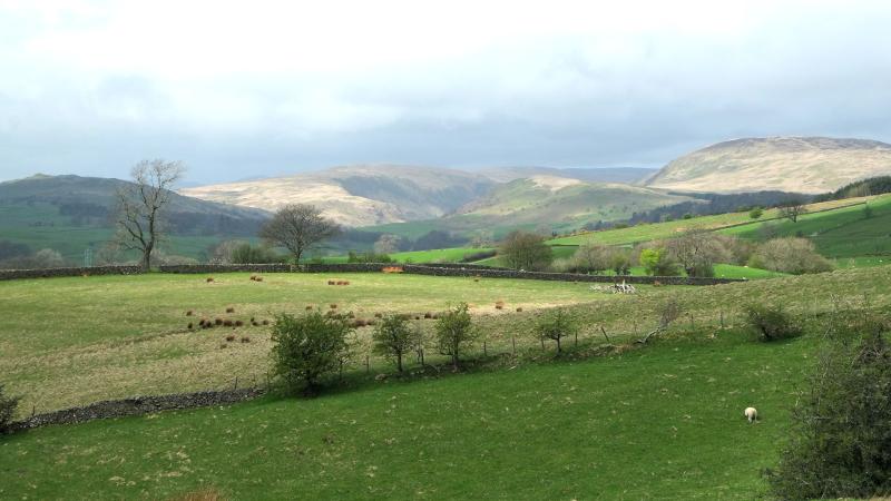
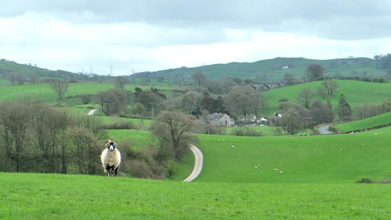
GRAYRIGG is more than just a small village that we pass through when driving between Kendal and Kirkby Stephen, writes JOHN EDMONDSON. Quiet green meadows and farm tracks invite walkers to explore attractive countryside overlooked by Whinfell Beacon with the pretty Whinhowe Gill at its centre.
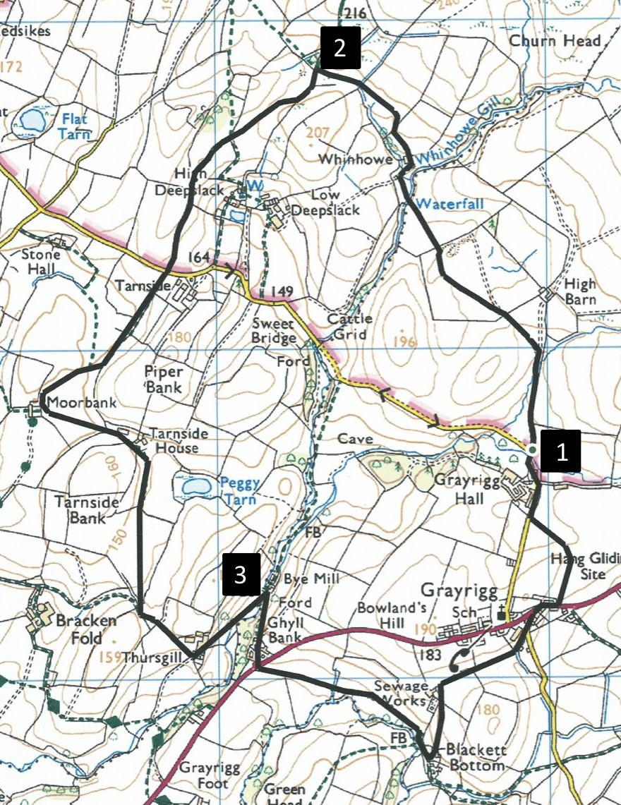
Park at the junction to the Private No Through Road north of Grayrigg Hall, grid reference SD 579 976, postcode LA8 9BU.
INFORMATION
Distance: 4 miles with 600 feet of ascent
Time: 2 hours
Terrain: farm tracks and field paths
Map: OS Explorer OL19
ROUTE
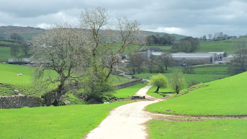
1 Walk northwards on the concrete track signed Whinfell for a quarter of a mile and after crossing a tiny beck bear left on to a grassy track. Go through a gate and across pasture to the left of a large tree. Go over a wall stile and cross the next field to below a rise on the right. Cross a fence stile next to a water gate then walk across the footbridge over Whinhowe Gill. Head upstream and go around the right of the tumbled Whinhowe barn. Go through a gate, across two fields, following the line of a beck on the left and over a wall stile in the corner next to the beck. Walk around a boggy area to meet a tarmacked lane to the left of a clay shooting shelter.
2 Walk along the lane and enjoy views of Bannisdale to the right. Cross the road to the right of the black barn with a clock tower at Tarnside and walk along a farm lane. Pass close by the right of the two houses and barn at Tarnside House, then walk along a stony track and through a metal gate ahead. Cross the field to a fence stile in its narrow left end, go through a gate and alongside a hedge on the left. Continue past a bungalow on the left then turn left to walk in front of the white Thursgill Farm house, through the farmyard and out via a gate. On 19th Century maps the farm is named Thrushgill. Descend a grassy track and cross the footbridge near Bye Mill. The beck upstream is called Whinhowe Gill but downstream, to where it joins the River Mint, it is Thrushgill Beck.
3 Turn right and follow the lane through Ghyll Bank to the A685. Cross the main road on to the track for Sunnyhollow Farm. After crossing a cattle grid followed by a gate turn left at a waymarker, across a grassy area then left in front of Ivy Bank, Blackett Bottom. Follow the lane to Punchbowl House. This was one of the Grayrigg's two pubs until it closed in 1922. Cross the A685, turn right and walk along the pavement. Immediately after the bend in the road turn left on to the signed field path. Go around the edge of the hill ahead then veer left to a wicket gate in front of Grayrigg Hall. The original hall was the home for generations of the Duckett family, who owned the land of Grayrigg from the 14th to 17th centuries. The old hall fell into disrepair and was demolished in the early 18th Century. Turn right, pass the farm entrance and return to where the walk began.
Next week: Caw and the Dunnerdale Fells
NB: Restrictions on space mean that this article provides a general summary of the route. It is advisable for anyone who plans to follow the walk to take a copy of the relevant Ordnance Survey map.


Comments: Our rules
We want our comments to be a lively and valuable part of our community - a place where readers can debate and engage with the most important local issues. The ability to comment on our stories is a privilege, not a right, however, and that privilege may be withdrawn if it is abused or misused.
Please report any comments that break our rules.
Read the rules here