
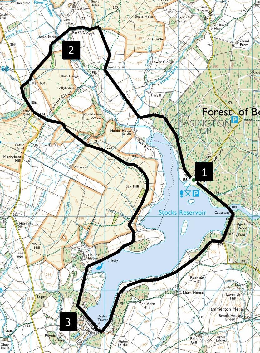
THE Forest of Bowland area is only an hour's drive from Kendal and has plenty of places to walk, writes JOHN EDMONDSON. This walk starts in Gisburn Forest and makes a circuit of Stocks Reservoir. For most of the way it follows a waymarked trail so navigation is easy. The route goes through woodlands and sheep pastures and there are opportunities to spot wildfowl on the reservoir.
The shortest way to drive there is via the A65 to Clapham, where you turn south to Clapham Station, then follow a narrow moorland road for eight miles to Stocks Reservoir pay and display car park (£3) on the right. Grid reference is SD 732 564, nearest postcode BB7 4TS.
INFORMATION
Distance: eight miles with 700 feet of ascent
Time: 3.5 hours
Terrain: grassy paths and stony tracks
Map: OS Explorer OL41
ROUTE
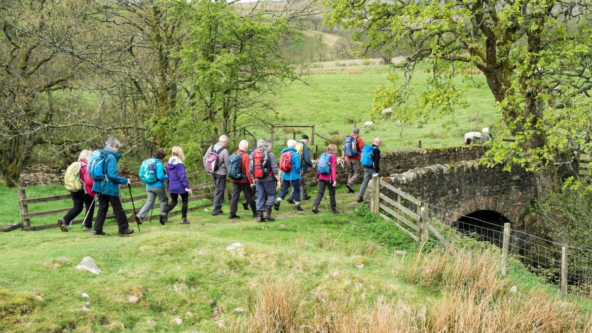
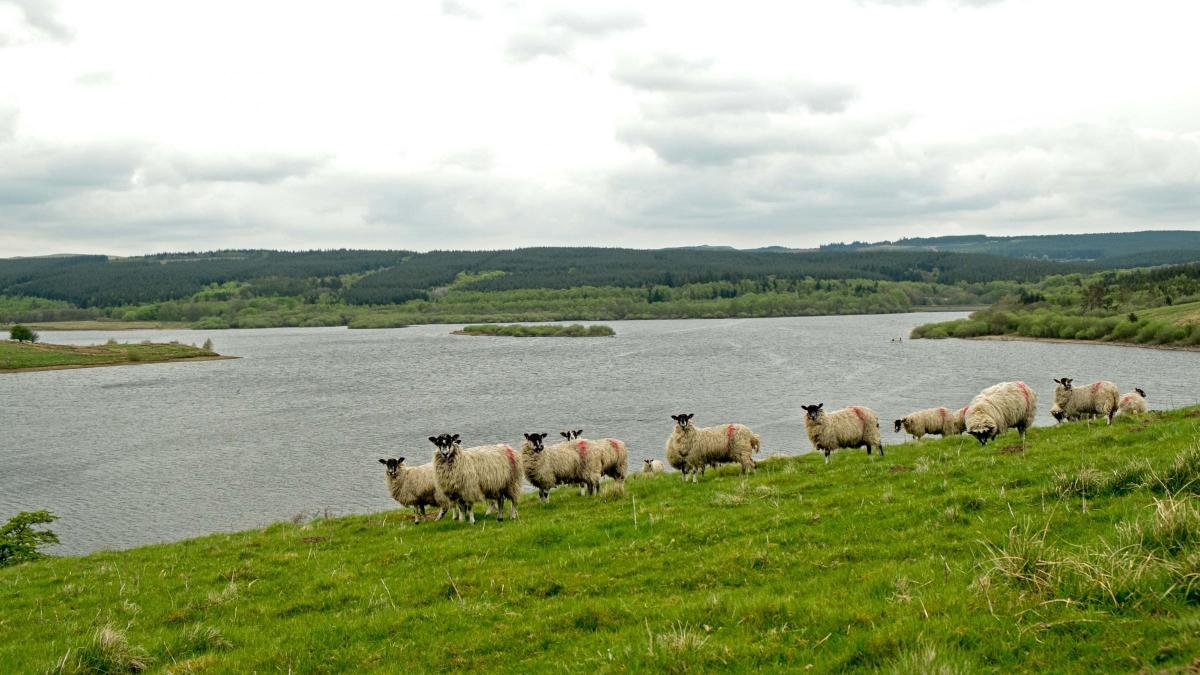
1 From the car park take the signed path behind the pay station. Just off the stony track there is a bird hide where, from October to March, some of the many species of wildfowl such as mallard, teal, wigeon, pochard, tufted duck and Canada geese might be spotted. Further on, after the track becomes grassy, go through a gate and over a stone bridge. Follow the track up to the next gate then leave the waymarked path by going to the right of the ruined farmhouse of New House. Continue up the track through a gate, branching left and after the track bends right.
Shortly before the track reaches Catlow Farm, turn left at a footpath fingerpost on to a grassy lane descending beside a beck on the left. At a wooden building turn left along a tarmacked lane and over Lock Bridge across the River Hodder.
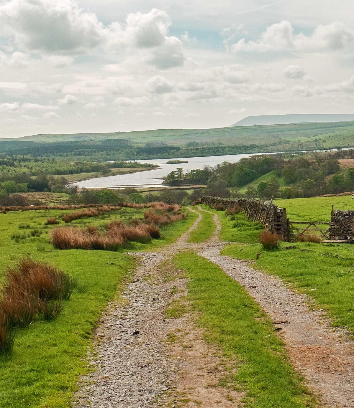
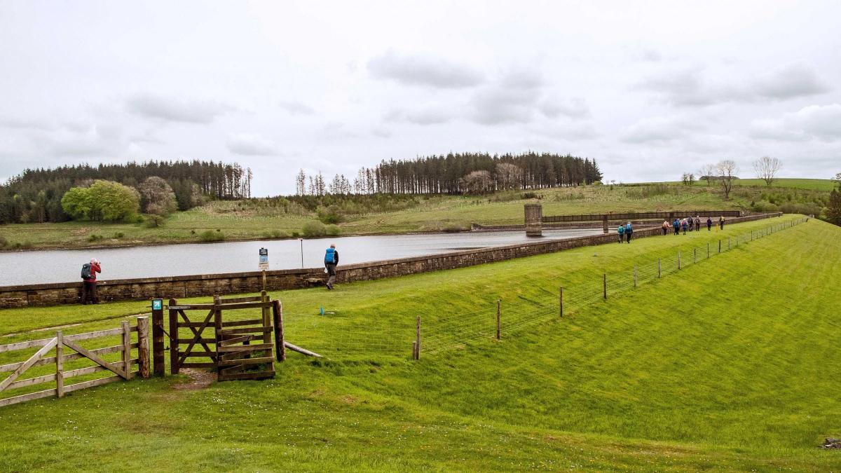
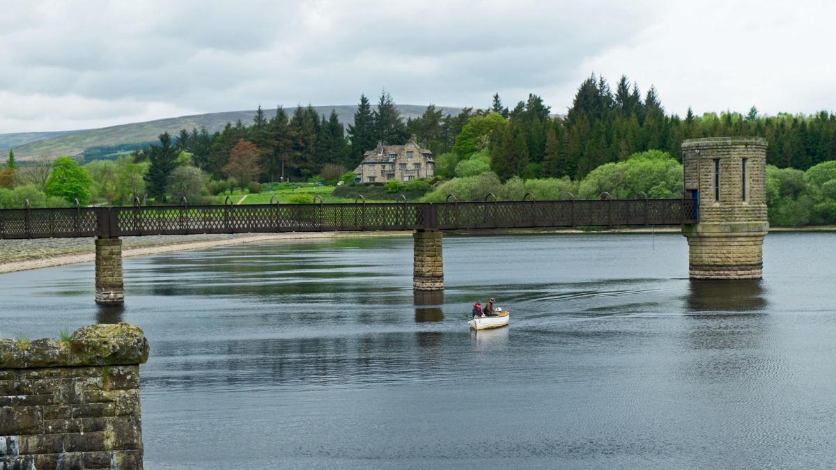
2 Pass Kenibus (a white house) and keep left at the road junction. Where the road swings right to go up a hill continue ahead and go through a gate past a barn on the left. Keep right on to the waymarked track (once a railway track) above the reservoir and descend to a jetty. Walk uphill past the Fishery Café and car park then along a tarmacked lane passing Life for a Life Memorial Forest. This site opened in 2004 and the charity raises funds for healthcare related organisations. Cross the driveway to the Bowland Estate offices and walk across the dam. Construction of the reservoir began in 1922. Preliminary work included reconstructing over five miles of road and constructing a five-mile long three-feet gauge railway from Tosside. A village (now demolished) housing 300-400 men and their families was built, complete with its own water supply, sewerage scheme, electricity supply, canteen, cinema and a recreation hall. The reservoir was completed in 1932 and supplies water mainly to the Fylde area.
3 Descend the steps from the dam and cross a bridge over the reservoir overflow then follow a grassy track beside the reservoir over meadows and through woodland. Turn left on to the track beside the roadside then left over the causeway and keep left along the roadside track through woods leading to the car park where the walk began. Information boards show that this was the site of the lost village of Stocks. All that remains now are the excavated walls of St James' Church and date stones in the wall beyond.
Next week: Loughrigg Fell, tarns and falls
NB: restrictions on space mean that this article provides a general summary of the route. It is advisable for anyone who plans to follow the walk to take a copy of the relevant Ordnance Survey map.


Comments: Our rules
We want our comments to be a lively and valuable part of our community - a place where readers can debate and engage with the most important local issues. The ability to comment on our stories is a privilege, not a right, however, and that privilege may be withdrawn if it is abused or misused.
Please report any comments that break our rules.
Read the rules here