
Written by Mary Welsh
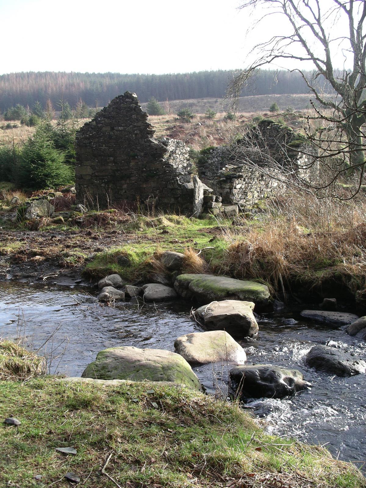
Broughton moor is a secluded forest that stretches east from the River Lickle. From it you have glimpses through the lower hills of Stickle Pike, Caw and White Pike. Through a narrow valley in the forest flows Appletree Worth Beck. It comes close to a derelict farmhouse and its equally derelict outbuildings, which sit on the east side of the lively beck. Once the beck was crossed by a wooden bridge beside a row of stepping stones. After all the rain we have had, some of the stones are under water and the ford where once the tractor would have crossed is deep and surging. Close to the stones and the ford is a delightful, narrow stone bridge. It was built in memory of Lady Angela Rooker, wife of a government minster. She was a keen fell walker and loved the low level walks around the area.
Park on open ground on the north side of Hawk Bridge, grid reference 239919, reached from Broughton or Torver by narrow lanes.
Information:
Distance: 4 miles
Time: 2-3 hours
Terrain: Good forest roads, one long narrow wet descending footpath.
Map: OS Explorer OL 6
1 Go ahead from the parking area, along a good track. Pass through the side gate by the farm gate and continue on, below fine larch and birch trees. Enjoy this pleasing stretch through the quiet forest, with no traffic sounds to spoil your walk. Follow the path as winds a little left and climbs, passing various holes in the crags on your left. Soon you come close to the beck rushing on it way. At the junction of paths, keep right and walk on for a short way to view the stepping, stones and the lovely little bridge.
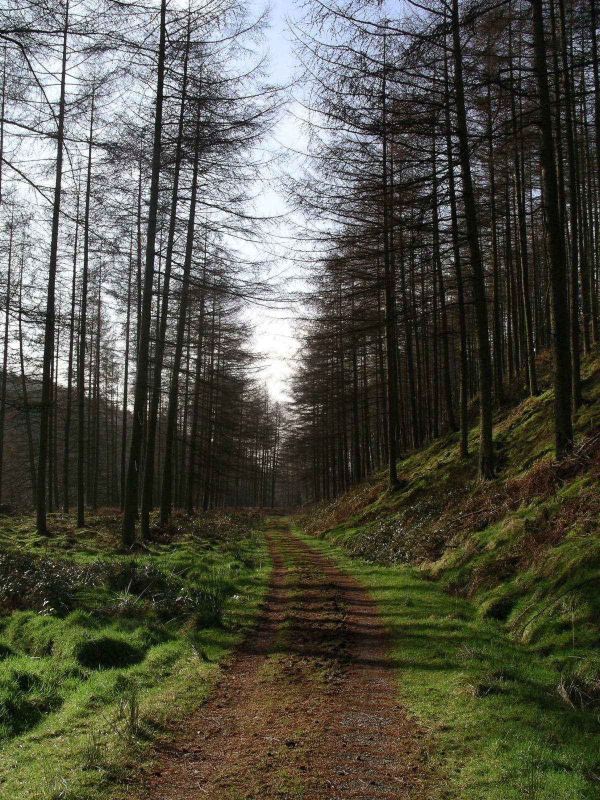
2 Climb up the signposted narrow path opposite the bridge and turn right onto a forest track. Stroll on climbing steadily as the easy-to-walk track climbs and winds a little as it goes. Ignore an early left turn and two footpaths and continue up the wide track for a mile to reach a junction. Here turn left and follow the winding way for nearly three quarters of a mile through the forest. Here the track is muddy after forestry activity but still easy to walk.
3 At the next junction, bear left and follow an older forestry track, which still provides quite a reasonable surface as it steadily descends. Eventually it arrives at an open area. Bear left here along a narrow path over rough ground to the edge of the forest where it becomes a narrow path descending through the conifers.
4 The entrance to the path is slightly to your right. It is muddy for most of the way and has puddles to bypass. With the trees close to both edges of the path the way becomes silent. At one point the path supports a narrow shallow stream, which soon turns away into the conifers. Eventually you do come out of the trees and the narrow path continues beside the forest on your right. It then leads you over to open ground and onto the track you walked earlier.
5 Turn right and stroll on along your outward route, with the beck, the little bridge and the ruins of the farm soon coming into view below to your left. Carry on to the junction and descend to walk your outward path right, with the beck to your left and the pleasing walk to the gate and the car park beyond.
NB: Restrictions on space mean that this article provides a general summary of the route. It is advisable for anyone who plans to follow the walk to take a copy of the relevant Ordnance Survey map.


Comments: Our rules
We want our comments to be a lively and valuable part of our community - a place where readers can debate and engage with the most important local issues. The ability to comment on our stories is a privilege, not a right, however, and that privilege may be withdrawn if it is abused or misused.
Please report any comments that break our rules.
Read the rules here