
written by John Edmondson
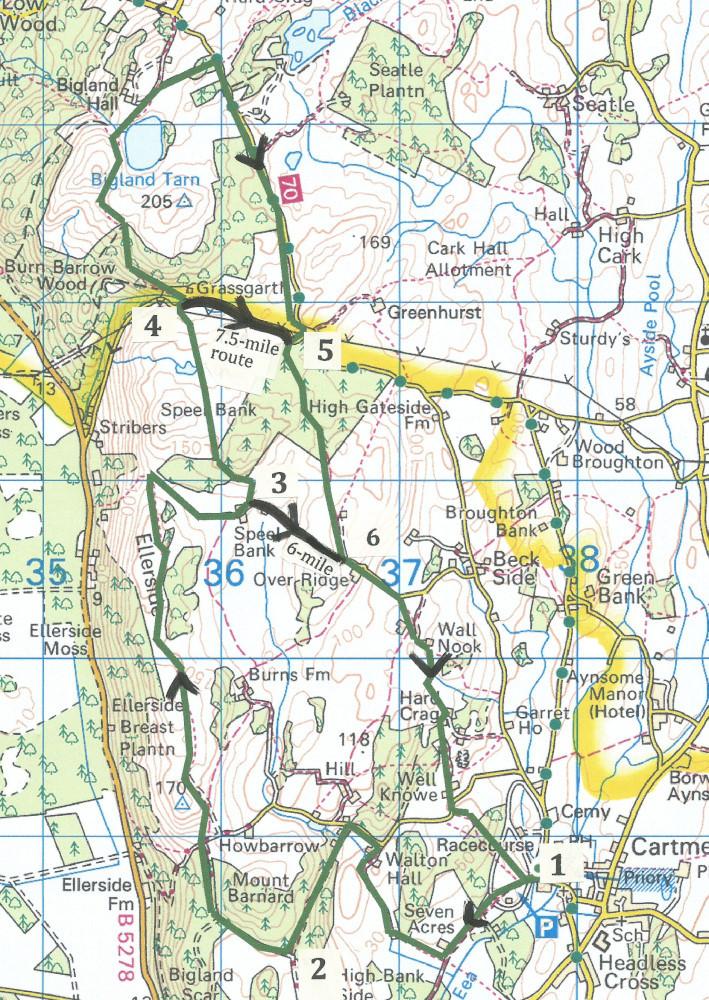
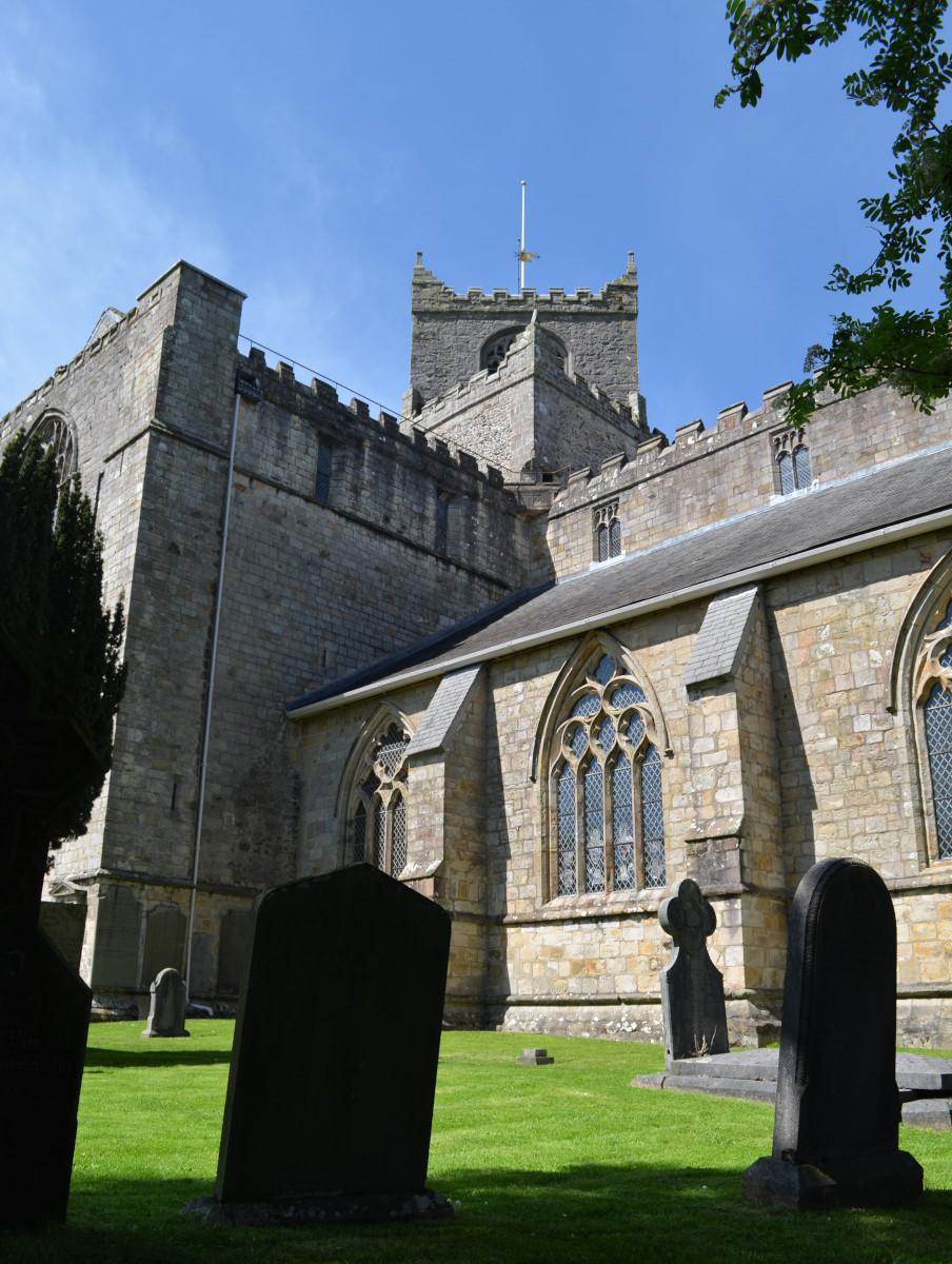
Cartmel and Bigland Tarn
This is a 10-mile walk with options to shorten it to either 6 or 7.5 miles. Each option covers pleasant pastoral and woodland scenery and offers splendid views, particularly over the Leven Estuary. The longer route also includes a loop of the attractive Bigland Tarn.
Start from Cartmel racecourse car park (grid reference SD 377 787).
Information:
Distance: 10, 7.5 or 6 miles
Time: 3-4 hours
Terrain: mainly grassy footpaths and tracks.
Map: OS Explorer OL7
Route
1 Leave the car park on the opposite side to its entrance passing through a metal gate and follow the middle of three tracks; cross the racecourse and go through two more metal gates. Walk across the field along a stony track then turn right onto the footpath signed Howbarrow and Walton Hall. Follow the grassy track beside a wood to a metal gate then cross a narrow beck over a stone footbridge next to a ford. Turn right and walk along a stony track. Bear right at Walton Hall and continue to a tarmac road. Turn left up the road then left onto a signed Public Bridleway. The stony track goes uphill through woods at the edge of which turn right onto the Cumbria Coastal Way.
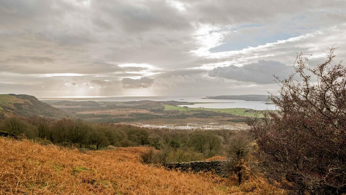
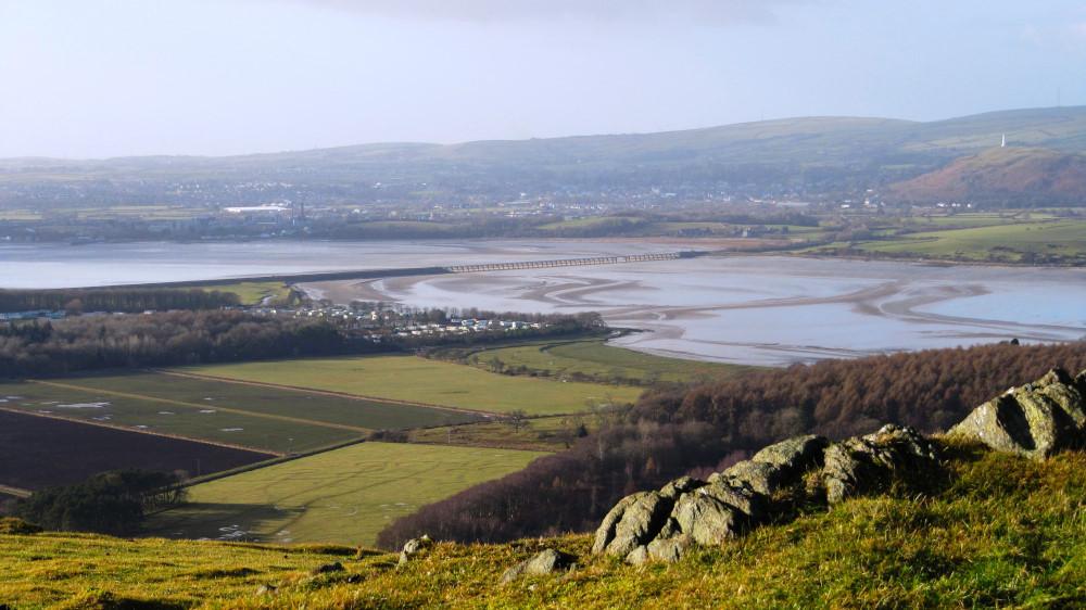
2 A view of Morecambe Bay appears on the left. Walk along the wide, walled track emerging to a field, and continue walking along the signed Cumbria Coastal Way. Views of Ulverston appear on the left with the railway viaduct in the foreground and Hoad Hill Monument beyond. Walk up to the hilltop keeping to the right of a wall as indicated by a waymarker. On a clear day, views as far as the Howgills now become visible to the north. Cross to a gateway at a wall corner, go round the left of a boggy area and head downwards to pass to the right of a large rock outcrop. Walk alongside a wall on the right to a metal gate, passing a wood and two small ponds to emerge into an open area with views of the Leven Estuary. Climb over a wall stile on the right just before a metal gate. There is a deer farm here and a herd may be seen through the fence on the left. Continue to Speel Bank farm onto a track.
3 For the six-mile walk turn right and walk along the road for 600 yards to rejoin the longer route at Over Ridge. For the longer walks go left over a fence stile with a footpath fingerpost up to the wood signed Cumbria Coastal Way then onto open fells. Go over a wall stile then to the right on a track with a pond on the left. Walk downhill towards the white house of Grassgarth and through a kissing gate to a road.
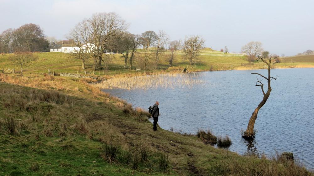
4 For the 7.5-mile walk turn right and continue along the road for 600 yards then rejoin the route by turning right into Great Allotment. The longer route crosses the road onto a path signed Cumbria Coastal Way, crosses Stribers Beck near the house and goes left into woods. Follow the waymarked path northwards to Bigland Tarn, with the hall on the left. After the tarn go past a log chalet then turn right onto the track signed High Gate. Turn right onto the road and after about a mile right again, then left onto a public bridleway into Great Allotment.
5 Walk along the stony track past a pond on the right; the track then narrows to a footpath and goes through two gates then between a ruin and a concrete hut. Continue along the track then turn left onto a road at Over Ridge.
6 Go downhill and turn right onto a footpath through a hedge. Cross the field to a roadside gap stile. Turn right on the road and go round the right of the houses called Wall Nook. Cross the field and bear right to a wall stile then go along the wall on the left, across a stone footbridge, through a gateway on the left and down to some houses. Go around the front of the white house onto a signed footpath underneath trees. Walk down the track (past a motor graveyard and a recently built house named Rocklands). Turn right at the road and through a waymarked metal gate on the left, across a field to a wall stile into woods. Leave the woods and walk across the racecourse to where the walk began.
NB: Restrictions on space mean that this article provides a general summary of the route. It is advisable for anyone who plans to follow the walk to take a copy of the relevant Ordnance Survey map.


Comments: Our rules
We want our comments to be a lively and valuable part of our community - a place where readers can debate and engage with the most important local issues. The ability to comment on our stories is a privilege, not a right, however, and that privilege may be withdrawn if it is abused or misused.
Please report any comments that break our rules.
Read the rules here