
Low Borrowdale
Those who rush along the M6 near junction 38 at Tebay might not even notice the attractive countryside that surrounds them, writes John Edmondson. But leave this busy, noisy highway and you can enjoy peace and tranquillity by walking along the beautiful valley of Low Borrowdale and on part of the vast remote fell area of Roundthwaite Common. Sheep and fell ponies might be the only other creatures seen walking on these quiet open hills.
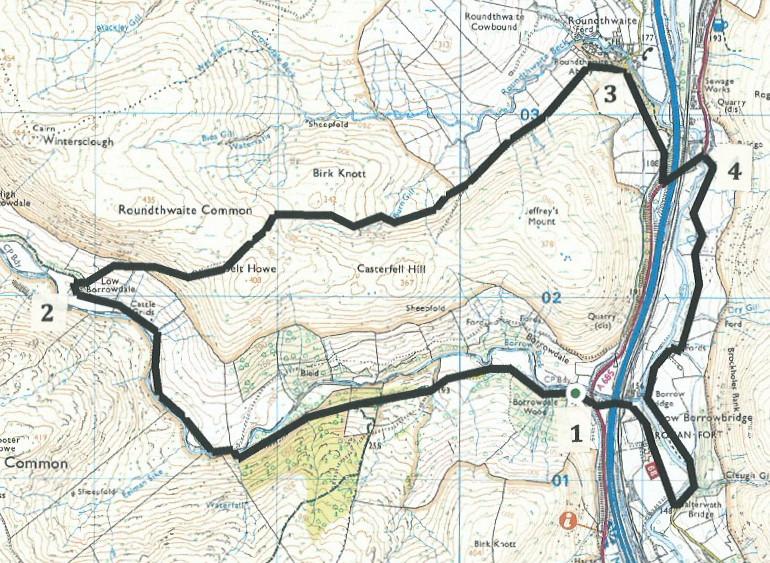
To get to the start, drive on the A685 to two miles south of Tebay. Near the bend where the road is at its lowest point, turn west (away from the M6) onto a minor road for 100 yards to a parking area on the left (grid reference NY 606014).
Information:
Distance: 7 miles, ascent: 1,100 feet
Time: 3.5 hours
Terrain: stony tracks and open fell land
Maps: OS Explorer OL7 and OL19
Route
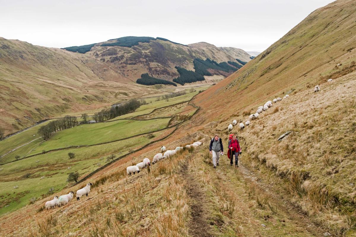
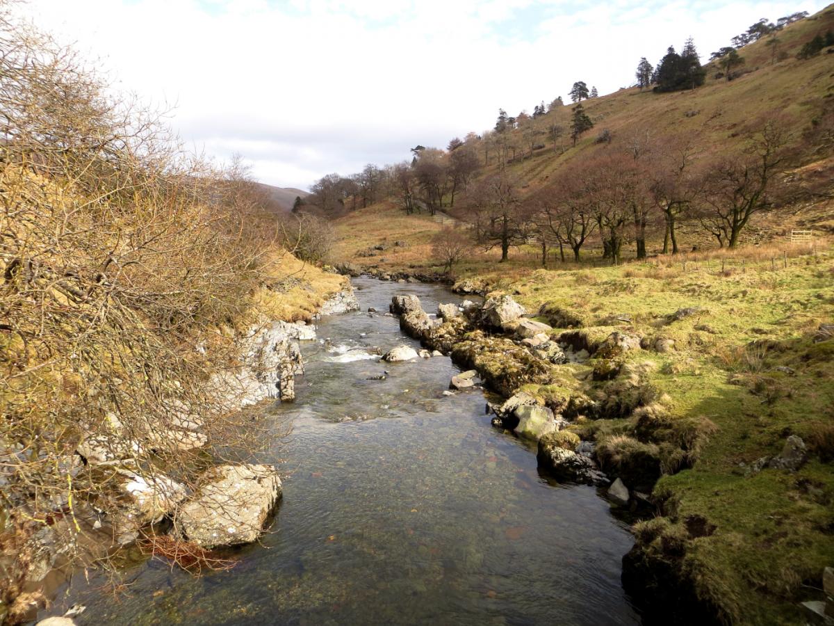
1 From the parking area walk through the gate into Low Borrowdale Woods and follow the lane with Borrow Beck on the right. After going over a cattle grid the lane crosses the beck and continues following its course, going over two more cattle grids and past a rustic toilet hut on the right. Go through the yard of the recently converted Low Borrowdale farm.
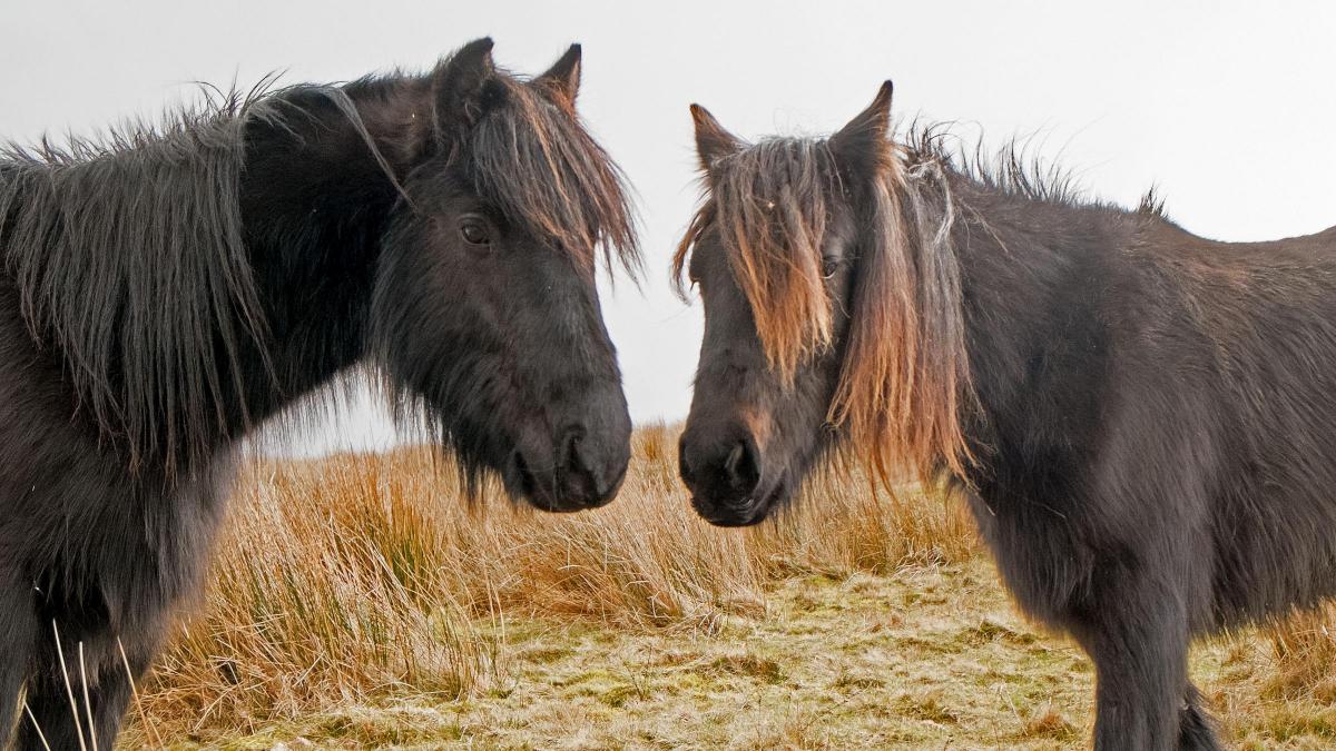
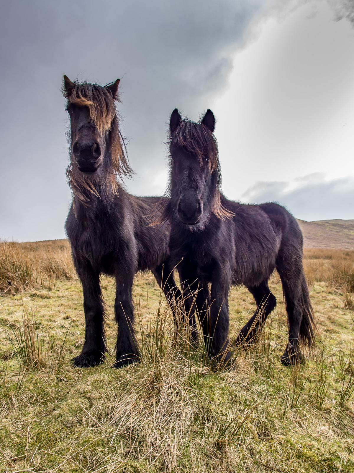
2 Follow the track turning sharply to the right and begin ascending the hillside. The track goes through a metal gate then becomes a grassy path going round to the right and slanting up the hillside of Roundthwaite Common. At the top of the climb keep straight ahead into a shallow valley. A view of Tebay and the M6 appears to the right. To me, this is no eyesore, but an attractive engineering achievement where the motorway, railway and road fit neatly together into the narrow Lune Valley. Lunesdale fell ponies abound on these hills. These stubby, hardy animals are one of only nine native breeds in Britain. The ponies live in their natural habitat and run freely for much of the year. They may be inquisitive but are harmless to people walking. Descend northwards towards the head of the valley ahead then follow a faint path to the right, past a small pile of stones and directly towards Tebay. If you lose sight of the path continue in the same direction over rough fell, down the shoulder of the hill and aim for the hillside track ahead. Ford a small beck and join the stony track. After passing through a wooden fell gate the M6 appears directly ahead and the track descends to the hamlet of Roundthwaite. Ponies may follow you to the gate because this is where they are fed with hay in bad weather.
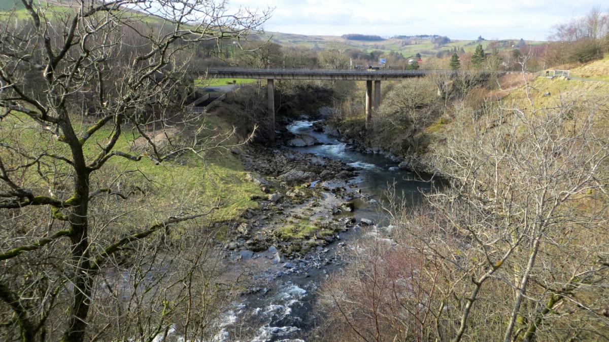
3 Turn right onto the road and on meeting the A685 turn left to cross the M6, the railway and River Lune. The attractive 17th Century Lune’s bridge crosses the river as it rushes over rocks just upstream from here and is worth making a short detour to view. A memorial stone commemorates the death of four rail track workers who were killed by a runaway trailer in 2004. From the bridge over the motorway, step over or go round the end of the crash barrier and cross the A685 to join the lane signed Brockholes.
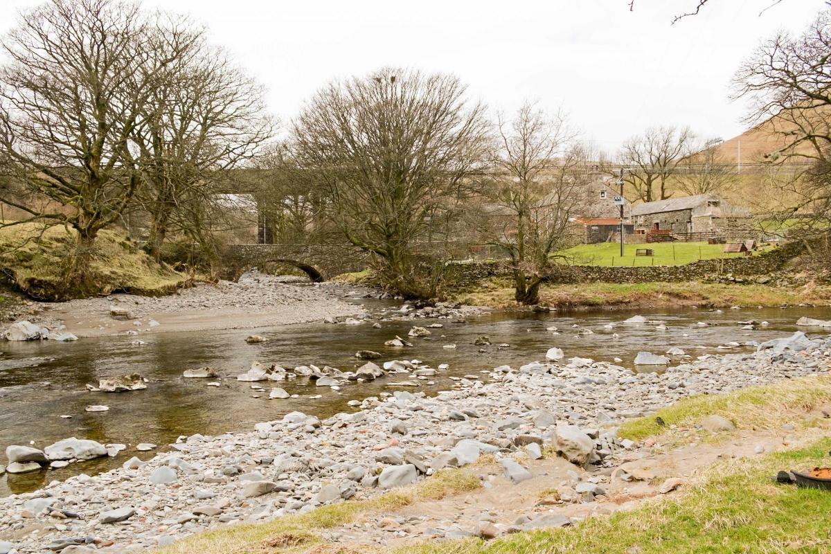
4 After crossing a cattle grid the lane follows the course of the River Lune downstream. At the third cattle grid, just before a farm, turn right over a step stile onto a waymarked footpath. The path goes down to the riverside around the farm buildings, through a gate, alongside a fence and into a field. Continue by the side of the river passing Low Borrowbridge, where Borrowdale Beck joins the Lune. Go through a flood-damaged gate into woods to meet a minor road at Salterwath Bridge. Before the M6 was built in the late 1960s this quiet road was the main road between Tebay and Kendal. Turn right and walk along the road, passing under the railway and the M6 at Low Borrowbridge to meet the A685 almost opposite the lane where the walk began.
Next week:
NB: Restrictions on space mean that this article provides a general summary of the route. It is advisable for anyone who plans to follow the walk to take a copy of the relevant Ordnance Survey map.


Comments: Our rules
We want our comments to be a lively and valuable part of our community - a place where readers can debate and engage with the most important local issues. The ability to comment on our stories is a privilege, not a right, however, and that privilege may be withdrawn if it is abused or misused.
Please report any comments that break our rules.
Read the rules here