
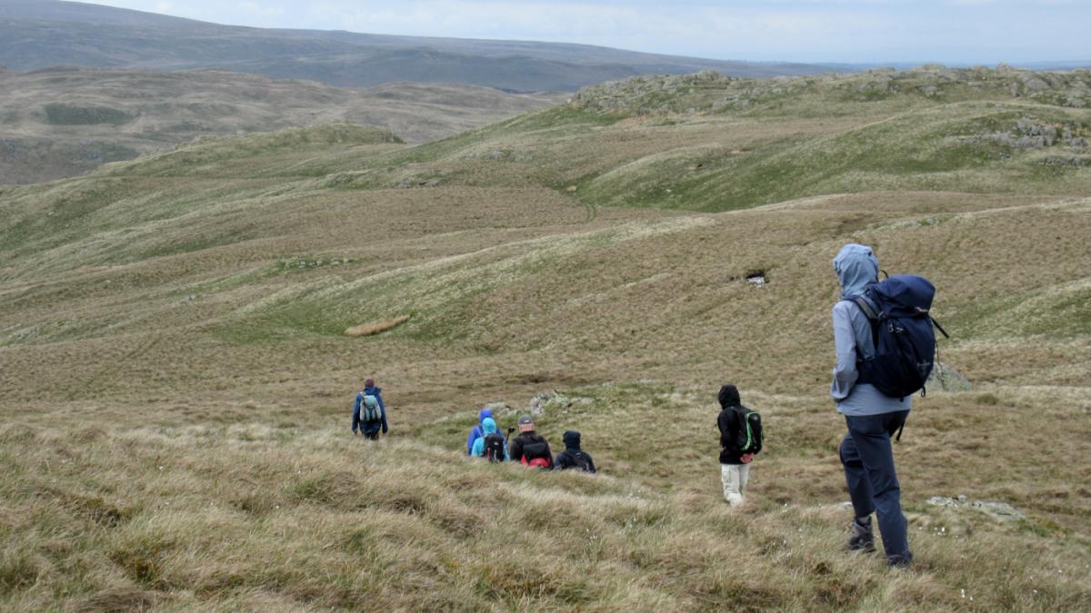
HOW about a wilderness wander on the remote Swindale Common and a look at the work done to improve Swindale Beck, writes John Edmondson. This fell walk, inspired by Wainwright’s The Outlying Fells of Lakeland, hops from one hilltop to another with Seat Robert and High Wether Howe as the main targets. Most of the walk is on completely open fells, without walls, fences or paths to follow and should only be tackled in clear, dry weather, using a large-scale map and a compass.
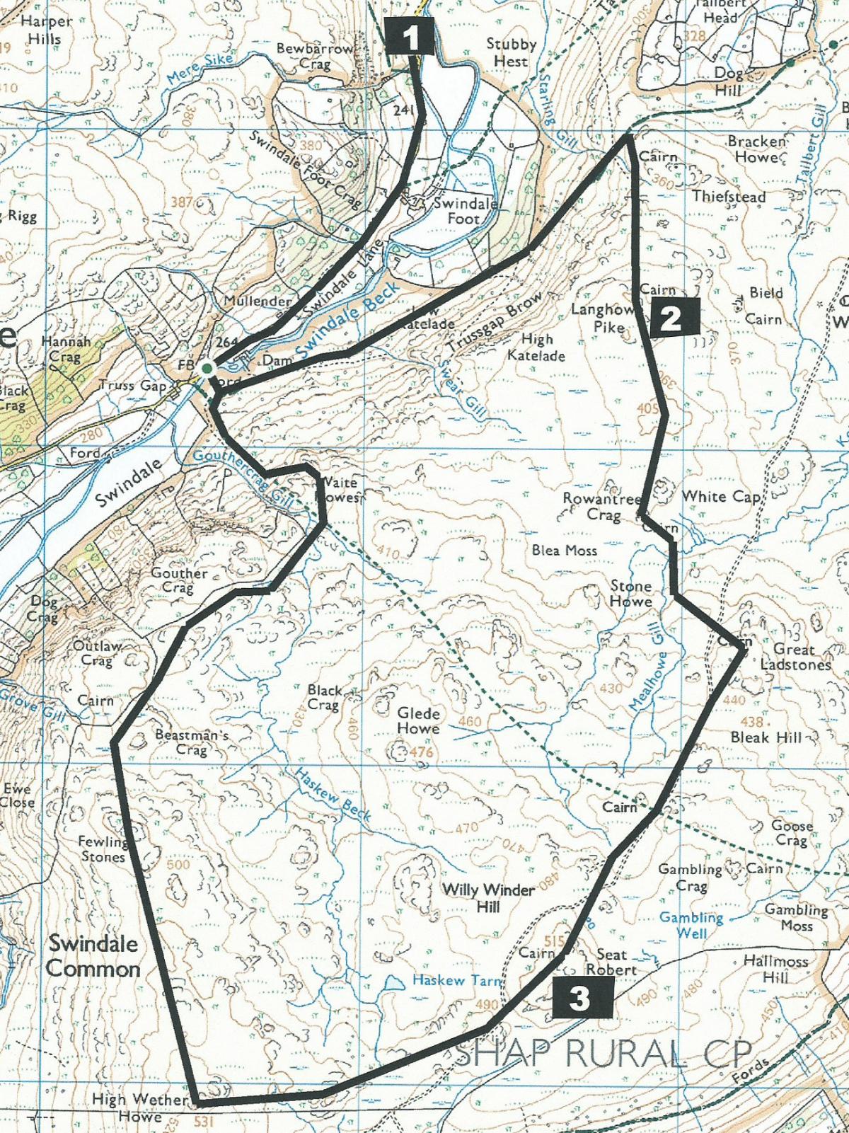
Start from the parking area near Swindale Foot (map reference NY 521 142, postcode CA10 2QT).
.
Information:
Distance: eight miles, ascent: 1,600 feet
Time: 4.5 hours
Terrain: open fell
Map: OS Explorer OL5
Route:
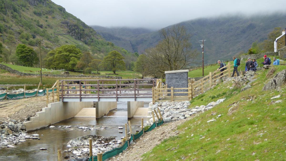
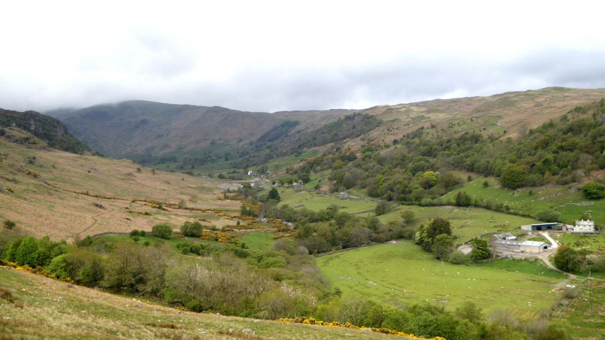
1 From the parking area, cross the cattle grid and walk along Swindale Lane for three quarters of a mile and past the new fish pass at Truss Gap. The purpose of the fish pass, water intake, hay meadow restoration and moorland drain blocking, is to help nature, to slow the flow of water and improve drinking water quality. Turn left to cross Swindale Beck via the new footbridge. Go straight ahead then turn left onto a stony track. Keep right when above the fish pass and walk along a grassy track that leads back down the valley and through a gate onto a stony footpath. When approximately opposite the parking area at the other side of the valley, bear right after the last of the gorse bushes. Follow the uphill path and zig-zag back to the right after 100 yards. Keep right at a marshy area and continue ascending on a faint path to the summit of Langhowe Pike that is marked with a cairn.
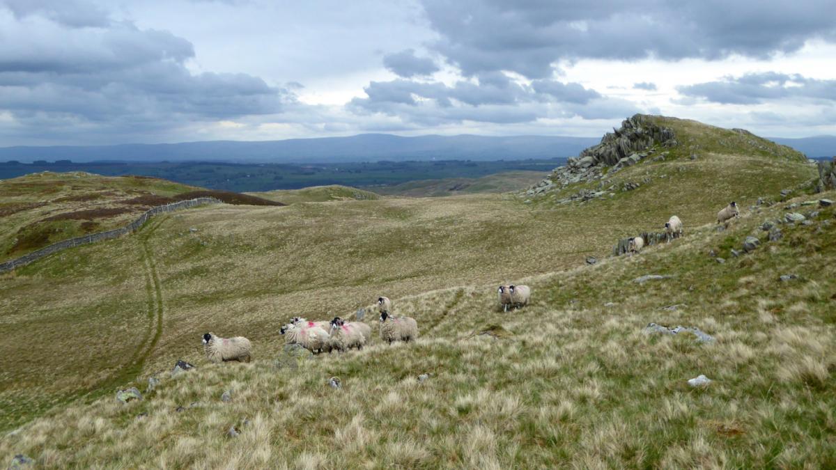
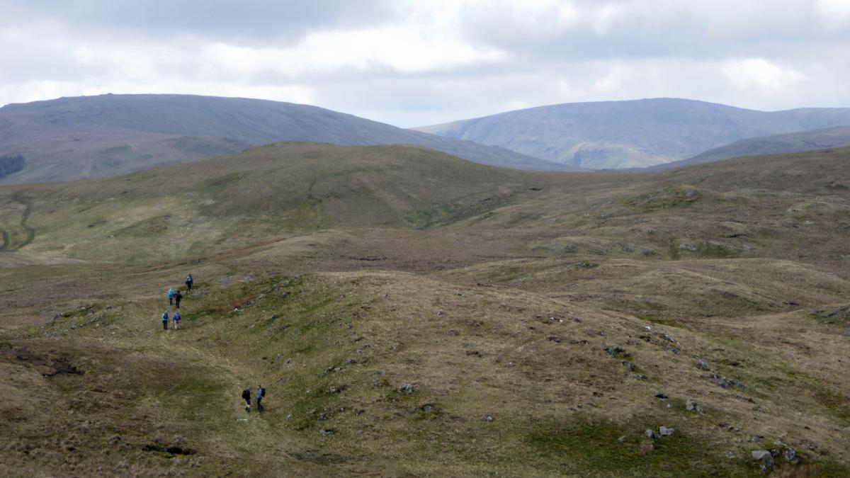
2 Head southwards towards Seat Robert, which is now visible in the distance. The next high point is the grassed rocky knoll of Rowantree Crag. The route now continues to hop from one hilltop to the next. It can be shortened at any point simply by walking due west to meet the wall above the valley side where turn right and return as described below. Descend the treeless Rowantree Crag past a holly tree at its base and proceed to the next summit, which is Great Ladstones. Continue in a south-westerly direction to Gambling Crag. From its cairn a quad track can be followed across the valley to Seat Robert, which has a stone shelter, a cairn and a ground level trigometrical stone. The word ‘seat’ derives from Old Norse ‘saetr,’ meaning a mountain shieling or shepherd’s hut.
3 From Seat Robert aim towards a distant wood following the line of a fence 100 yards to the left. The silted Haskew Tarn is on the right. Ascend around the left side of High Wether Howe to its summit at 1,742 feet above sea level - the highest point of this walk. The route now turns northwards to Fewling Stones, from where the head of Swindale Valley with its attractive waterfalls can be seen to the left. Descend to the wall on the left above the valley side and follow the track alongside the wall past vertical slabs of rock (Beastman’s Crag) on the right. Cross a beck and keep straight on past the ravine of Gouthercrag Gill. Descend to the left via a footpath in a shallow gulley. Glance up the valley to see where the artificial stretch of the river is now being reverted to its former slower-flowing, meandering course then go through a gate and walk past newly planted trees. Cross the beck via stepping-stones next to the bridleway ford or use the footbridge near the fish pass. Turn right onto Swindale Lane and walk back to the parking area.
NB: Restrictions on space mean that this article provides a general summary of the route. It is advisable for anyone who plans to follow the walk to take a copy of the relevant Ordnance Survey map.


Comments: Our rules
We want our comments to be a lively and valuable part of our community - a place where readers can debate and engage with the most important local issues. The ability to comment on our stories is a privilege, not a right, however, and that privilege may be withdrawn if it is abused or misused.
Please report any comments that break our rules.
Read the rules here