
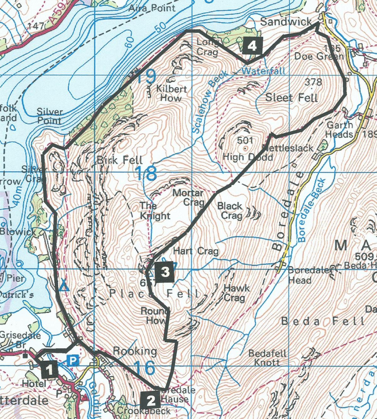
THIS moderately hard fell walk offers great views in all directions from the top of Place Fell, writes JOHN EDMONDSON. The return along the side of beautiful Ullswater captures the splendour of the Lake District’s second largest lake, with the opportunity of two refreshment stops along the way.
Park in the Pay and Display car park opposite Patterdale Hotel (map reference NY 395 159, postcode CA11 0NN, £4.50 per day).
Information:
Distance: 9 miles, ascent: 2,200 feet
Time: 5 hours
Terrain: fell paths and stony tracks, rough in places.
Map: OS Explorer OL5
Route
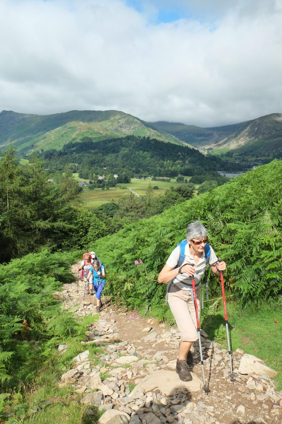
1 From the car park walk 150 yards along the A592 towards Glenridding and turn right after the primary school onto a track signed ‘Farm Entrance.’ After passing Side Farm turn right along the track signed Angle Tarn and Boredale Hause. After the second gate turn left, go through another gate then up a stony track to Boredale Hause. The two parallel tracks may once have been used like a dual carriageway for packhorse trains. Below the flat area of Boredale Hause is a pipeline transferring water from Ullswater to Haweswater. Brothers Water can be seen to the south.
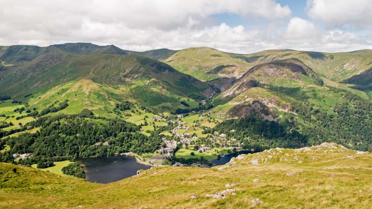
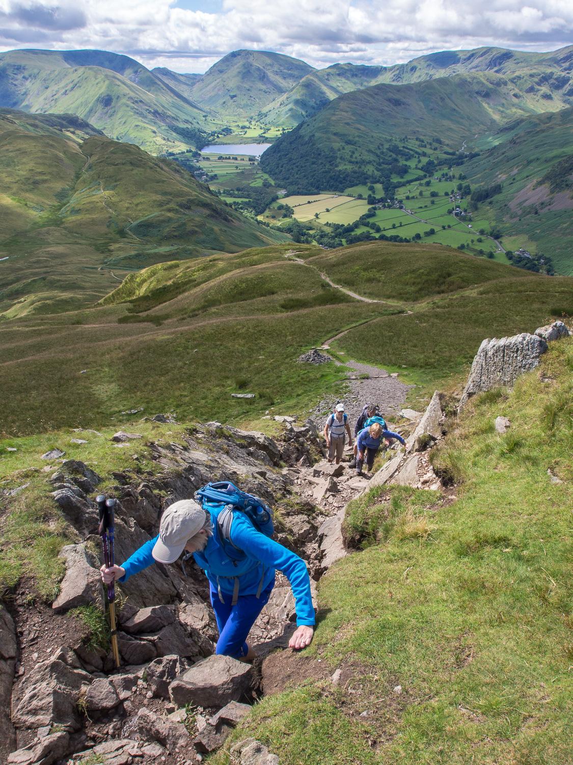
2 Take an indistinct path up a mound on the left heading northwards to meet a grassy track then a well made stony path that winds up the fellside. A short easy scramble leads to the summit of Place Fell, marked by a survey column and topped by a stone pillar. From this 2,154-feet summit enjoy views in all directions: to the north the end of Ullswater and out towards Penrith can be seen. To the east are High Street and the North Pennines. The peaks of Red Screes and Kirkstone Pass are to the south and Helvellyn to the west. Place Fell must be the best place to get an overview of Glenridding valley, once containing the largest lead mine in England and now recovering from the devastating floods of December 2015.
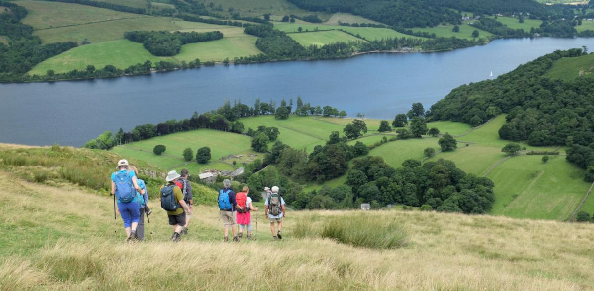
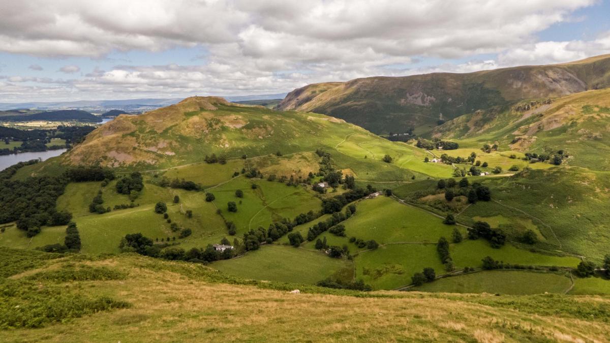
3 Continue northwards to go round the right of High Dodd, past a sheepfold and heading towards Hallin Fell. Stay at a high level to skirt around the end of Sleet Fell, bending northwards towards the lake. This elevated traverse offers a splendid birds eye view of Boredale to the east and Martindale to the north. It’s easy to see how Hallin Fell, with its 12-foot obelisk on the summit, makes a tempting target for Sunday afternoon strolls. Descend on a steep grassy path through bracken towards farm buildings at Sandwick. The large expanse of the lake below looks delightful on a sunny day with brightly coloured sails and steamers quietly navigating this second largest water in the Lake District. Gowbarrow is directly across the lake and trees to its left conceal the popular Aira Force. Join a track at the end of a wall and turn left to start following the Ullswater Way beside the lake in a south-westerly direction. A little less than half a mile along this track is the Lowther Barn tea room, which offers welcome refreshment in this remote location.
4 Continue walking along the Ullswater Way, part of a 20-mile circular route around the lake. Scalehowe Force can be seen through the trees on the left. The rough rocky parts of this undulating woodland path beside the lake can make the three-mile walk back to Side Farm seem longer than it actually is, so pause regularly and enjoy views over the lake, particularly at Silver Point, which is directly opposite the Glencoyne valley. Norfolk Island and Lingy Holm are tempting destinations for small boats. Turn right at Side Farm, perhaps stopping for a rewarding ice cream or refreshing drink, then return to Patterdale along the track where the walk began.
NB: Restrictions on space mean that this article provides a general summary of the route. It is advisable for anyone who plans to follow the walk to take a copy of the relevant Ordnance Survey map.


Comments: Our rules
We want our comments to be a lively and valuable part of our community - a place where readers can debate and engage with the most important local issues. The ability to comment on our stories is a privilege, not a right, however, and that privilege may be withdrawn if it is abused or misused.
Please report any comments that break our rules.
Read the rules here