
THE stark limestone plateau of Great Asby Scar, while still in Cumbria, is now part of the Yorkshire Dales National Park, writes JOHN EDMONDSON. Within this special landscape are field systems that have changed little since ‘commoners’ derived a living from the common land before the start of enclosures by wealthy landowners. The views are exceptional and the scenery varies from wide-open spaces to enclosed pastures.
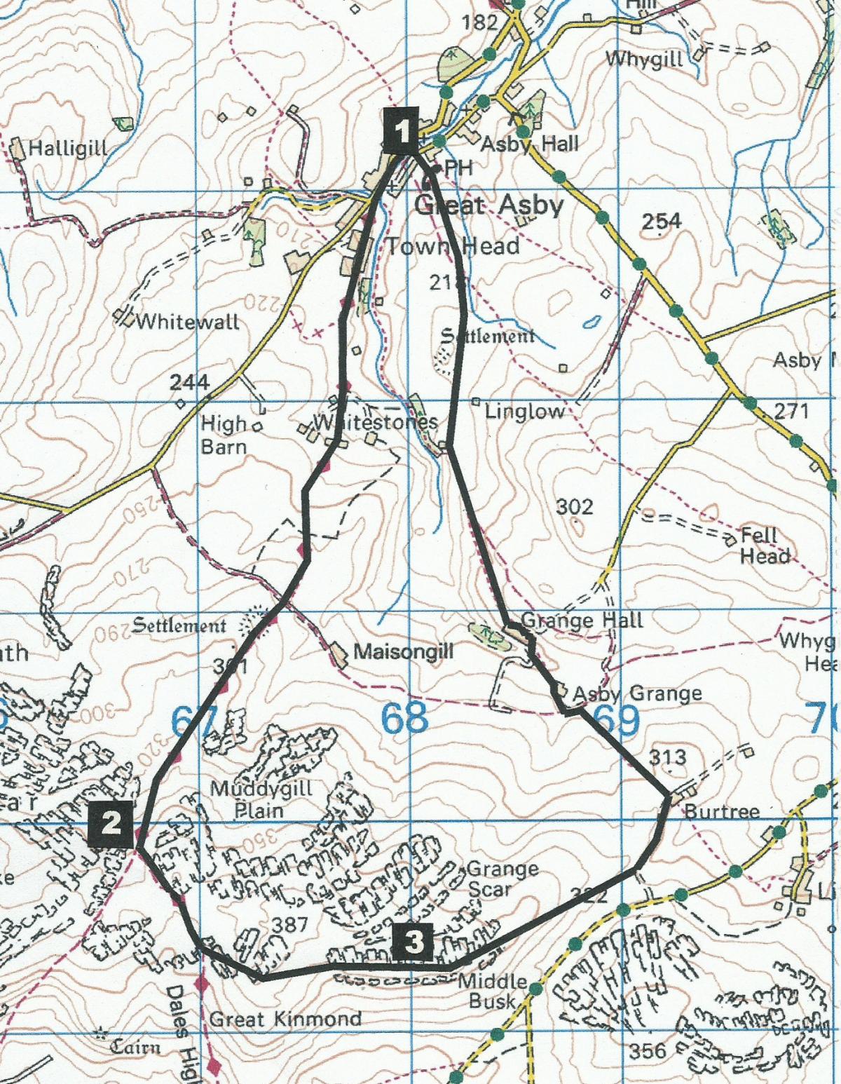
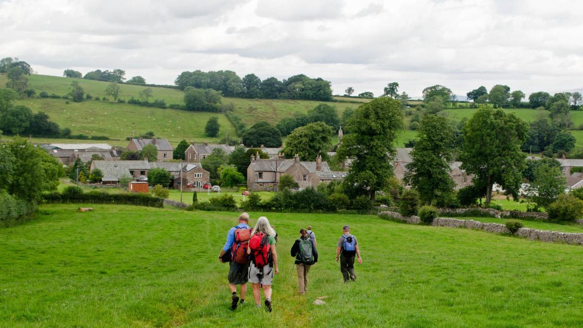
This walk starts from St Peter's Church at Great Asby (map reference NY 680 132, postcode CA16 6EY).
Information
Distance: 6.5 miles
Time: 3.5 hours
Terrain: Grassy footpaths and tracks
Map: OS Explorer OL19
Route
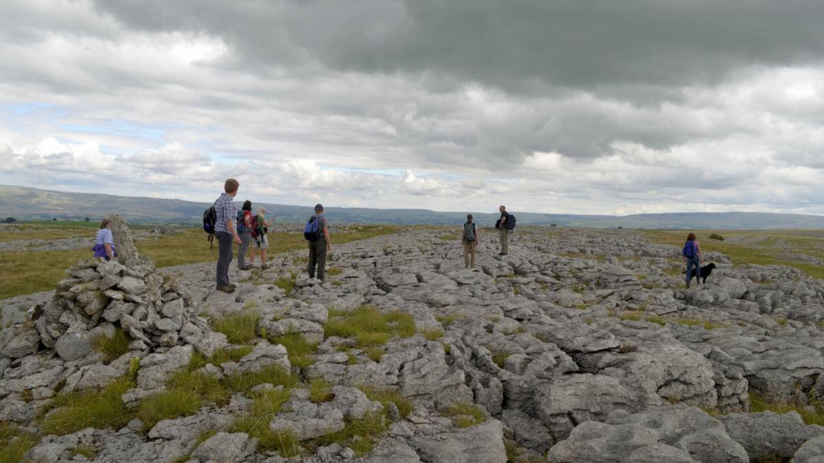
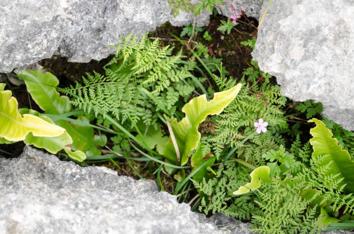
1 From the church, head in the direction of Orton and bear left by the playground onto a 'no through road.' Continue straight ahead on the track and through a gate to Clockeld Farm. Leave the farmyard along the right side of fields and at the second field head diagonally left to a stile through a wall. Go straight on over a fence stile and a wall stile. Cross a track and cattle grid and continue along the bridleway signed Sunbiggin Tarn and Sunbiggin. Walk alongside a wall on the left, through a gate and then along a fence on the left. Grassland soon gives way to pitted limestone shaped over thousands of years into clints (blocks or the surface of the pavement) and grikes (fissures) where you can spot hart’s tongue ferns, herb Robert, wood sorrel and Dogs Mercury. This is the second largest of this type of limestone pavement in England after Malham.
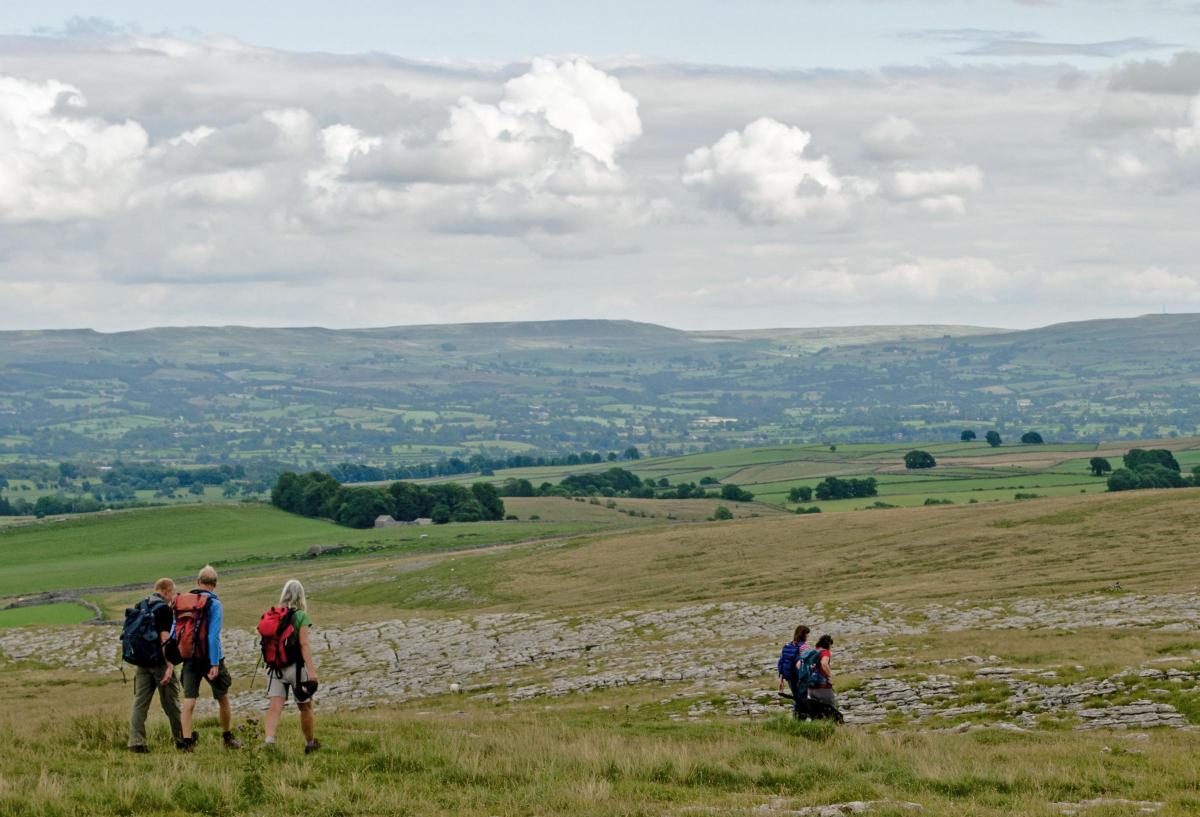
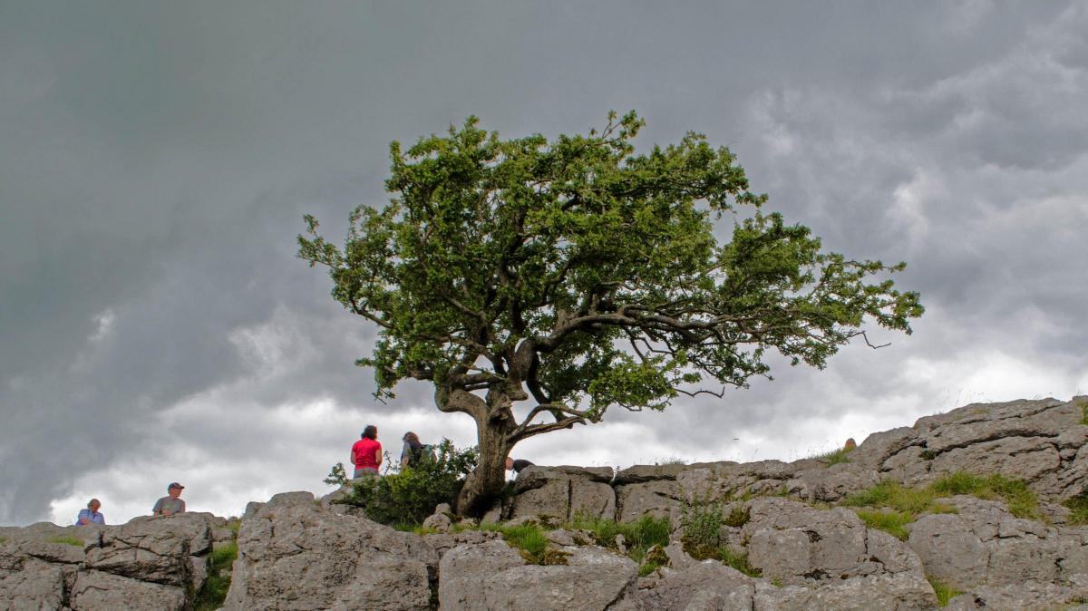
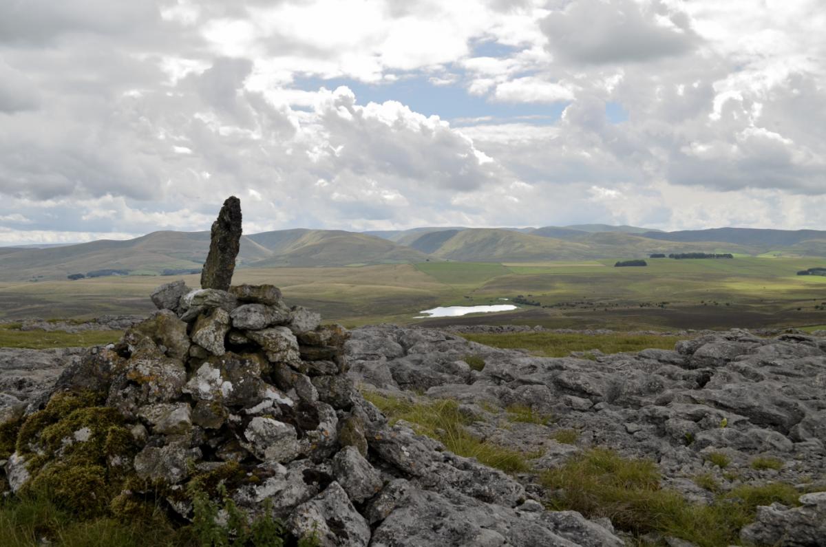
2 Angle off left, go through a field gate then left along the line of a wall on the left to a ladder stile. Views of mountains can be seen in all directions. Pass a pile of stones ahead and continue beside the wall. Covering more than 1,100 acres Little Asby Common has remained largely undisturbed for centuries: a remnant of medieval times when people relied on commons for their survival. Owners of nearby properties have rights such as grazing animals that still exist today. The Friends of the Lake District bought the common in 2003 because it is very important for access, biodiversity and wildlife and is their largest property. England contains the largest area of common land in Europe, and a third of it is in Cumbria. Cross the limestone pavement to a cairn with a vertical stone on it. Walk along the top of the ridge to a spectacularly located solitary hawthorn tree on the limestone pavement. Pause to enjoy splendid views over Sunbiggin Tarn and the northern Howgills. Beside the road junction below are remains of the Dowly (meaning sad, melancholy or lonely) tree that is associated with tales of murder and hanging.
3 Follow the line of the limestone pavement to a gravel track near a gate with a cattle grid. Turn left through the gateway, left after a barn, over a stepped wall stile then down across a field through a metal gate to a farm. Turn left on the track signed Great Asby and go to the right through Asby Grange farmyard past the front of the farmhouse and through a wicket gate near a barn on the right. Cross the field to a wall stile and go to the right of the barns ahead. Cross over a fence stile then walk past Grange Hall with its oriel windows. Go through a gate beside a wall on the right, descend into the valley then go up to the trees and around them on their left, through a gate and alongside a wall on the left. Follow the path through fields in a northerly direction ultimately meeting a field track down to Great Asby where you cross the bridge and return to the church.
NB: Restrictions on space mean that this article provides a general summary of the route. It is advisable for anyone who plans to follow the walk to take a copy of the relevant Ordnance Survey map.


Comments: Our rules
We want our comments to be a lively and valuable part of our community - a place where readers can debate and engage with the most important local issues. The ability to comment on our stories is a privilege, not a right, however, and that privilege may be withdrawn if it is abused or misused.
Please report any comments that break our rules.
Read the rules here