
THIS is a varied walk combining woodlands, part of the Lancashire Coastal Path and Leighton Moss nature reserve, writes JOHN EDMONDSON. Good paths and quiet roads make it suitable for any time of year, whatever the weather.
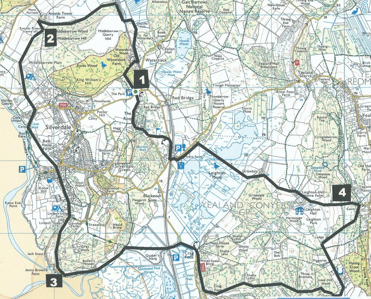
Park at Eves Wood Car Park (map reference SD 471 759, postcode LA5 0UQ), which is off Red Bridge Lane, north of Silverdale railway station
Information:
Distance: 11.5 miles, ascent: 1,300 feet
Time: 5 hours
Terrain: well made paths and quiet roads.
Map: OS Explorer OL7
Route
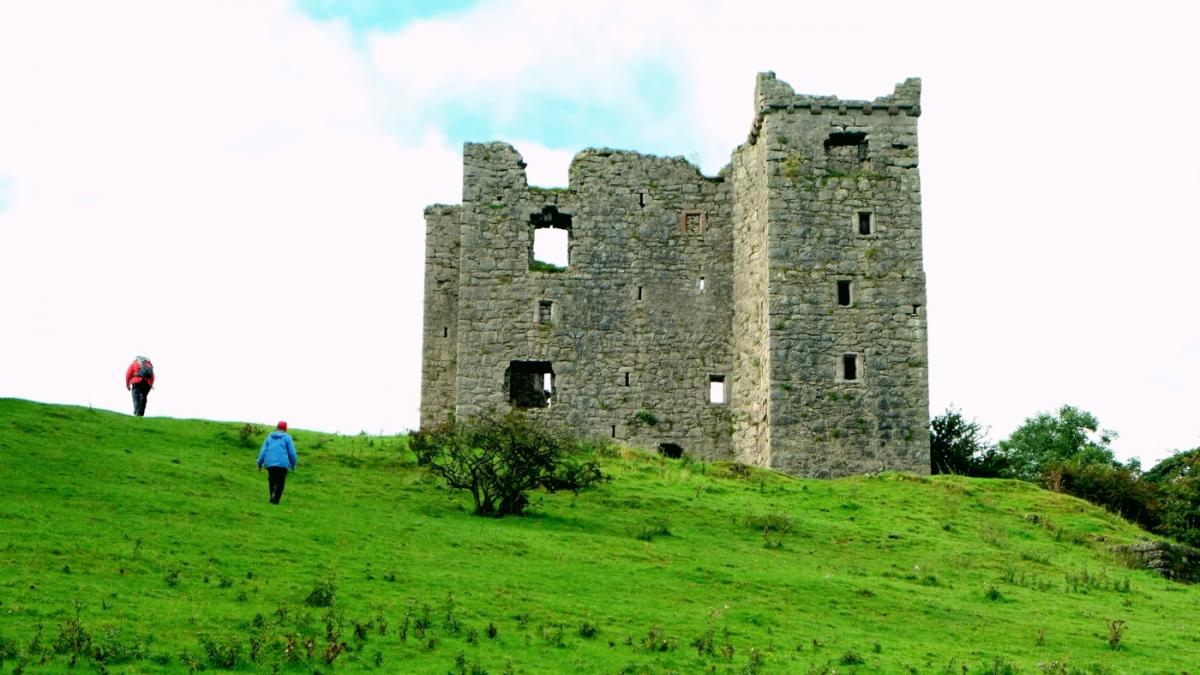
1 From the back of the car park go through a gate and along a track through Eves Wood. Turn right onto the path signed Waterslack, keeping right, descending to a lane. Go straight ahead on the path signed Waterslack Road past caravans, across the railway and left on the road. The road bends left and crosses back over the railway. After the crossing turn right onto a footpath and follow signs all the way to Arnside Tower. Arnside Tower is the largest pele tower in the area and was built in the 15th Century as a defence against marauding Scots.
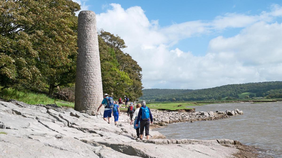
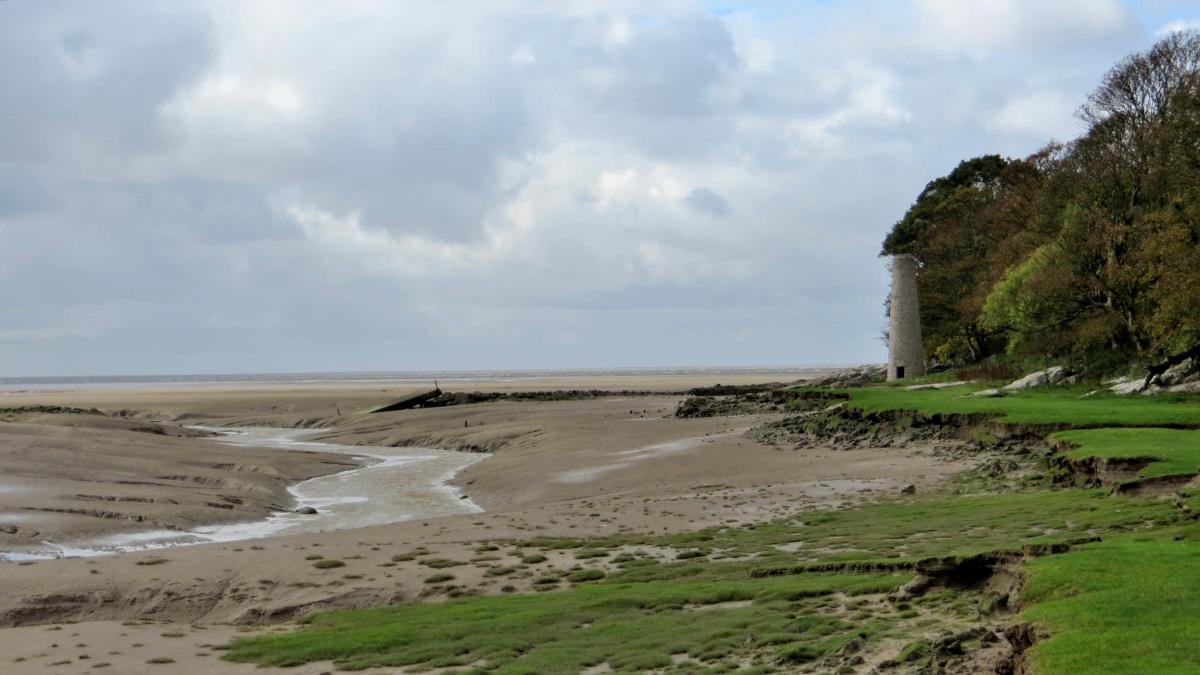
2 From the tower follow a path signed Holgates Caravan Site. At the site walk ahead past the main building and the exit barrier. Turn left onto the road and right at a junction after Cove Cottage along a No Through Road. At the sea cove turn left and walk along the cliff top path signed The Lots Shore Road. Go through a kissing gate signed Bank House Farm, then over The Lots. Go through a gate and down steps, turn right then cross the road into Lindeth Road, signed Jenny Brown’s Point. Bear right at Hollins Lane past Gibraltar Farm Caravan and Camping Site. Turn right opposite a white bungalow through a kissing gate to Jack Scout, passing a lime kiln and curving left along the shore path in the trees. Go along the path beside a fence and onward to a kissing gate at a tarmacked lane. Turn right over a cattle grid and continue walking along the seashore to Jenny Brown’s Point, where there was once a quay and copper smelting works. Walk past the right of the house, over rocks (or sand at low tide) and past the old works chimney.
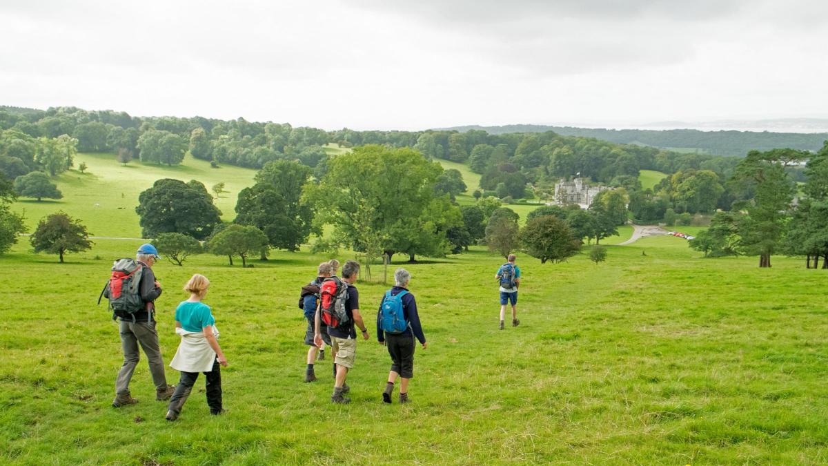
3 Continue over grassy banks to a fence stile and at a crossing of paths turn right onto a permissive path signed Quakers Stang, along a grassy causeway. Turn right to cross a stone bridge signed Coastal Way then left under a low railway bridge. Turn right along the roadside pavement and after passing the turning to Paintmine Woods, turn left up Crag Road, signed Cycle Route Carnforth and Warton. At the top of the slope turn left onto a bridleway with a fingerpost. Continue steadily uphill through a wooded area on the path signed Coach Road Warton then steeply downhill to meet a road. Turn left (past a picnic area) and continue beyond Leighton Hall entrance. Where the road descends at a right hand bend turn left and go through a gated squeeze stile onto an uphill path signed Summerhouse Hill Leighton Hall. Walk past the mound and across the flat top to a line of trees. Stop at the benches to admire views over Leighton Hall.
4 Descend to a cattle grid next to a gate to the right of the hall. Follow the lane past Holm Farm and Keepers Cottage to a metal field gate then go along a field-side track that bends to the right beside a hay barn. Follow the track to Leighton Moss, passing the causeway hide and turn left onto a wide boardwalk and path to the RSPB Visitor Centre. From the front of the centre turn left at the road, cross the railway bridge then turn right. Walk past the station and turn left onto a footpath signed Silverdale Village, across the golf course along the waymarked route to a kissing gate. Turn right and follow the lane back to the car park where the walk began.
Next week: Lupton
NB: Restrictions on space mean that this article provides a general summary of the route. It is advisable for anyone who plans to follow the walk to take a copy of the relevant Ordnance Survey map.


Comments: Our rules
We want our comments to be a lively and valuable part of our community - a place where readers can debate and engage with the most important local issues. The ability to comment on our stories is a privilege, not a right, however, and that privilege may be withdrawn if it is abused or misused.
Please report any comments that break our rules.
Read the rules here