
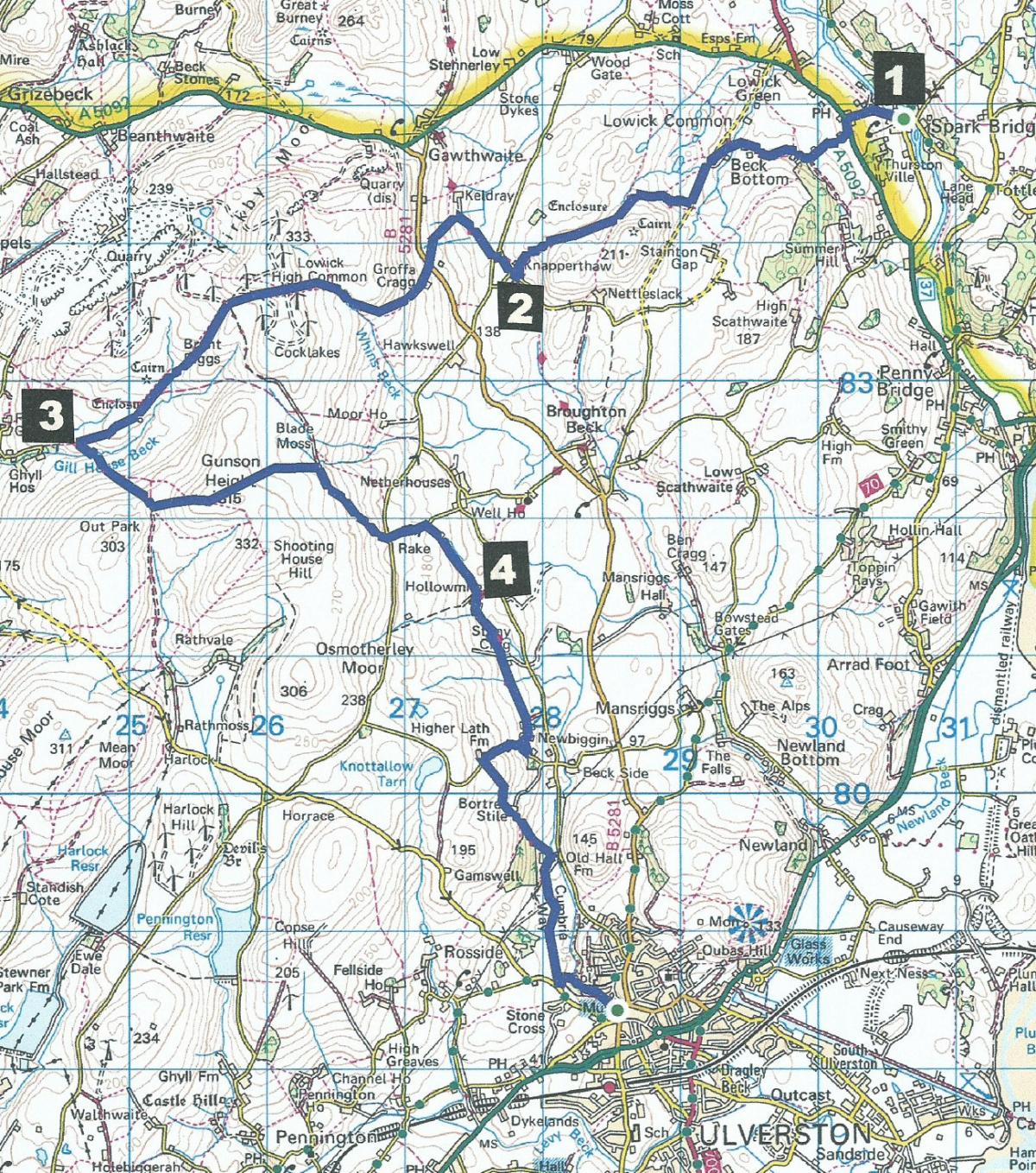
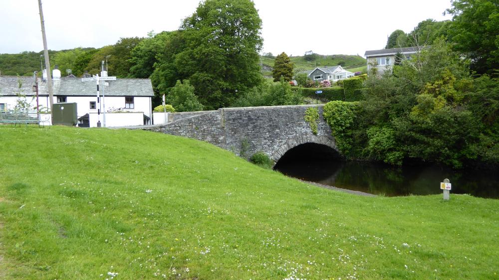

THIS walk starts from Spark Bridge (map reference SD 305 848), writes JOHN EDMONDSON.
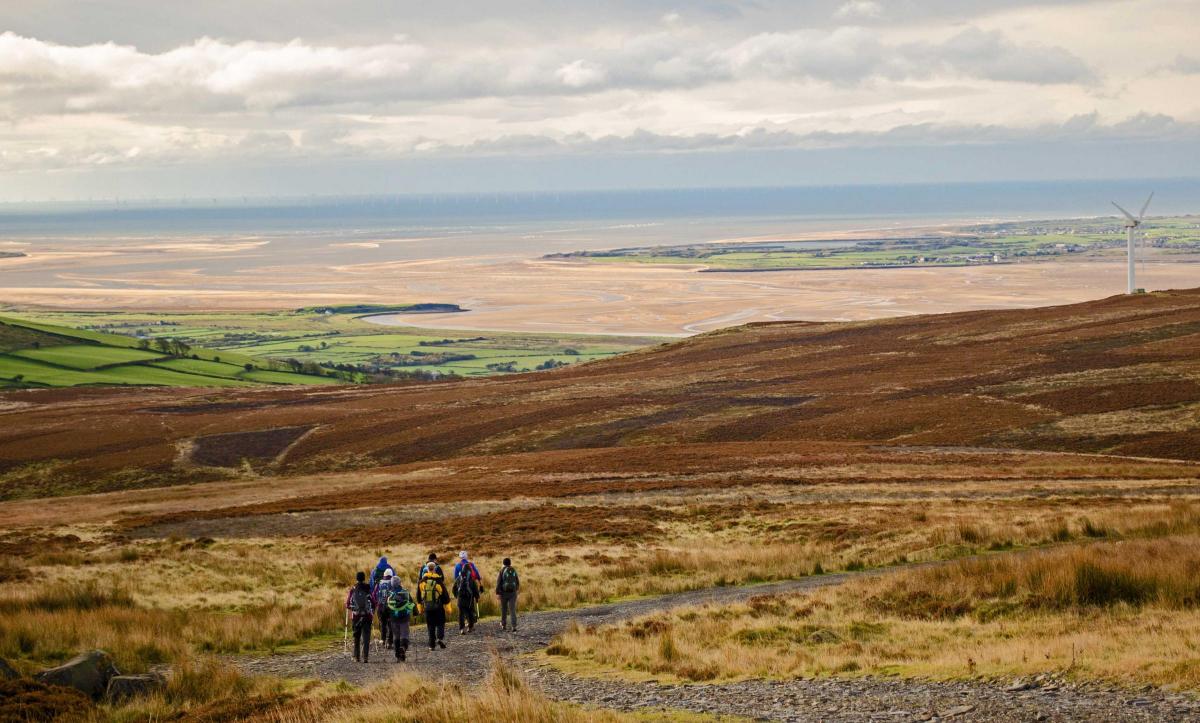
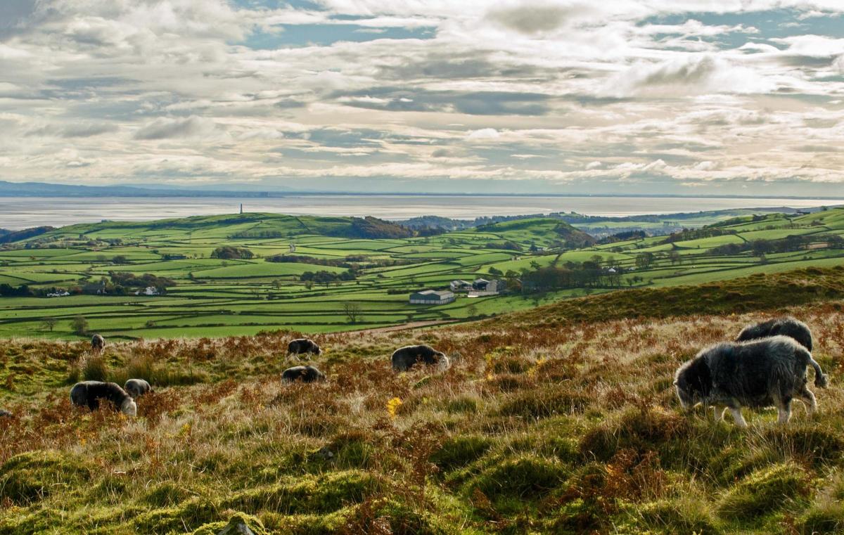
There’s interest all the way with views over Coniston Water and Fells, Black Combe, Duddon Sands and Morecambe Bay, pleasant pastoral countryside, open fells and a wind farm.
Take the X12 bus from Ulverston to Spark Bridge (8.45am Saturday and school holidays or 10.45am Monday-Friday) then walk back over Lowick Common and Gunson Height and on to Ulverston via the Cumbria Way.
Information:
Distance: 10.5 miles, total ascent: 2,000 feet
Time: 5 hours
Terrain: grassy paths and rough fell
Map: OS Explorer OL7
Route:
1 Walk up to the A5092, turn left and after 100 yards right to pass the former chapel. Continue onto a walled green lane to Beck Bottom. Turn left on the road then right at the fingerpost onto an uphill grassy path. Just before reaching a wall bear left and continue towards the wall descending to a metal gate. Continue alongside the wall to a lane beside woodland and down to Knapperthaw.
2 Turn right onto the road and keep right on the Cumbria Way. Just before a road junction turn left and cross the road to go over a cattle grid and down to the valley bottom. At the sign for Keldray Farm turn left and go over the stile on the left, heading uphill SW to the B5281. Cross the road onto Groffa Crag Private Road. Go past the houses and up steps to a rough uphill fell path towards wind turbines. The path curves to the right above a dell past a waymarker post. At a second waymarker turn left and cross the track at the top of the hill between turbines then descend towards Duddon Sands ahead. On reaching a track turn right facing Black Combe in the distance then bear left to continue towards the sands. Where the stony track bends right at a junction, continue down the valley to the right of Gill House Beck. Where woodland appears ahead turn left onto a track and descend to the bottom of the valley.
3 Cross the beck and climb the other side of the valley near a wall on the right; the track bends right to go towards the hilltop. Turn left at a waymarker near the top of the slope, cross a boggy area and continue climbing over heather to the top of Gunson Height, the highest point of the walk. Continue eastwards down to a gate in the valley bottom then alongside a fence on the right to meet a tarmacked track. Turn right, facing Hoad monument, go over a crossroads and continue downhill. Turn right onto a footpath signed Hollowmire and follow the field path, descending to the left of woodland and the farm, then down steps to a road. The route from here to Ulverston follows the Cumbria Way.
4 Turn right and then left in Hollowmire farmyard. Follow the hedge on the right and turn right to cross a ditch to continue along the other side. At Newbiggin, the way crosses a stony driveway past the front of a house to a field path. At a white house turn right onto the road, up a steep hill then left near the top, signed Bortree Stile. Go down the pretty valley and turn right past Old Hall Farm, along a lane and through a gate on the left. At the wall stile by a road turn left down a concrete path, cross the beck then go right beside the beck to the Gill car park in Ulverston.
NB: Restrictions on space mean that this article provides a general summary of the route. It is advisable for anyone who plans to follow the walk to take a copy of the relevant Ordnance Survey map.


Comments: Our rules
We want our comments to be a lively and valuable part of our community - a place where readers can debate and engage with the most important local issues. The ability to comment on our stories is a privilege, not a right, however, and that privilege may be withdrawn if it is abused or misused.
Please report any comments that break our rules.
Read the rules here