
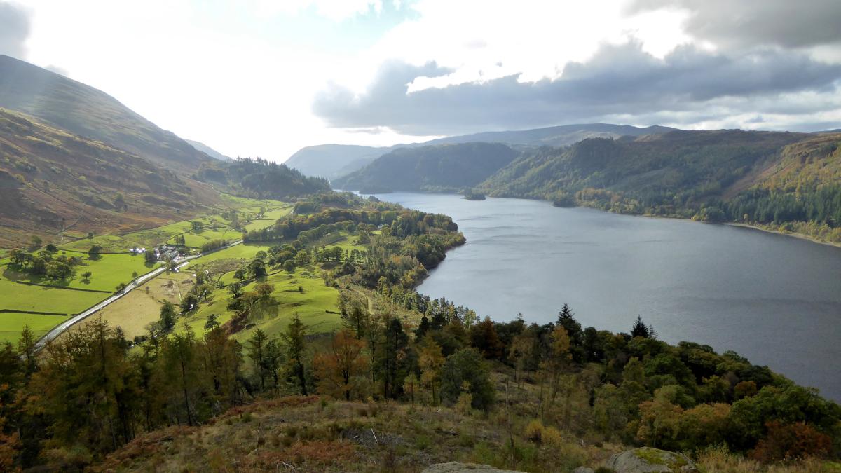
HIGH Rigg is one of the lowest of the Wainwright Fells, writes JOHN EDMONDSON. Alfred Wainwright described the ridge traverse as "a splendid little expedition admirably suited to old and rickety fellwalkers long past their best." This linear walk also includes the option of visiting Great How: an even lower, yet worthy fell offering a better view along the length of Thirlmere Reservoir than any of its higher neighbours. Use the 555 bus service for the return journey or better still to get to the start as well.
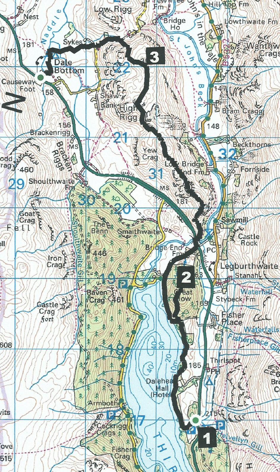
Start from Thirlmere Station Coppice car park (MR NY 316 169), which is next to the A591 near The Swirls.
Information:
Distance: 6.5 miles with 2,500 feet of ascent.
Time: 4 hours
Terrain: fell paths, some steep but with no scrambles.
Map: OS Explorer OL5
Route:
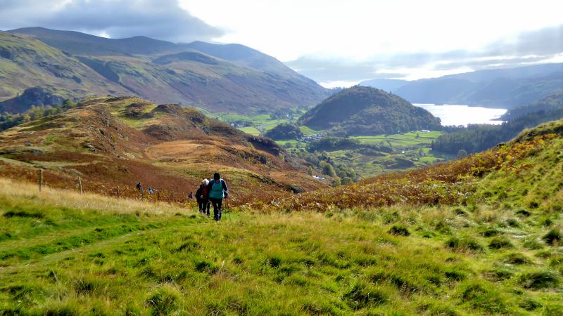
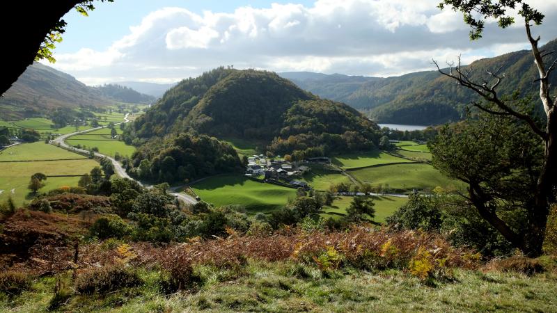
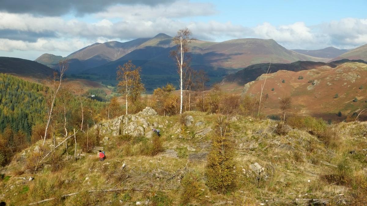
1 From the steps to the subway (completed in 2016) below the A591 follow the permissive path signed Thirlmere Loop. The path descends towards Thirlmere Reservoir close to Helvellyn Gill then turns right onto a woodland track. Further on, where the track bends right, keep to the footpath ahead to pass between Dalehead Hall and the reservoir. The foot of Great How is approached after 1.2 miles at a junction where the track bends right. Look for a waymarker post on the left and follow the path up through woods to the summit of Great How. There are two summits: the main one is to the south and affords great views along the length of Thirlmere.
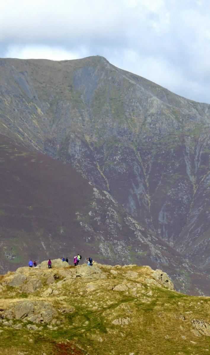
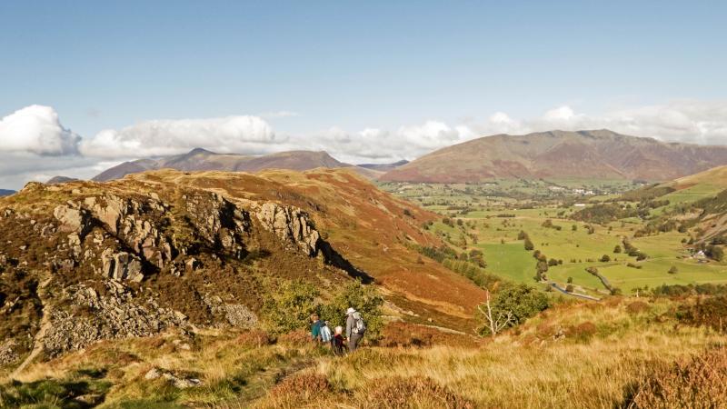
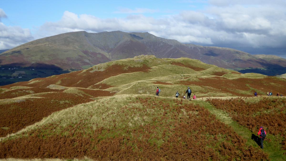
2 Descend by the same route and on returning to the track turn sharp right, descending close to the reservoir shore, and continue to the road just east of the dam. Turn right then left at the A591 to a bus shelter. Cross the road with care then turn left to the ladder stile and gate on the right. Walk up through the woods, bearing left at a junction to keep ascending. The path climbs to Wren Crag. High Rigg, Skiddaw and Blencathra can all be seen ahead. The undulating ridge path continues northwards and includes a steep climb and boggy areas before reaching a high point that appears on the map to be High Rigg. The summit of the fell, also referred to as Naddle Fell, is marked by a cairn and is a third of a mile further north, dwarfed by Blencathra that towers beyond.
3 From the summit, descend along a path to the left to avoid a steeper path to the north. Go to the left of a coppice, past a bench seat, and then turn left onto a stony track. Follow the twisty track down to a junction of tracks and go straight ahead on to the footpath at a fingerpost. The path descends over rock outcrops then crosses a field and a narrow footbridge over Naddle Beck. Continue across the next field, stepping over a ditch to meet a grassy track just before a bridge covered with metal plates. Turn left and follow the track through a gate to the corner of Dale Bottom caravan site. Turn right and continue along the track to meet the A591 at Causeway Foot bus stop. Buses in the return (Kendal) direction are due at 37 minutes past the hour, Monday to Saturday, and 32 minutes past on Sundays.
NB: Restrictions on space mean that this article provides a general summary of the route. It is advisable for anyone who plans to follow the walk to take a copy of the relevant Ordnance Survey map.


Comments: Our rules
We want our comments to be a lively and valuable part of our community - a place where readers can debate and engage with the most important local issues. The ability to comment on our stories is a privilege, not a right, however, and that privilege may be withdrawn if it is abused or misused.
Please report any comments that break our rules.
Read the rules here