
VISIT Yorkshire’s Wensleydale, taking in a scenic riverside walk and a climb up Penhill Beacon, writes JOHN EDMONDSON. Those who travel along the A684 towards Leyburn may have noticed Penhill standing prominently on the right. This walk samples some of the best of Yorkshire’s scenery: a pretty river with waterfalls, walled fields and a hill with views that can stretch almost to the east coast.
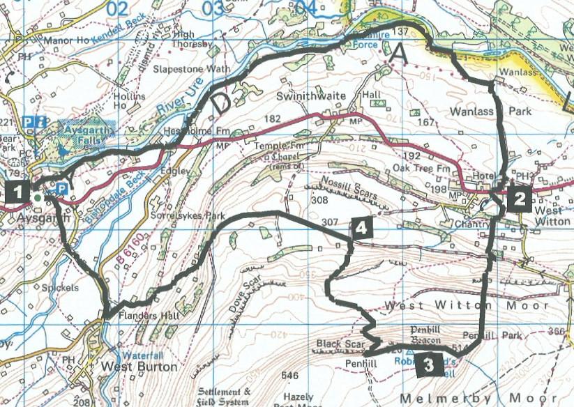
Start from Church Bank Car Park, near the Aysgarth Falls Hotel, grid reference SE 011 883, postcode DL8 3SR.
INFORMATION
Distance: 12 miles with 2,000 feet of ascent
Time: 5 hours
Terrain: good footpaths and stony tracks
Map: OS Explorer OL30
ROUTE
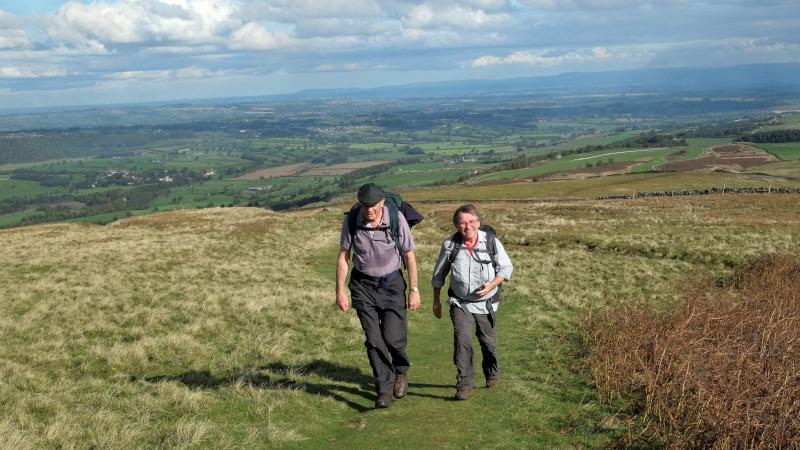
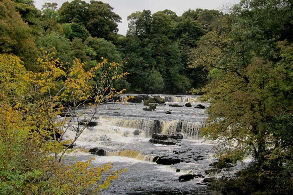
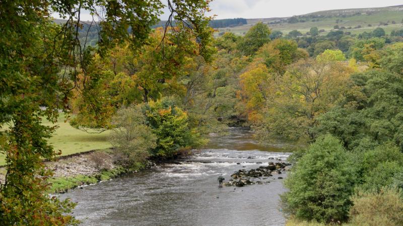
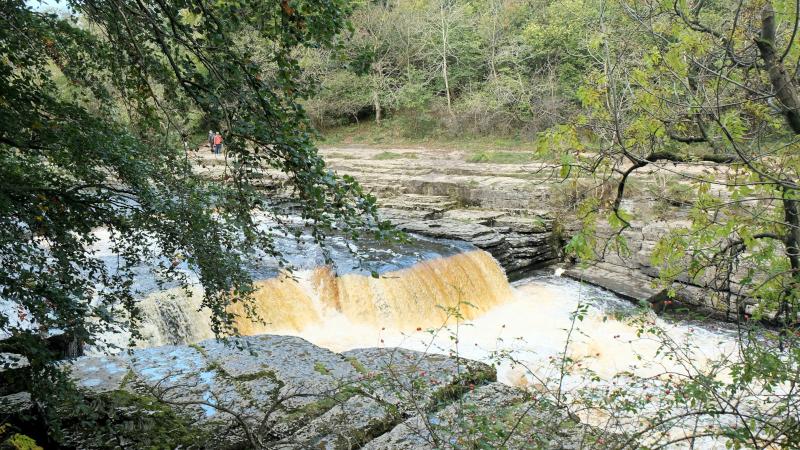
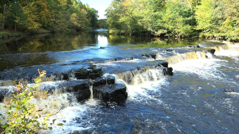
1 Walk down Church Bank, turn right onto the footpath going past the church then keep left to join the path beside the River Ure. The path passes Lower Force and after about three quarters of a mile leaves the riverside over a field to the A684. Cross Hestholme Bridge then turn left onto the footpath signed Wensley Bridge. After the second field bear left to continue walking along the riverside following fingerposts. Ascend grassy steps to a metal wicket gate and continue above the woods to a ladder stile, through woodland (past a sign to Berry’s café), then down steps to the riverside at Redmire Force. The path then goes over a mounded field, continues to a bend in the river and ascends a steep bank. At a fingerpost turn right (signed West Witton) across fields to Wanlass Farm. Turn right onto the farm track and along the tarmacked Flats Lane to West Witton, keeping right up the hill past St Bartholmew’s Church.
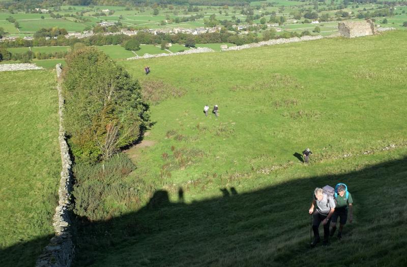
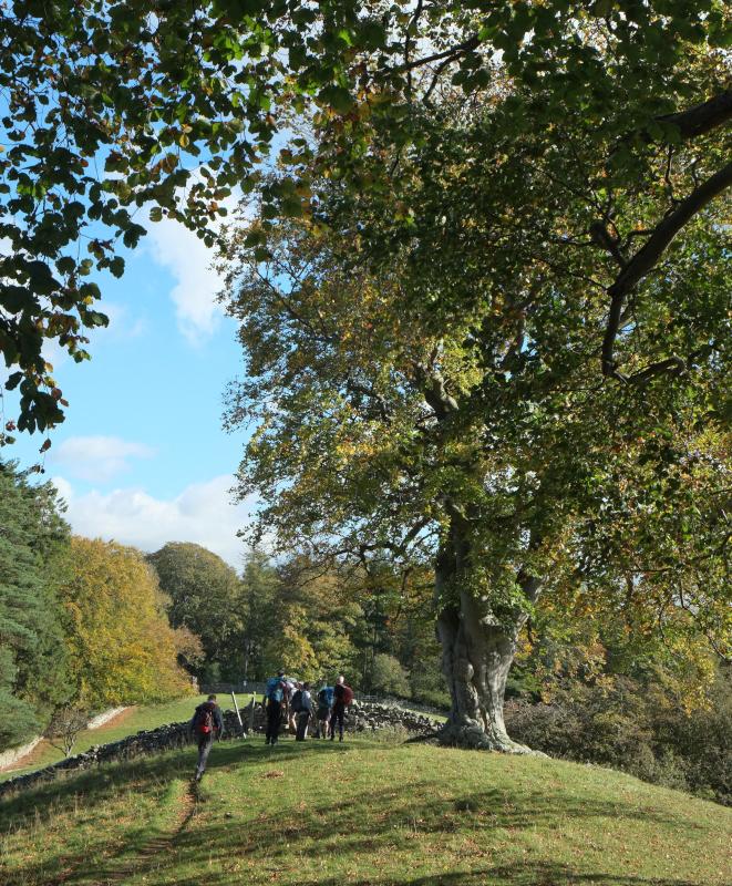
2 Turn right on the A684 and opposite the Wensleydale Heifer turn left onto a footpath signed Capple Bank. Pass Pondside Barn and follow the field path up through woods. Keep left at the fingerpost (signed Water Lane and High Lane) and go straight on to ascend West Witton Moor, crossing a track and continuing uphill to cross Flint Lane. After passing old stone tips continue alongside a wall on the right then go through a gate on the right to make the final ascent to Penhill Beacon with its circular shelter. The climb to the 1,686-feet summit can feel hard after the earlier flat walking. Pen is an ancient word for 'hill' so 'hill-hill' seems an apt description of the climb. Enjoy the spectacular views: on a clear day they can extend as far as Teesside.
3 Walk along the edge of Penhill Scar following the line of a wall on the left. On reaching a gap in the wall turn right to descend via a twisty former quarry track in a gulley. At the bottom of the slope turn left heading towards Castle Bolton visible on the opposite side of the valley. Merge with a grassy track heading westwards alongside a wall on its right. Go through a gate on the right, down to a double gate and ladder stile. Turn left onto the stony track.
4 Walk along the track for two miles to the edge of West Burton, keeping right at a junction - where the left fork is signed West Burton via Hudson Quarry. Cross Burton Bridge, turn right onto the B6160 then bear left onto a minor road signed Aysgarth. Walk along the roadside pavement, cross Eshington Bridge then turn left onto a footpath signed Palmer Flatts. Follow the hilly, signed path to the A684 and turn left then right at the Aysgarth Falls hotel onto Church Bank.
NB: restrictions on space mean that this article provides a general summary of the route. It is advisable for anyone who plans to follow the walk to take a copy of the relevant Ordnance Survey map.


Comments: Our rules
We want our comments to be a lively and valuable part of our community - a place where readers can debate and engage with the most important local issues. The ability to comment on our stories is a privilege, not a right, however, and that privilege may be withdrawn if it is abused or misused.
Please report any comments that break our rules.
Read the rules hereLast Updated:
Report this comment Cancel