
written by Mary Welsh
This walk starts along the Ulverston Canal, continues over quiet paths through pleasing pastures, before returning by a long narrow lane.
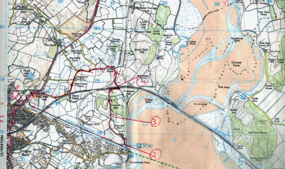
Park in the unmarked car park off the A590, grid reference 293787. This is difficult to spot as you travel the busy road. The entrance lies on the south side of the road, between two bus stops, one on either side. Pull into the signposted turning for the canal and then bear sharp right to park in the large space up against the wall of the road.
Information:
Distance: 4 miles
Time: 2.5 hours
Terrain: Generally good paths, long narrow lane, three stiles
Map: OS Explorers OL 6 and 7
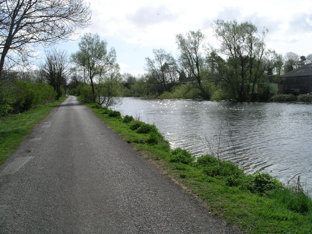
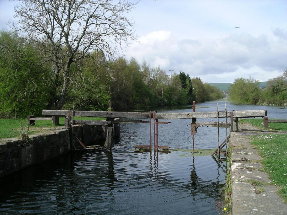
1 In a few steps you join the towpath beside of the canal basin. It is claimed to be the straightest (one mile), the deepest (15-feet) and the widest (66-feet) canal. It was cut so that sea-going ships could get closer to Ulverston and compete with rival ports. Work began in 1803. Enjoy this lovely stretch of water where the reinforced towpath soon takes you under a magnificent bridge, which carries the trains that eventually brought about the demise of the canal as a working waterway. Today geese, duck, moorhen, heron and shag abound. The way is hedged to your left and after half a mile you begin to see the vast number of buildings and giant pipes of the huge pharmaceutical company that once owned the canal and still contributes help when needed. Notice the railway line across the path that carried a branch line into the works. Carry on to reach the end of the canal where a lock stands which once controlled the water flow.
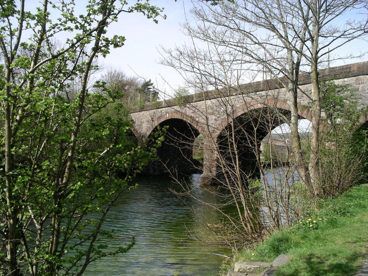
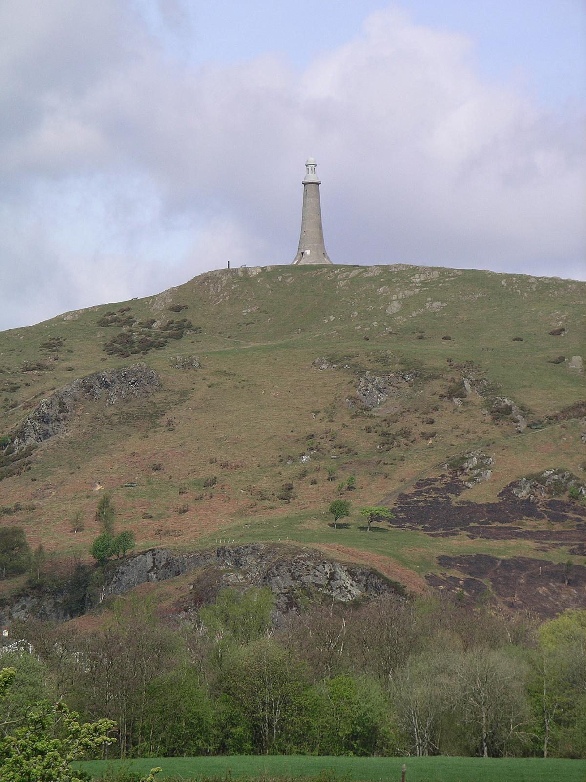
2 Wind around left to join a road beside the estuary, with the superb Leven viaduct now in view. A short way along, follow the signposted road as it climbs uphill between houses to a locked gate, with a small one to its right, into pastures. Stroll the grassy way beside a fence on your left and an attractive old quarry to your right. Ahead lies quiet, pleasing countryside and glimpses of the Hoad and the Sir John Barrow Monument.
3 Carry on the stiled way, keeping ahead to join a reinforced track. Go on, left, along the path beside it and on nearing a pylon follow the indistinct way, up the gentle grassy slope, right. Then look down to locate a fine stile and descend to it. Join the narrow lane beyond and turn left.
4 Cross the railway bridge and continue on the lane, passing the houses at Moss Nook. Head on along the quiet lane, ignoring three right turns to reach Next Ness. Remain on the lane as it comes closer to the railway and then curves right and continues to the roundabout on the A590. Keep ahead, cross the several roads with care and continue on the pavement on the left side of the A590. A short way along you come to the signpost at the start of the parking area.
NB: Restrictions on space mean that this article provides a general summary of the route. It is advisable for anyone who plans to follow the walk to take a copy of the relevant Ordnance Survey map.


Comments: Our rules
We want our comments to be a lively and valuable part of our community - a place where readers can debate and engage with the most important local issues. The ability to comment on our stories is a privilege, not a right, however, and that privilege may be withdrawn if it is abused or misused.
Please report any comments that break our rules.
Read the rules here