
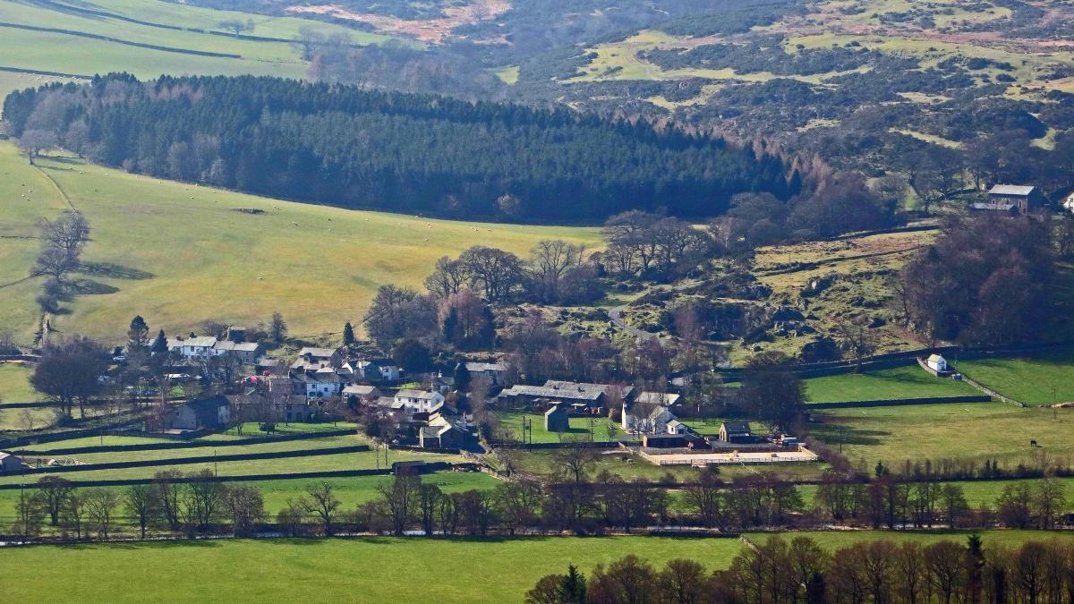
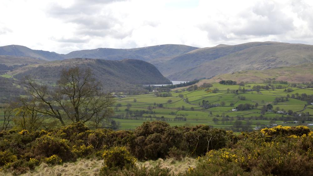
KNIPE Scar is a rarely visited feature above Bampton, near Penrith, writes JOHN EDMONDSON. A walk along its mile-long terrace is rewarded by far reaching views across the valley to Haweswater Reservoir and the surrounding fells. Remains of a stone circle indicate that this was once the site of an ancient settlement. The villages of Bampton Grange and Bampton make this an attractive area for a walk. You might also be interested in how some of the places got their names.
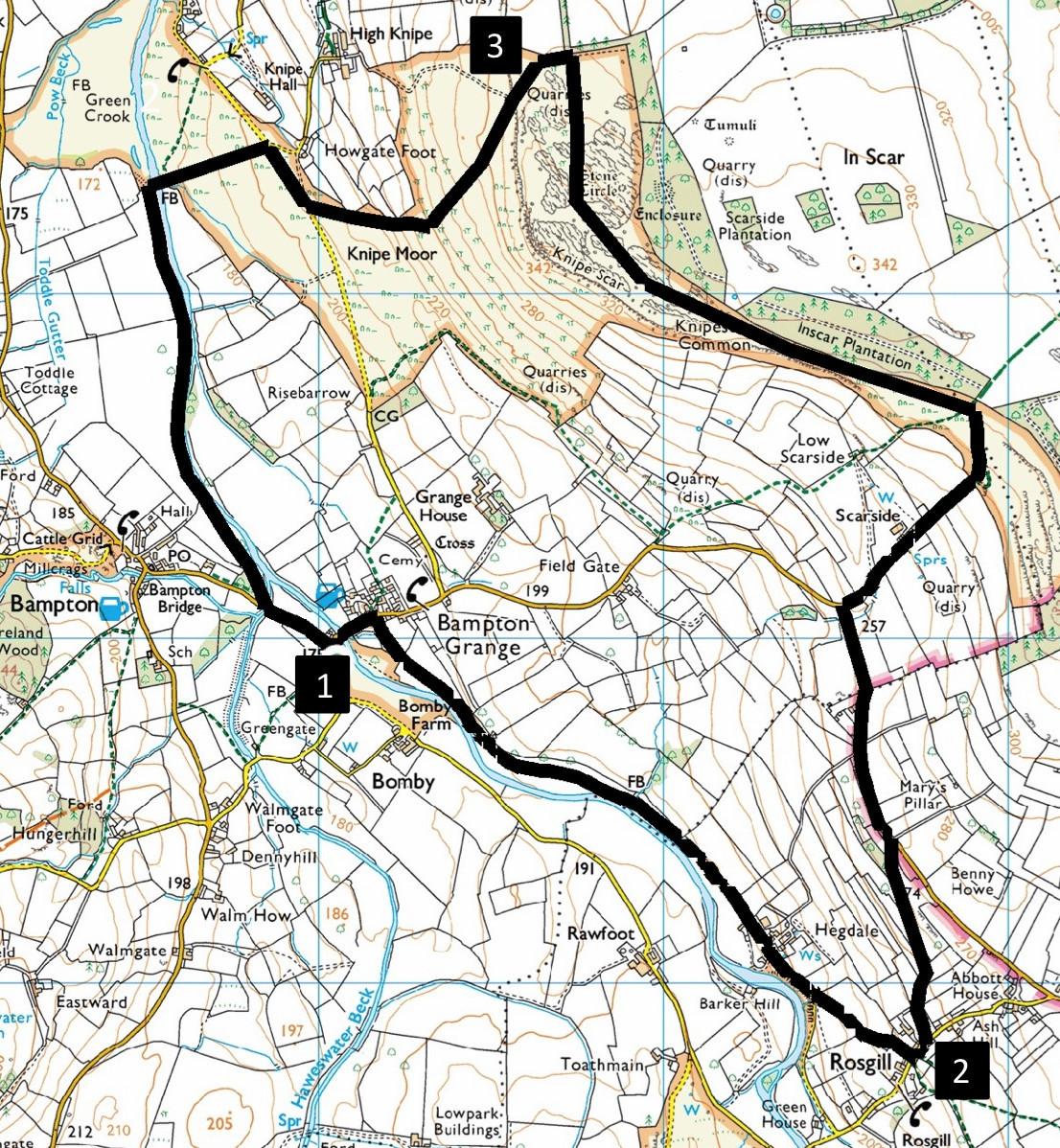
Park by the roadside at the junction near Bampton Grange Bridge, grid reference NY 520 179, near postcode CA10 2QR.
INFORMATION
Distance: 6 miles with 700 feet of ascent
Time: 2.5 hours
Terrain: mainly grassy footpaths
Maps: OS Explorer OL5
ROUTE
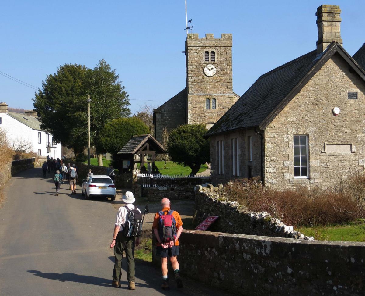
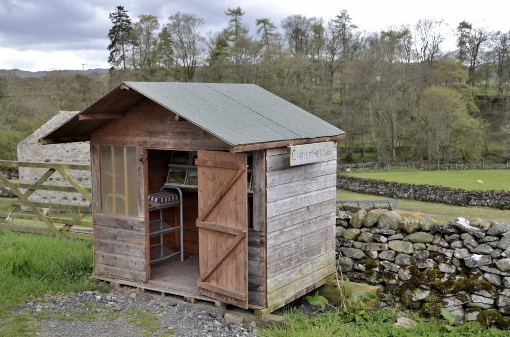
1 From the road junction, cross the bridge and at St Patrick’s Church turn right onto the path signed Shap via Rosgill. After one mile you reach Hegdale (meaning the valley where bird cherry grows) where, from Christine’s Cards hut, you can buy greeting cards and limited edition prints that are produced from Christine Longmire’s paintings of cattle, sheep and horses. Continue ahead along a tarmacked lane. Where the lane goes close by the river below on the right bear left onto the path signed Rosgill. Cross the field to the left of a wall ahead and aim towards cream houses to a gated wall stile. At Rosgill (meaning the ravine with a stream where horses graze) turn left. Walk up the road to a triangle containing a hawthorn tree.
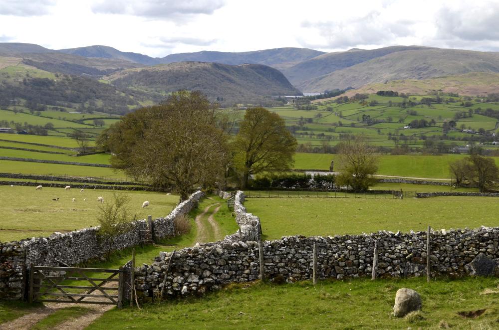
2 Turn left and walk up the walled track to a road. Turn left and walk along the road for half a mile then turn right at the junction to Scar Side. Pass the farm and continue up a track to a gate. Keep ahead going uphill to the edge of a wood. Turn left alongside the wood and stroll along the terrace above Knipe Scar. Knipe comes from the Old Norse word 'gnipa' meaning a jutting crag or rocky summit. Splendid views over Haweswater Reservoir dam can be seen to the left. Follow the grassy track above the scar past areas of limestone pavement. There is a scheduled stone circle on the right. It is difficult to find but consists of a ring bank of limestone boulders and rubble with a limestone block at its centre. Continue walking to the northern end of the scar.
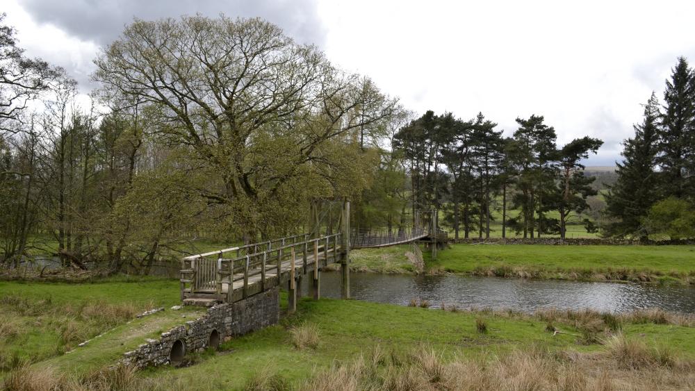
3 Descend to the left (in a southwesterly direction) down the grassy slopes of Knipe Moor. Go around the left side of a wall then veer right to merge with a road. Follow the road and turn left opposite the junction with High Knipe Farm lane. Descend scrubland and cross the wooden suspension footbridge. Turn left and follow the footpath alongside the River Lowther. The river’s name may derive from the old Brittonic word ‘lou’, meaning to wash. On the right is the village of Bampton, meaning the settlement by a tree (beam in Old English). In 1710 Bampton had a grammar school, which was far ahead of its time. Its graduates become clergymen, lawyers and architects. Because of this it used to be said, "In Bampton, they drive the plough in Latin these days." The lane beside Bampton Hall is called Baxters Lane after Thomas Baxter who financed the school. The vicarage opposite the church houses the famous Tinklar Library, which was provided by Baxter in 1710 and contains many books written in Latin. At the road, turn left, cross the bridge and follow the road for 300 yards to Bampton Grange where the walk began.
Next week: Dunsop Bridge
NB: restrictions on space mean that this article provides a general summary of the route. It is advisable for anyone who plans to follow the walk to take a copy of the relevant Ordnance Survey map.


Comments: Our rules
We want our comments to be a lively and valuable part of our community - a place where readers can debate and engage with the most important local issues. The ability to comment on our stories is a privilege, not a right, however, and that privilege may be withdrawn if it is abused or misused.
Please report any comments that break our rules.
Read the rules here