
Ingleton waterfalls, potholes and cave
VISIT spectacular waterfalls, see a huge pothole and enter a giant’s cave, writes JOHN EDMONDSON. This walk extends the 4.5 mile Ingleton Waterfalls Trail by continuing northwards up Kingsdale to Yordas Cave and returning on the opposite side of the valley and Beezley Falls.
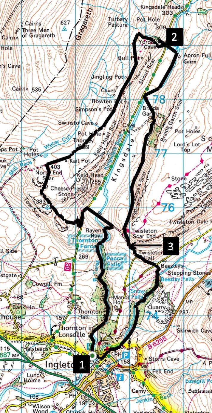
Start from Ingleton Falls car park, SD 693 733, postcode LA6 3ET. The £6 per person includes entrance to the Waterfalls Trail. Take your receipt to show on entering the return path.
INFORMATION
Distance: 11 miles with 1,800 feet of ascent
Time: 5 hours
Terrain: grassy footpaths and stony tracks
Map: OS Explorer OL2
ROUTE
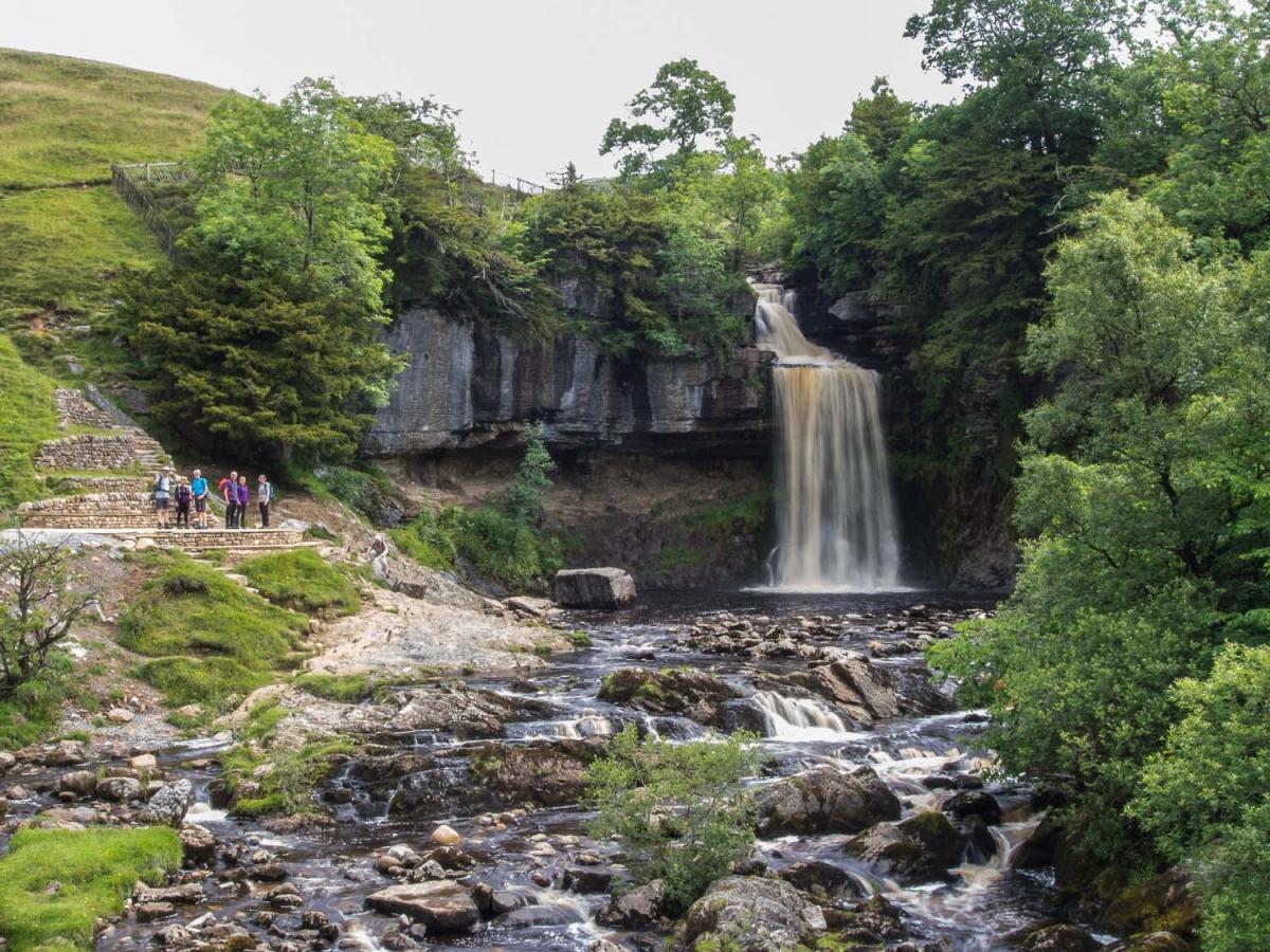
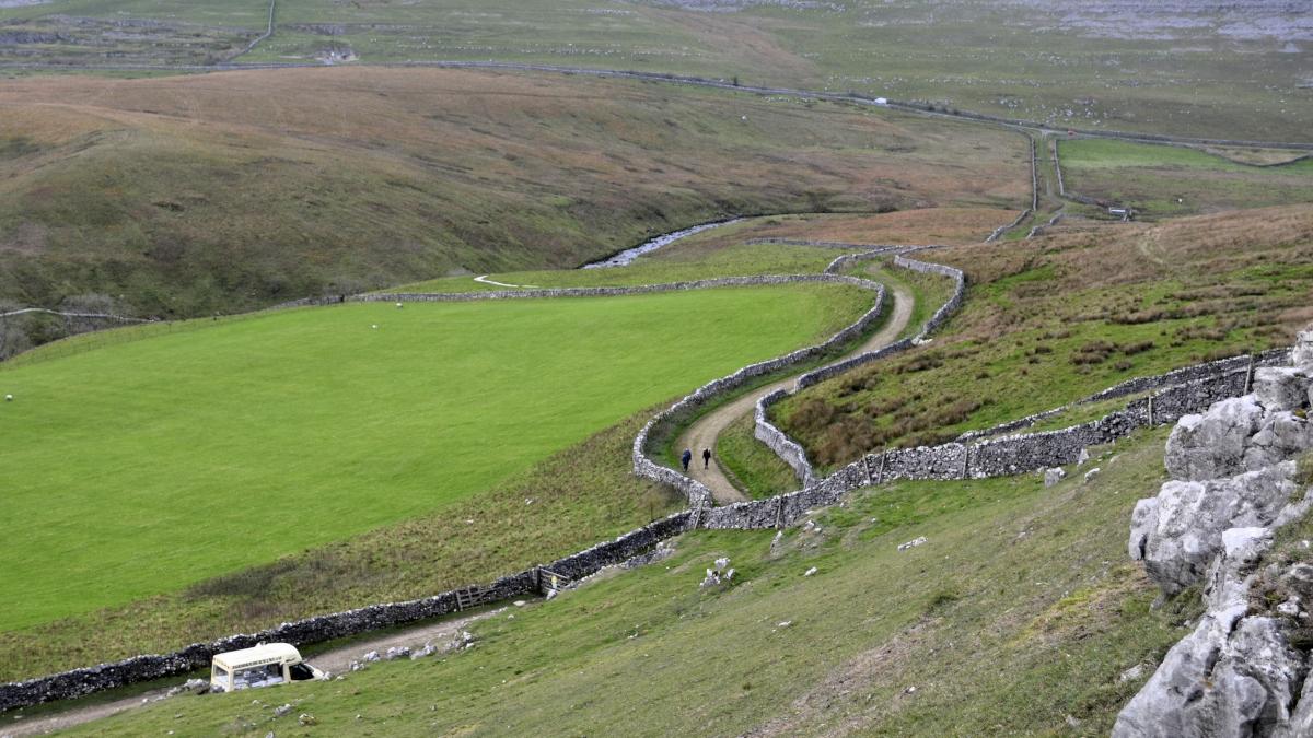
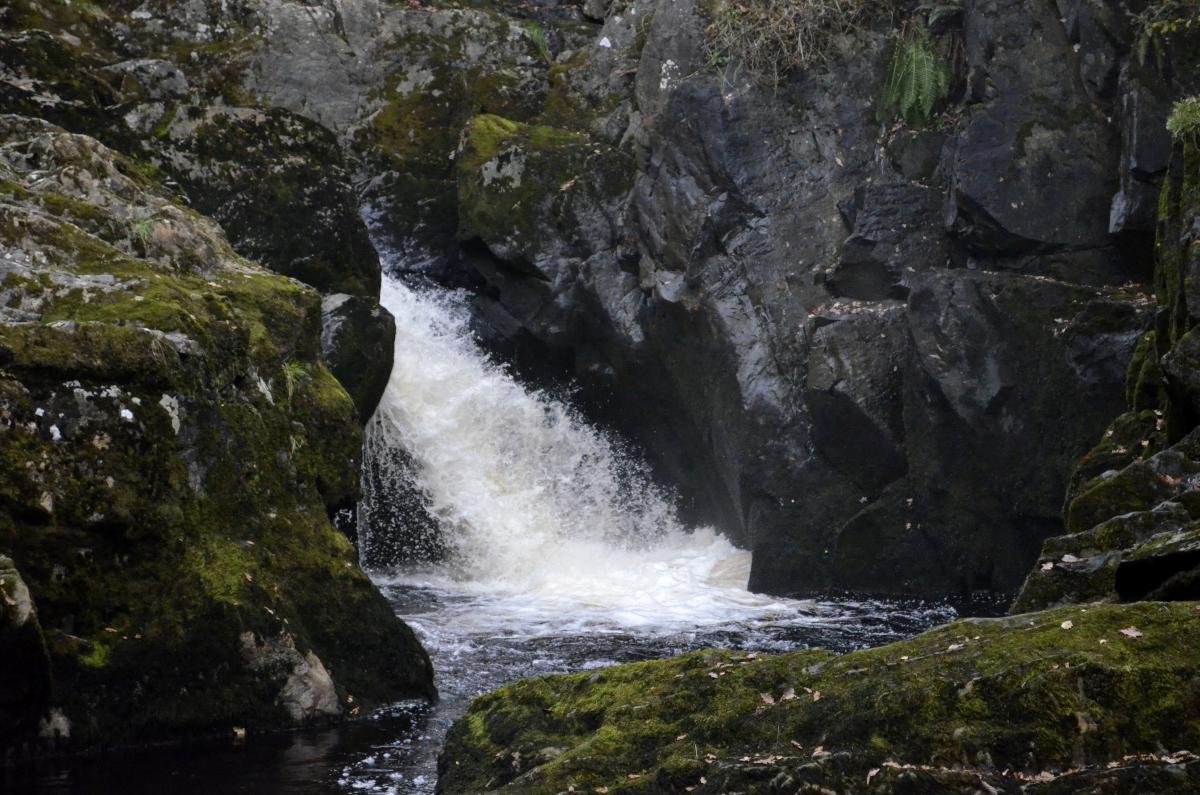
1 Follow the Ingleton Waterfalls Trail from the car park viewing Pecca Falls, Hollybush Spout and Thornton Force. After crossing Ravenray Bridge exit the trail and turn left onto a track, across a footbridge and up to Thornton Lane. Turn left and after 400 yards right onto an uphill track by a telecom station. At the top of the ascent the path bends right then merges with Turbary Road, a track going alongside a wall on the left. Follow the track northwards passing areas of shake holes and potholes. Rowton Pot, which is just before a gate covered with a black rubber mat, is a 200-feet deep hole with a waterfall that starts from a stream about 30 feet below ground level. Keep away from the edge! Cross a stile by a No Motor Vehicle sign, cross a boggy area, then turn right across a ladder stile. Descend past Yordas Wood on the left to a roadside gate.
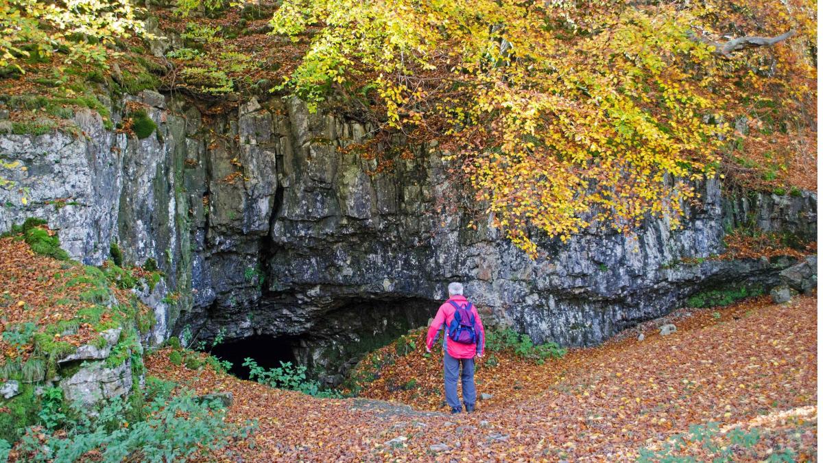
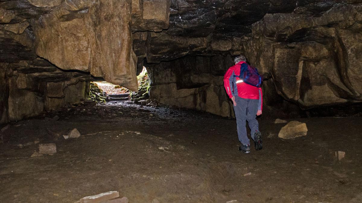
Visit Yordas Cave, which is uphill on the left. This former Victorian show cave is reputedly the lair of an infant-devouring Norse giant and may have provided inspiration for the Fairy Cave in Bronte’s Jane Eyre. After the low entrance the cave opens into a huge dark cavern (about 160 feet long, 50 feet wide and 47 feet high), called the Great Hall of the Giant Yordas. Shapes on the rock walls can be imagined to be figures, including one called The Bishops Throne. Yordas Gill flows through the cave from a narrow passage (The Chapter House), which leads to a cascade falling through an opening above.
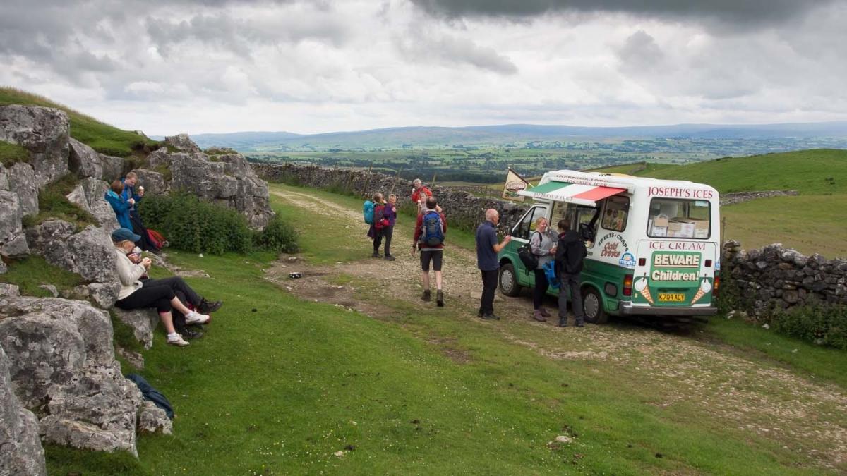
2 Return to the roadside gate, turn right and after 25 yards left to go over a wall stile. Follow the fence on the right, bending right to walk between it and the river. Cross a wall stile and follow the beck to cross a footbridge on the left. Cross the field diagonally right to a wall stile and turn left at the farm on the signed footpath. Go through a gate on the right in front of Braida Garth farmhouse then over a stile into a field below the wood. Follow the grassy path ahead, crossing two stiles, a boggy area and ascending to cross a ladder stile. The path then goes alongside a fence on the left and climbs steadily to a wall stile in the corner followed by a ladder stile leading to a grassy track. Descend to the main track (where there is often an ice cream van).
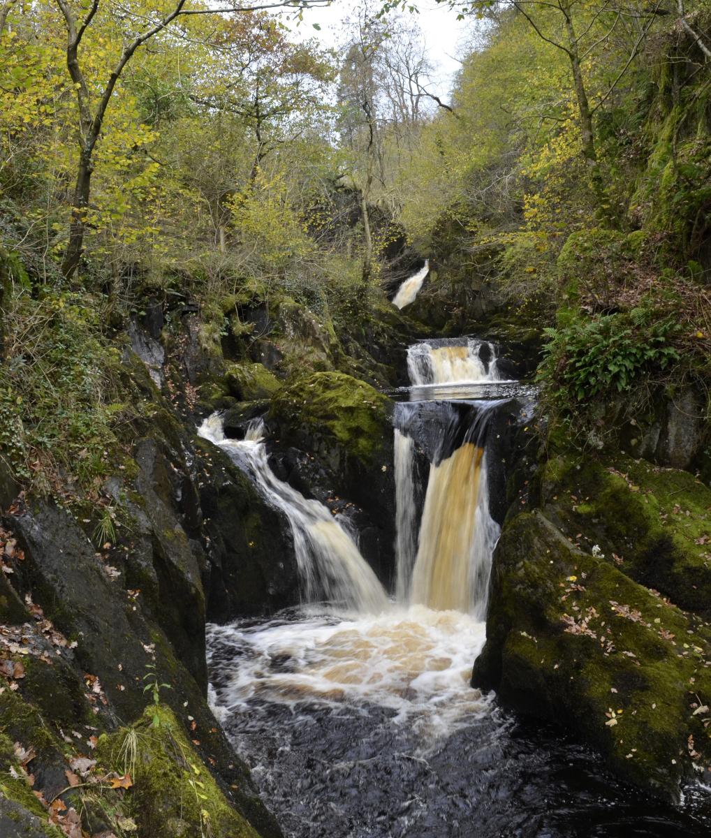
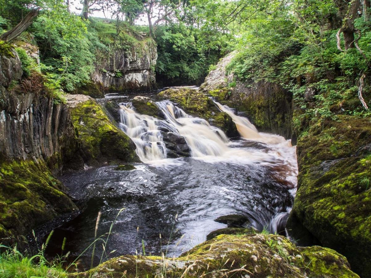
3 Turn left and go straight on past Scar End following signs to Ingleton Waterfalls Trail. Follow the waterfalls trail past Beasley Falls, Backson Gill Gorge and Snow Falls then exit through a kissing gate. Continue ahead through a disused quarry and follow the road into Ingleton. Go through the village and down to the river and back to where the walk began.
Next week: Staveley and Cowan Head
NB: restrictions on space mean that this article provides a general summary of the route. It is advisable for anyone who plans to follow the walk to take a copy of the relevant Ordnance Survey map.


Comments: Our rules
We want our comments to be a lively and valuable part of our community - a place where readers can debate and engage with the most important local issues. The ability to comment on our stories is a privilege, not a right, however, and that privilege may be withdrawn if it is abused or misused.
Please report any comments that break our rules.
Read the rules hereLast Updated:
Report this comment Cancel