

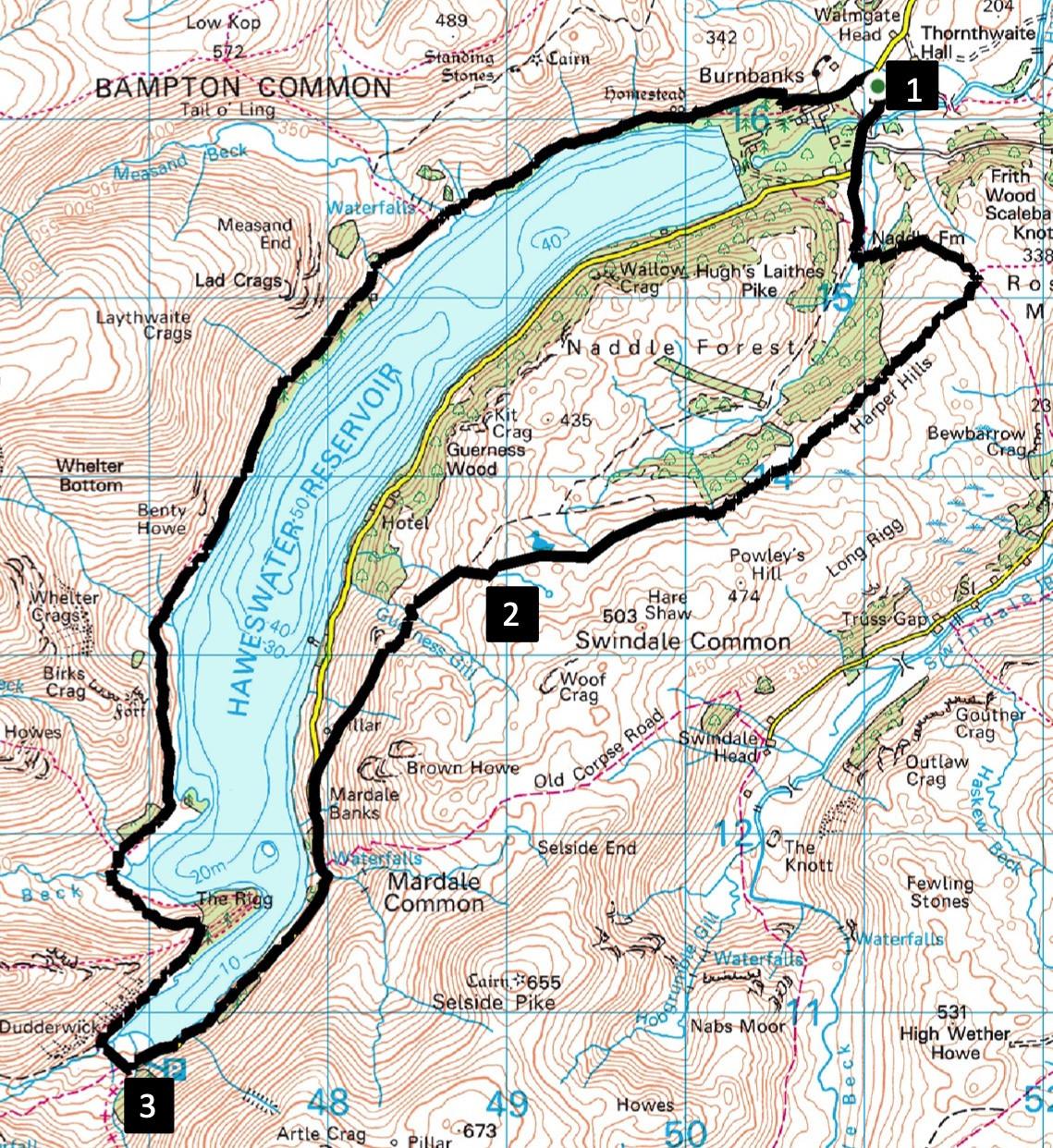
Haweswater Circuit
IT IS satisfying to walk around a large expanse of water, writes JOHN EDMONDSON. This walk makes a circuit of Haweswater going out over wild fells to Mardale Head and back along the reservoir’s west side path. It’s quite a tough walk but suitable for winter, with few boggy areas and never going higher than 1,430 feet.
Park by the roadside at Naddle Gate, which is at the junction to Burnbanks on the road to Haweswater, map reference NY 510 162, postcode CA10 2RL.
INFORMATION
Distance: 12 miles
Time: 6 hours
Terrain: fell paths, open fell and 1.5 miles of minor road
Maps: OS Explorer OL5
ROUTE
1 Walk along the road towards Haweswater. Cross Naddle bridge and where the road swings right keep straight on the concrete lane to Naddle Farm, signed Swindale. After passing the farm fork left on the bridleway, cross Naddle Beck and ascend the winding stony track. Go through two gates and after the second one at the top of the hill turn immediately right. Follow the wall on the right for the next two miles, passing woodland in the valley on the right. Close to some caged saplings the track disappears but continue walking in the same direction over rough fell. Keep to the higher ground about 200 yards from the wall.
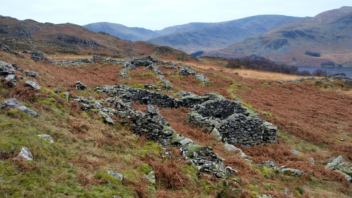
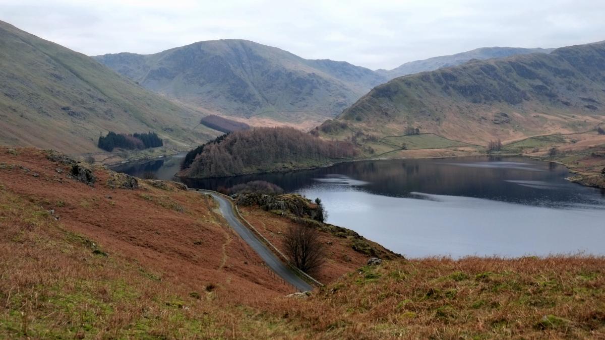
2 Descent to an outside 90-degree corner of the wall. Continue following the wall to the right down a faint path, passing an attractive waterfall. Hidden among the bracken to the north of here are remains of an early 18th Century steading. Walk left of crags and cross an attractive ravine of Guerness Gill to the left of a metal pipe. Traverse the fellside maintaining height and heading roughly parallel to the reservoir. Widely spaced concrete posts mark the course of the path, which then descends to meet the road. Turn left and walk along the road to the parking area at the end of the reservoir. The waterside permissive path is currently closed for safety reasons. After crossing the bridge over Rowantreethwaite Beck the road passes close to the drowned site of Mardale’s Dun Bull Inn.
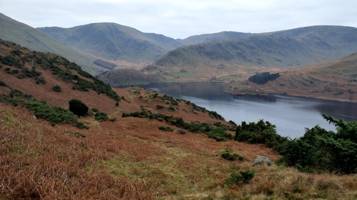
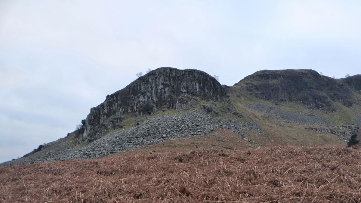
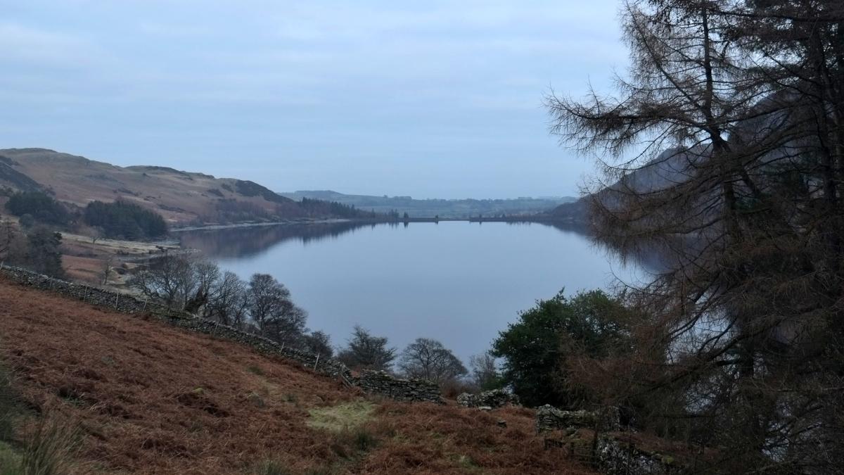
3 From Mardale Head parking area go through the Gatescarth Pass gate and turn right onto the path going round the end of a wall. The walk now follows the reservoir side path back to Burnbanks. It’s a straightforward route but harder than you might expect: although there is no more than 200 feet between the highest and lowest points, the total ascents add up to more than on the outward journey. From below The Rigg there is an impressive view along the length of the reservoir. The waters just beyond the tree-topped spur of Speaking Crag hide the location of Flake How, once the home of Dales farmer John Edmondson and generations before him. The main climb on the path goes to the foot of Castle Crag. An optional scramble to the site of an Iron Age fort that still contains remnants of its ditches and ramparts top would be rewarded by impressive views of the reservoir. At the approach to Burnbanks turn right to go through a gate (signed C2C) and follow the lane through the model village that was built to house dam construction workers. The present bungalows were rebuilt and the green created after the village population had dwindled in the 1970s. Continue along the lane to meet the main road where the walk began.
Next week: Grange and Cartmel
NB: restrictions on space mean that this article provides a general summary of the route. It is advisable for anyone who plans to follow the walk to take a copy of the relevant Ordnance Survey map.


Comments: Our rules
We want our comments to be a lively and valuable part of our community - a place where readers can debate and engage with the most important local issues. The ability to comment on our stories is a privilege, not a right, however, and that privilege may be withdrawn if it is abused or misused.
Please report any comments that break our rules.
Read the rules here