
THIS easy walk encompasses the patchworks of pasture, woodlands, scattered settlements and network of twisting minor roads that typify the lovely Rusland valley, writes JOHN EDMONDSON.
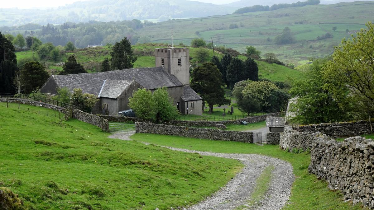
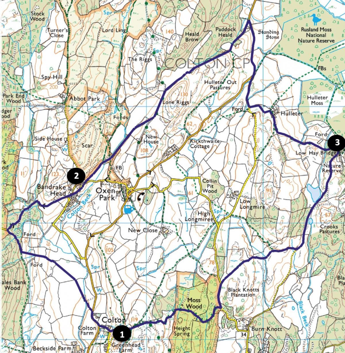
Park by Holy Trinity Church, Colton, map reference SD 318 860, postcode LA12 8HF.
INFORMATION
Distance: 6 miles with 1000 feet of ascent
Time: 3 hours
Terrain: grassy paths, stony tracks and quiet lanes
Map: OS Explorer OL7
ROUTE
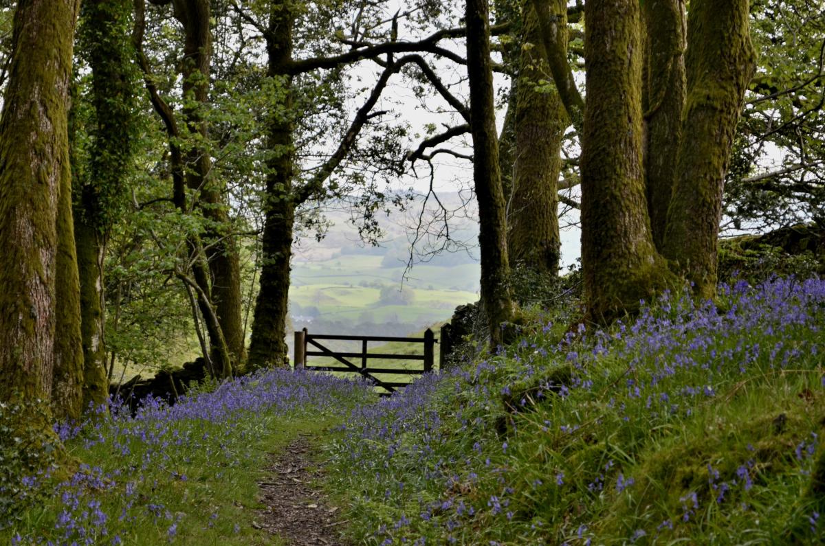
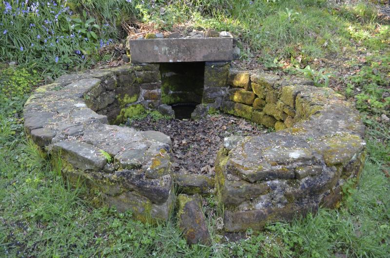
1 From the church car park turn right then bear right down a stony track. Pass St Cuthbert’s Well, turn right onto the road and right at the road junction. After passing the Old Vicarage turn left onto the footpath signed Bessy Bank Lane. Cross three fields to a wall stile on the left then walk alongside a hedge and wall on the right. Go through a field gate then uphill to Sales Bank Wood. The tiny villages of Bandrake Head, Oxen Park and Colton and the patchwork of meadows in between typify this lovely valley. Turn right and follow the waymarked woodland path to a road. Turn right to go downhill, across a pretty beck, up a steep bank then descend into Bandrake Head. Keep left but pass a junction on the left and after Moss Rigg House turn left through a gateway onto a public bridleway.
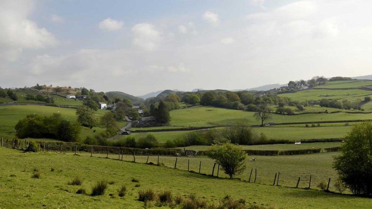
2 At a crossroads of paths turn right, signed Oxen Park, cross Colton Beck and turn sharp left along a grassy path going beside the beck. The path enters a field, climbs beside a bank wall on the right and goes through a gateway to a stony track. Turn left and after 350 yards bear right through a gate onto the path signed Whitestock Hall. Walk alongside a wall on the right and through Paddock Heald Wood, keeping straight on at the path junction by a gate. At the road turn right and continue for a quarter of a mile, keeping to the outside of bends to be visible to drivers. At a junction, called Sheep Wash, keep left onto the gated road and turn left at the junction signed Low Hay Bridge. This lane offers splendid views of the Rusland Valley, with Rusland Moss Nature Reserve in the foreground, the church on the left and the hall in the centre. Pass to the right of Hulleter Farm then keep left along the track to Hay Bridge Natural History Study Centre.
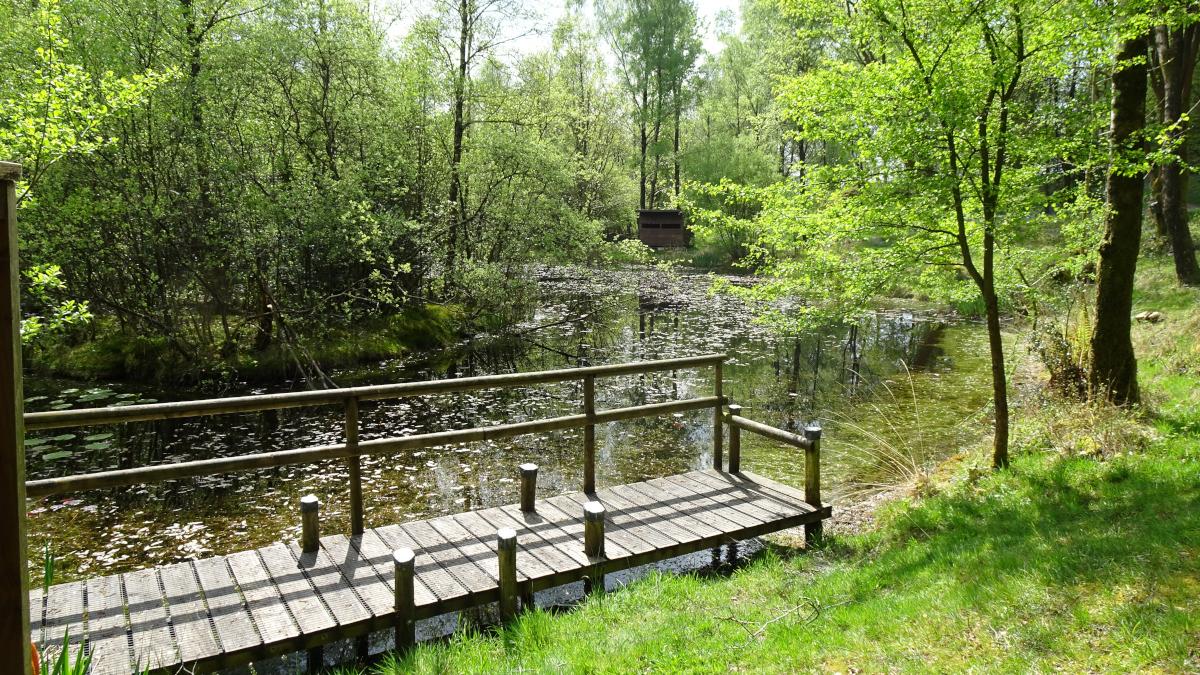
3 Follow the tarmacked lane to the right towards Bouth. On the right a short stepped path leads up to a memorial to Helen 'Tissie' Fooks, who designated the area as a wildlife reserve and deer sanctuary in the late 1960s. Pass White Moss and Black Beck Tarns with their bird hides then cross a cattle grid to exit the woods. After 150 yards turn right onto the grassy path signed Moss Wood. Walk over a rise then down to the left of an oak tree and follow the Greenwood Trail waymarkers going across Black Beck, through a gate and alongside a wall on the left. At the road turn left and after 300 yards on right go through a gate onto the public byway signed Colton. Stay on the main track through Height Spring Wood, bending left at a memorial bench to leave the woodland. The twisting track ascends to Colton Heights - a good viewpoint - before Colton Church suddenly appears just ahead, making a pleasant surprise ending to the walk.
Next week: Dolphinholme and Scorton
NB: restrictions on space mean that this article provides a general summary of the route. It is advisable for anyone who plans to follow the walk to take a copy of the relevant Ordnance Survey map.


Comments: Our rules
We want our comments to be a lively and valuable part of our community - a place where readers can debate and engage with the most important local issues. The ability to comment on our stories is a privilege, not a right, however, and that privilege may be withdrawn if it is abused or misused.
Please report any comments that break our rules.
Read the rules here