
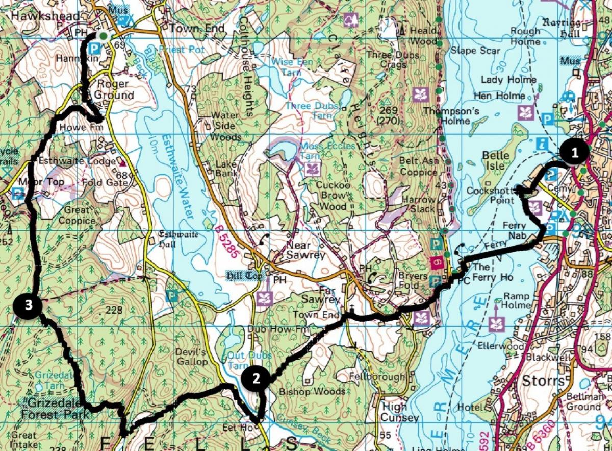
HERE is a pleasant walk from Bowness to Hawkshead that you can do without a car, writes JOHN EDMONDSON. Use the 599 bus service from Windermere bus station to start the walk from Bowness Pier. Cross Windermere by ferry, visit Claife Viewing Station then follow undulating paths and woodland tracks to Hawkshead. Return to Windermere using the 505 bus.
INFORMATION
Distance: 8 miles with 1,400 feet of ascent
Time: 4 hours walking plus bus travel
Terrain: clear footpaths, tracks plus 1.3 miles of minor roads.
Map: OS Explorer OL7
ROUTE
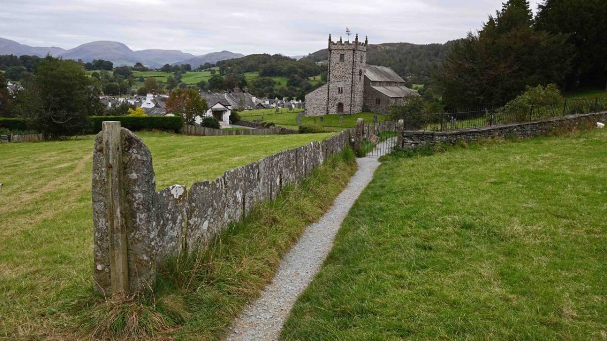
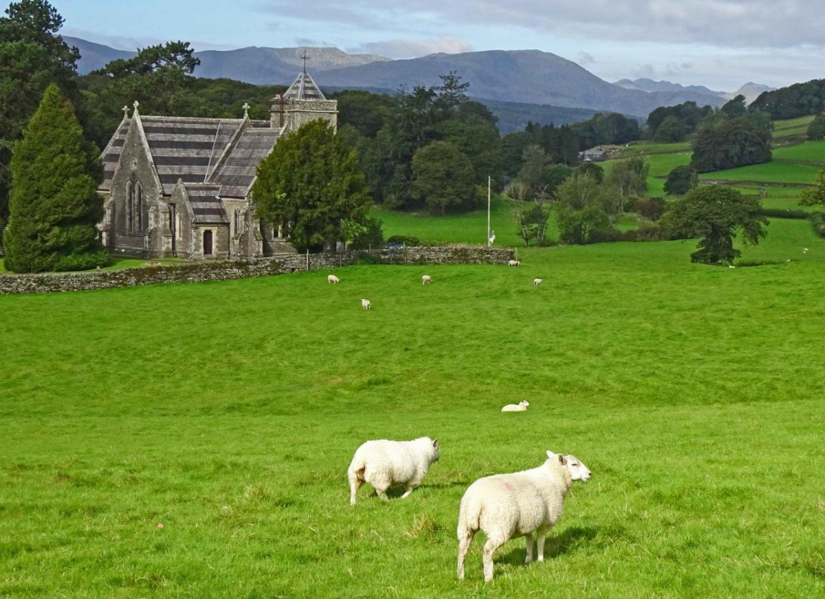
1 From Bowness Pier walk along Glebe Road and continue by the lakeside path signed ‘Footpath to Ferry’ past Cockshott Point. Take the car ferry across Windermere (£1 for pedestrians) then follow the path signed ‘Claife Viewing Station’, going along the edge of Windermere. Turn left onto the path signed ‘Hilltop, Near and Far Sawrey’ going through the archway. Visit Claife Viewing Station then descend the steps to a car park. Continue following the roadside path signed ‘Near and Far Sawrey’ to Fair Rigg walk then alongside the uphill road for a quarter of a mile. Stay on the road past the double bend and turn left at the top of the slope onto a signed footpath. Descend to pass St Peter’s Church then turn left on the lane past Dove Cottage. Turn right onto the signed footpath taking the higher path alongside a fence on the right. Cross a meadow, go through a gate then branch off the farm track to the right through a kissing gate. Follow the grassy path between two woods and into woodland at the end of the field.
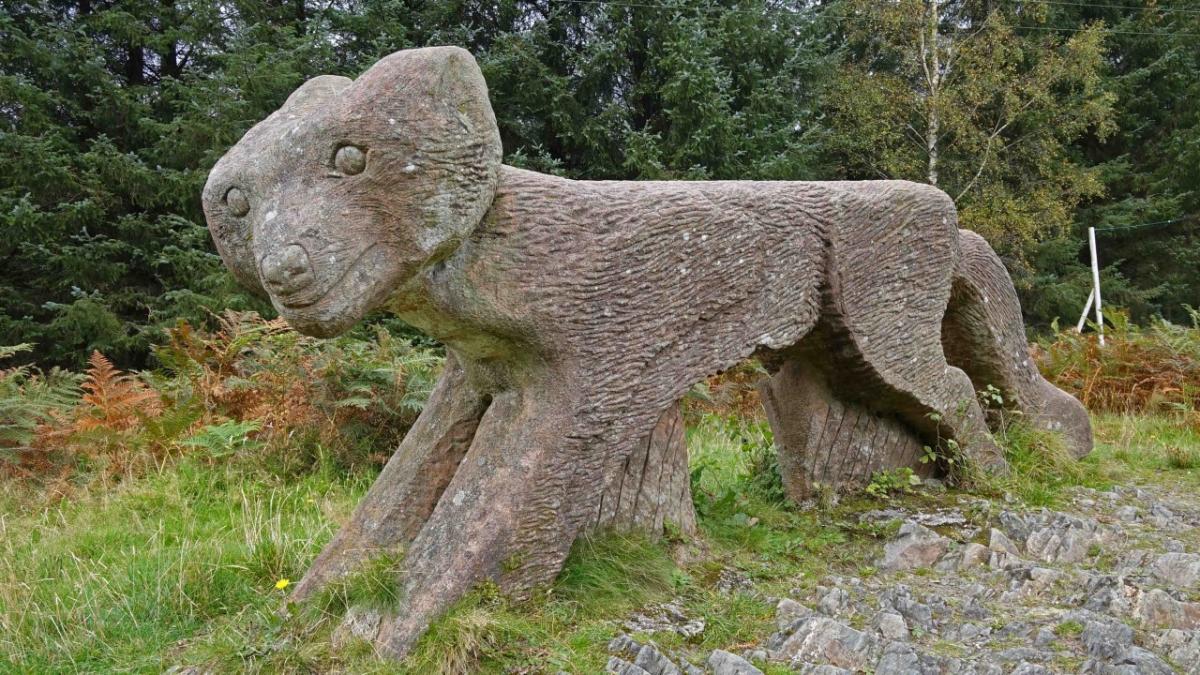
2. After a total of two miles walking you meet a road. Turn left, cross Cunsey Beck via Eel House Bridge and turn right at the junction. After a third of a mile along this road turn left onto the bridleway signed ‘High Dale Park’. Follow the initially stony track through High Dale Plantation. At the next road turn right and after 200 yards at the top of a slope, left (through a parking area) onto the bridleway signed ‘Grizedale Forest North East’. This is the main ascent of the walk. On meeting a forest track turn right. Where the track bends left keep right following a blue bridleway waymarker. On reaching a forest track turn right and continue to the Red Sandstone Fox, which was created by Gordon Young in 1991.
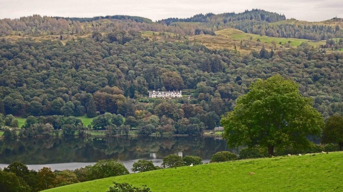
3. Turn right then left continuing to follow blue waymarkers. On meeting the base of a U-bend keep left. Turn right onto a footpath leaving the track below overhead power lines. Exit the woodland through a gate and keep ahead at the path crossing signed ‘How Intake’. A splendid view over Esthwaite Water appears on the right. The large white building across the water is Broomriggs, built in 1900 as a holiday home and now divided into apartments. Turn right onto the road and descend for half a mile. At the bottom of a slope turn right onto the path signed ‘Howe Farm’ following a fence on the left. Go between farm buildings and after passing the front of the farmhouse turn left onto the path signed ‘Roger Ground Hawkshead’. Turn right onto the road and descend for 100 yards then turn left onto the path signed ‘Hawkshead Village’. Enter Hawkshead near the church and catch a bus back to Windermere. A 505 bus leaves Hawkshead at 46 minutes past the hour until 15.46 then at 15.58 (school days only), 16.58 and 17.58.
Next week: Rydal and the Coffin Road
NB: restrictions on space mean that this article provides a general summary of the route. It is advisable for anyone who plans to follow the walk to take a copy of the relevant Ordnance Survey map.


Comments: Our rules
We want our comments to be a lively and valuable part of our community - a place where readers can debate and engage with the most important local issues. The ability to comment on our stories is a privilege, not a right, however, and that privilege may be withdrawn if it is abused or misused.
Please report any comments that break our rules.
Read the rules here