
Coniston Coppermines and the Old Man
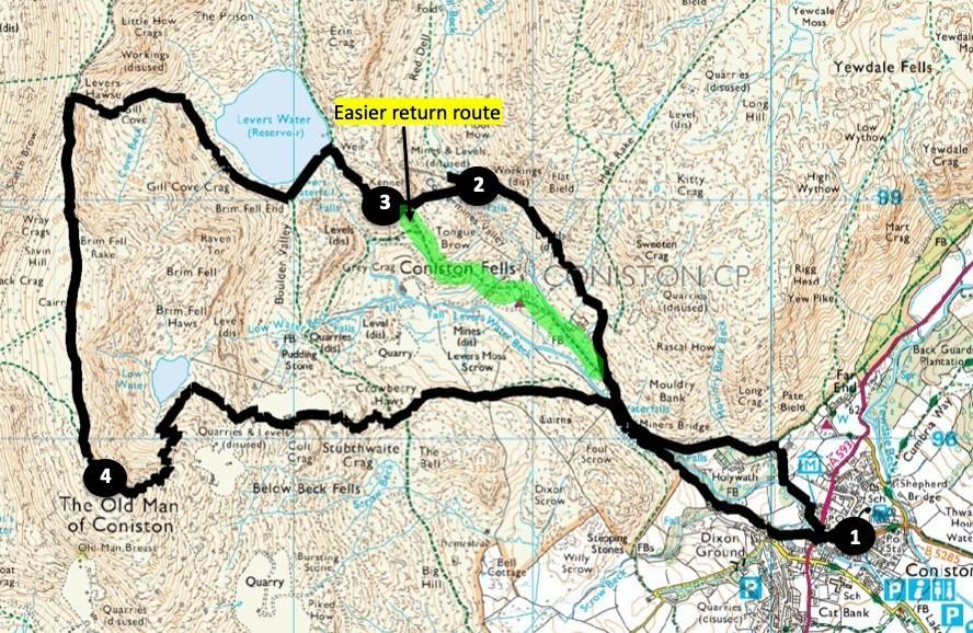
FROM the centre of Coniston walk past the historic copper mines, then climb above Levers Water to the Wainwright summits of Brim Fell and Coniston Old Man, writes JOHN EDMONDSON. Alternatively, take an easier walk omitting the summits by returning to the start from below Levers Water.
Start from Coniston Tourist Information Centre, map reference SD 303 975, postcode LA21 8EH.
INFORMATION
Distance: 7 miles with 3,000 feet of ascent or 4 miles with 1,250 feet of ascent
Time: 4.5 hours
Terrain: mountain tracks and footpaths including easy scrambles on the longer route
Maps: OS Explorer OL6
ROUTE
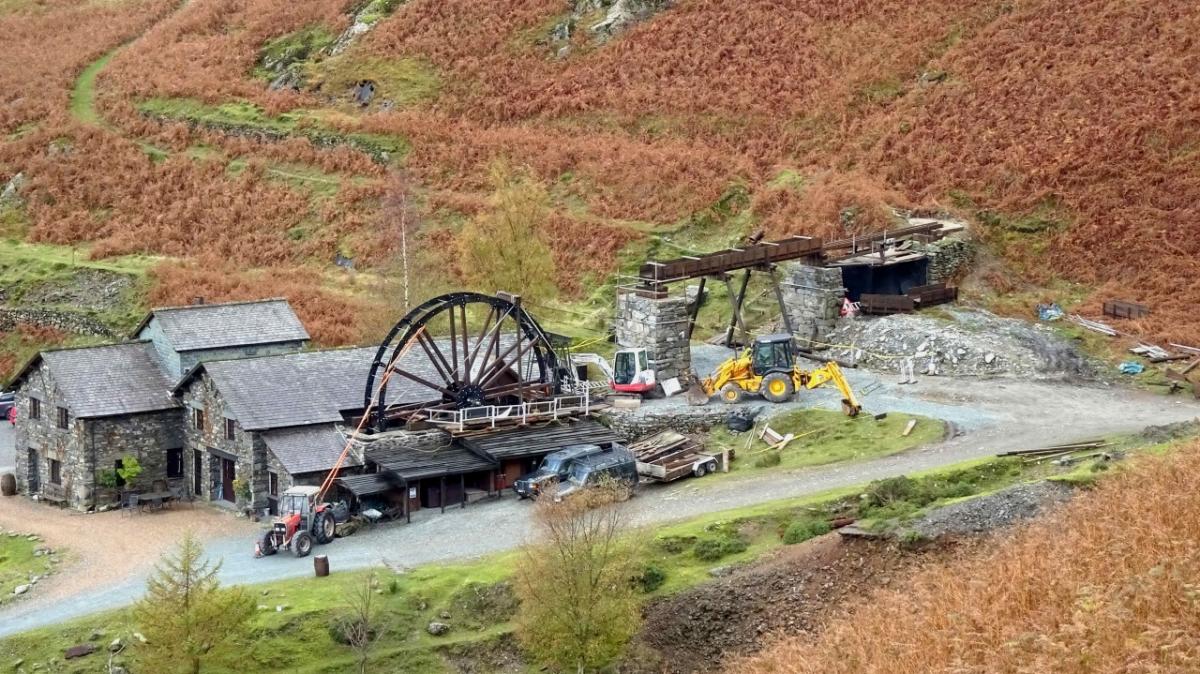
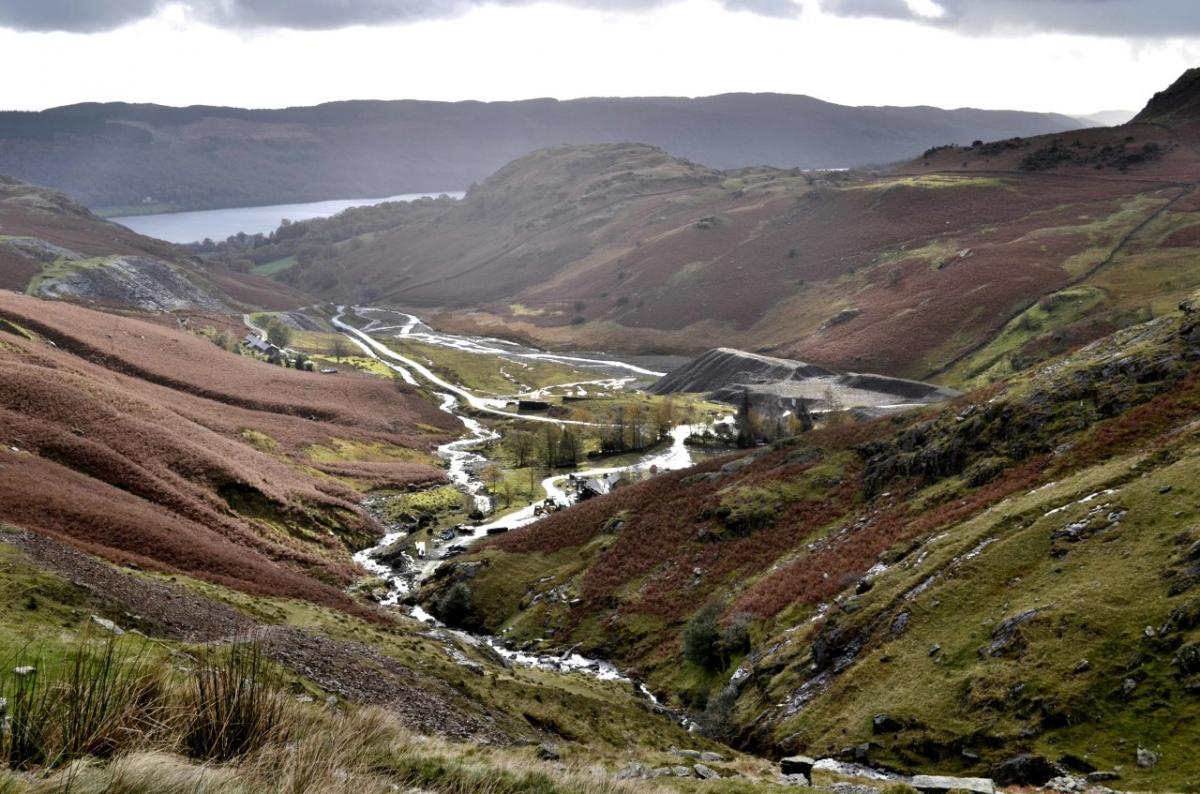
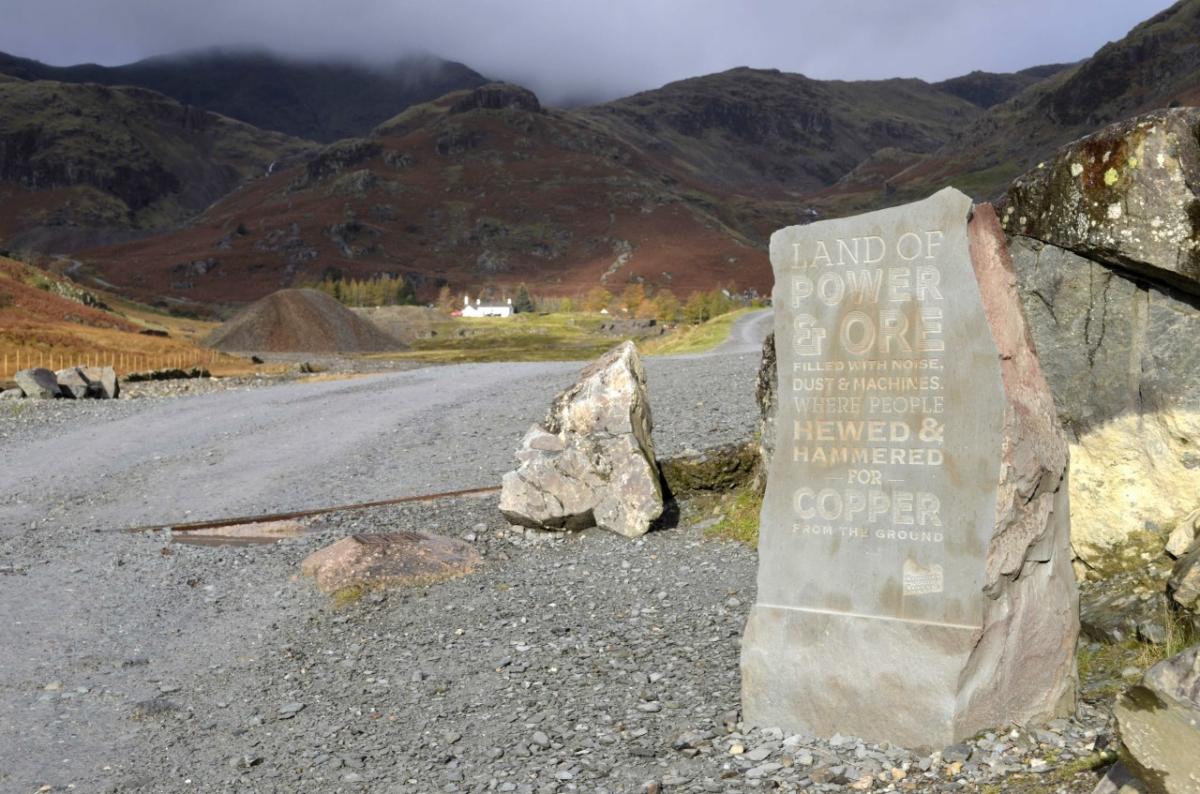
1Walk past the Crown Inn and church then turn right onto Yewdale Road, left at the Black Bull and past the Ruskin Museum, outside of which is the engine from the Halifax bomber which crashed on High Carrs in 1944. Pass Holywath, the 19th century home of John Barratt, then the principal shareholder in the copper mining operation. Continue along the track past Miners Bridge and the intake for hydroelectric power generation, then take the turning to the right. Keep right past the lane leading to Irish Row and fork left where the main track swings right to head up the side of the Coppermines valley. A 32-feet diameter waterwheel has recently been installed at the former sawmill, replacing the original one removed when the mine closed around 1890. Note the slab of rock alongside the track carved with miners’ names. Pass the refurbished Bonsor East wheel pit on the left and optionally visit the Old Engine Shaft on the right. The shaft housed a mechanism for pumping water from the 1,395-feet deep mine and was powered by a huge waterwheel housed in the structure ahead.
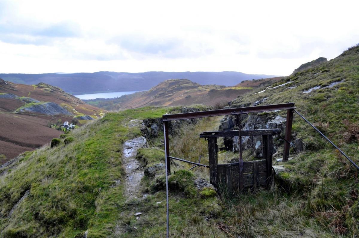
2 Cross Red Dell Beck via the footbridge and view the wheel pit at the foot of Thriddle Incline. The waterwheel here powered a cable inclined tramway bringing ore trucks down from the mine levels above. Go back towards the footbridge and turn right to follow a former leat (millstream) above the valley head. The area below was known as the Upper Bonsor dressing floors, where copper ores were crushed and concentrated. Go around the outside of a rocky outcrop, then keep right to ascend a stony track leading to Levers Water dam.
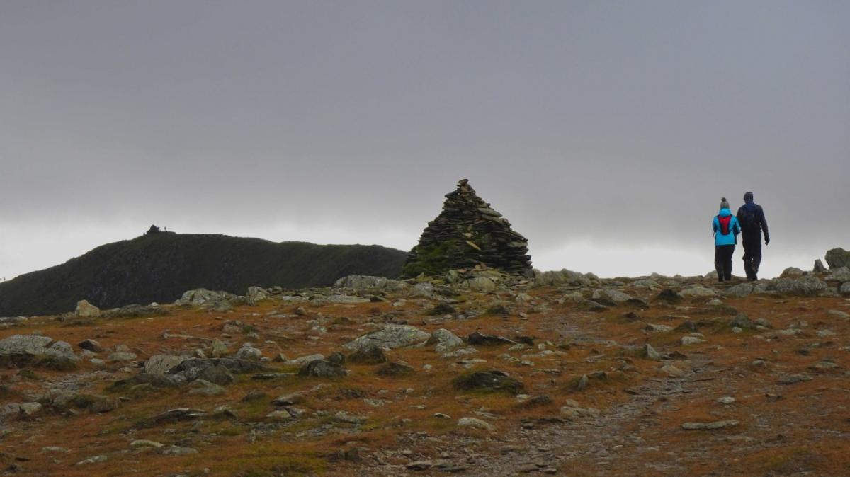
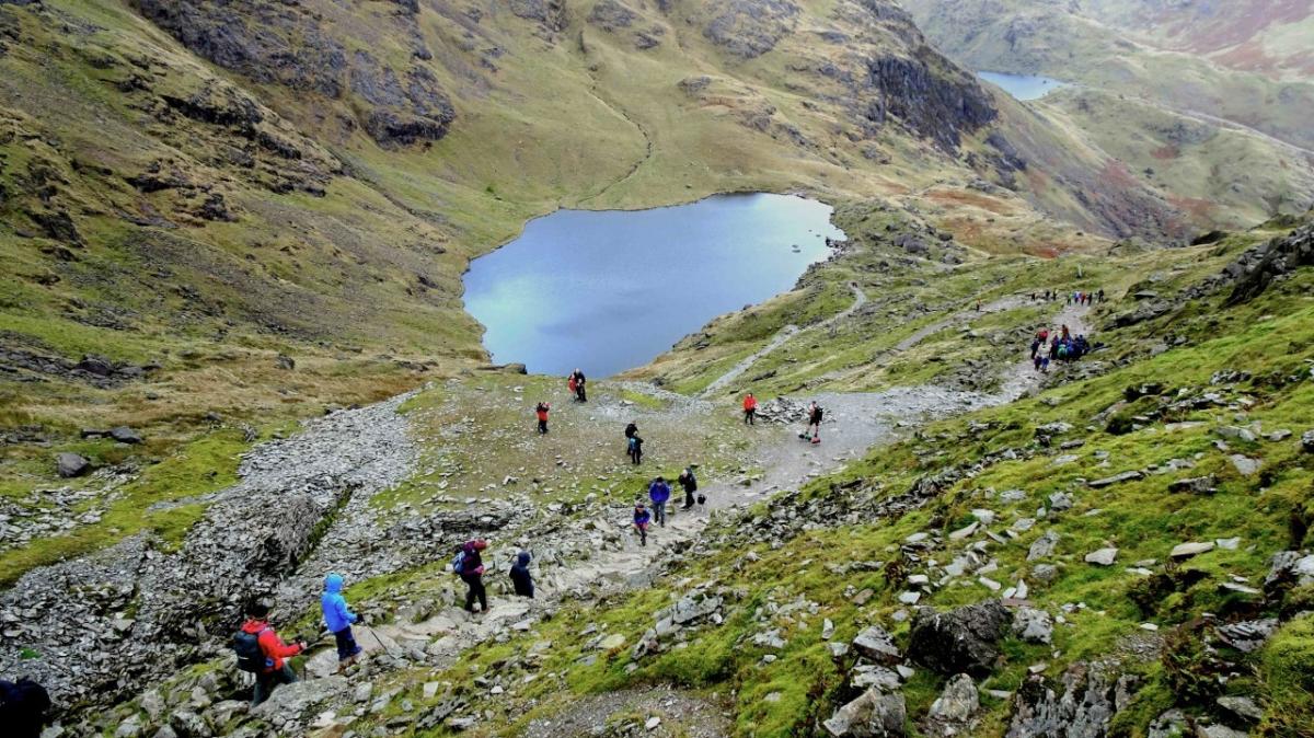
3 To shorten the walk, turn left and walk down past the Paddy End mine workings then back to the start. To continue, cross the spillway weir and the dam then turn right onto the path above the west side of Levers Water. Ascend the steep path (stone pitched in parts) to Levers Hawse. At the top of the slope turn left. A view of Seathwaite Tarn appears on the right. Walk southwards over Brim Fell (2,612 feet) to the 2,635-feet summit of the Old Man of Coniston.
4 Descend ahead by the popular path, initially heading towards Coniston Water then descending to Low Water, where the path swings right. After passing a path joining from the left take the next left descending to the valley. Continue past Miners Bridge keeping to the right of Church Beck. This track was built to bring the copper ore to a railhead built in 1860, from where it was taken to Swansea for smelting. The former Copper House and railhead area is now occupied by Coniston Stonecraft Limited. Turn left at the 16th century Sun Inn. The Sun Hotel was attached in 1902 to accommodate tourists who came to Coniston by rail. This was Donald Campbell’s base during his attempts on the water speed record. Follow the downhill road returning to Coniston village.
Next week: Carnforth canal and the Kellets
NB: restrictions on space mean that this article provides a general summary of the route. It is advisable for anyone who plans to follow the walk to take a copy of the relevant Ordnance Survey map.


Comments: Our rules
We want our comments to be a lively and valuable part of our community - a place where readers can debate and engage with the most important local issues. The ability to comment on our stories is a privilege, not a right, however, and that privilege may be withdrawn if it is abused or misused.
Please report any comments that break our rules.
Read the rules here