

Walk through lovely quiet rolling countryside north of Kendal. The route contours slopes above the River Mint, then follows the Dales Way before heading to the River Sprint, a river once busy with mills and now a quiet habitat for crayfish. The Mint’s name derives from Celtic mimet, meaning make a sound.

QR code
1. Take the footpath near the southern (Kendal) end of the lay-by. Cross the field along the line of overhead cables and turn left onto a wall-side path leading to Helme Lane. Turn right, then left onto the driveway of Dodding Green (footpath signed Skelsmergh Hall). Bear right after the pond, go through a gate then alongside a wall on the left to a road beside a row of cottages. Turn left and follow the road uphill for about a mile, bypassing a junction on the left.
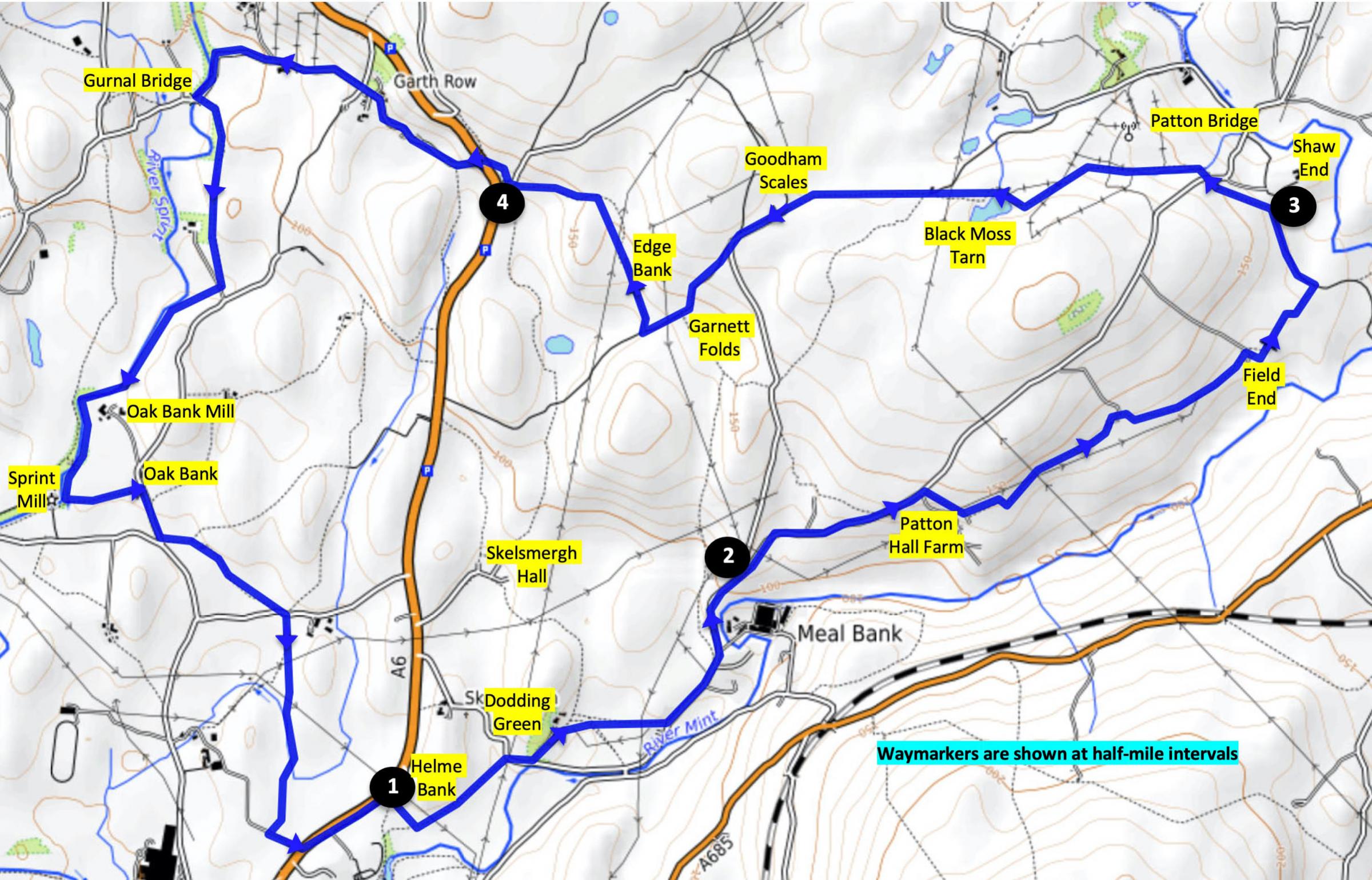
Mint and Sprint route
2. Turn right to Patton Field Farm (above the first gateway) and left through a metal field gate near the farmyard entrance. Walk parallel to the wall on the right, through a gateway, ahead to a wall stile then along the line of trees on the left. Cross a fence stile and then a ladder stile to Old Field End Farm. Go through a small gate behind a parking area, alongside the fence then through a small paddock with conifer trees on the right. Follow the grassy lane to Field End Farm. Turn right past the white cottages then left through a gate onto a stony track. Continue ahead along a wall on the right and go through a metal gate on the right. Continue ahead alongside the fence on the left to a metal kissing gate. Turn left onto the Dales Way along the hedged lane towards Shaw End mansion.
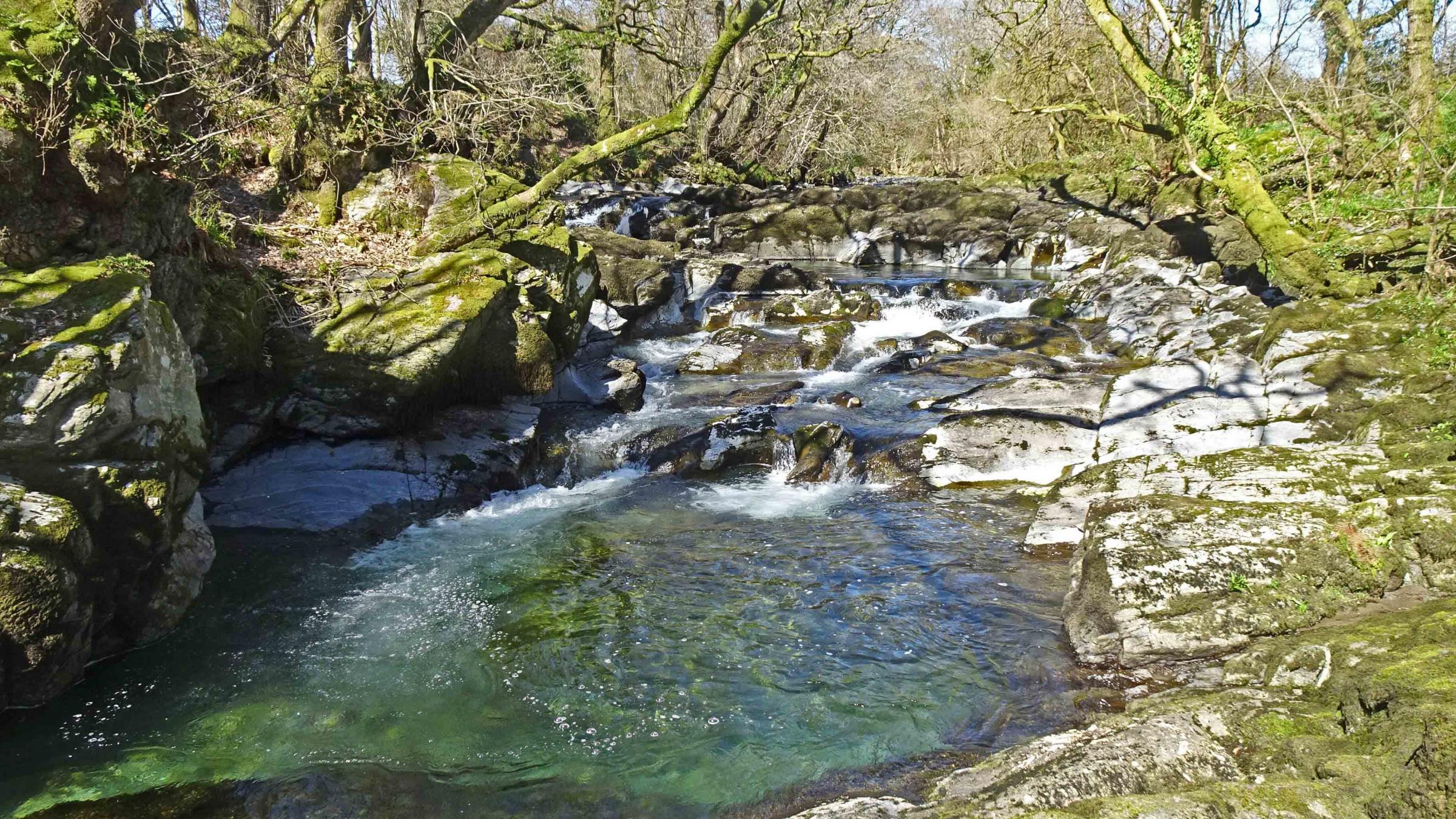
River Sprint
3. Before reaching the mansion turn left through a kissing gate, then go through a field gate and up to the left past High Barn. Cross the road onto a path (signed Black Moss Tarn) at Biglands and follow the Dales Way past the tarn then over a hill below power lines. Pass in front of the white New House Farm then walk along the Public Way to merge with a lane at the entrance to Goodham Scales. Walk along the lane past Garnett Folds and where the lane meets an open field turn right to pass Edge Bank. At the end of the field the path swings left to meet a lane at Otter Bank.
4. Walk up to the end of the disused road, cross the A6 and go down Gurnal Bridge Lane. Continue for ¾ mile passing Garth Row and where the road swings left follow the footpath ahead beside the River Sprint to Gurnal Bridge. Cross the road and follow the footpath above the river. Cross a track, walk through a willow plantation, go over a fence stile and footbridge then follow the River Sprint downstream passing Oakbank Mill. Turn left opposite Sprint Mill to Oakbank. Turn right onto the road and left at the road junction onto the Dales Way. After crossing a footbridge turn right, pass a barn then cross the next field to a road. Turn left then right onto a field path, along a short track and beside a beck on the right. Cross a footbridge then walk over the left side of a mound ahead to a farm lane. Turn left, cross the A6 and turn left to walk along the footway to where the walk began.
Walk factfile
Distance: 8.3 mi (15 km)
Time: 4 hours
Ascent: 850 feet
Map: OS Explorer OL7
Start: Layby off A6 north of Kendal, 200 yards beyond the 40mph speed limit signs
Grid ref.: SD 527 951
Postcode: LA9 6NU


Comments: Our rules
We want our comments to be a lively and valuable part of our community - a place where readers can debate and engage with the most important local issues. The ability to comment on our stories is a privilege, not a right, however, and that privilege may be withdrawn if it is abused or misused.
Please report any comments that break our rules.
Read the rules here