
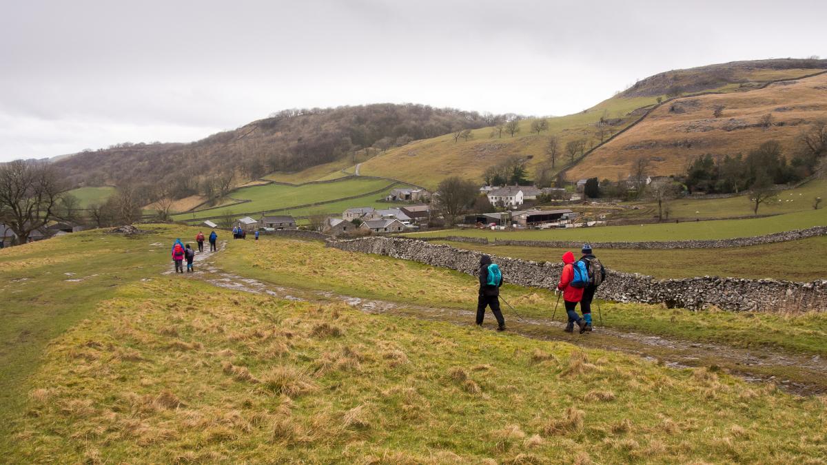
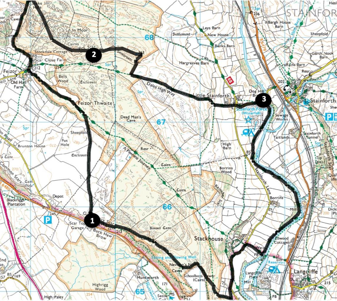
This walk starts from Scar Top, a hill near Settle that some readers may remember was a significant climb for vehicles before the A65 bypass. The walk passes through the hamlet of Feizor and proceeds along the edge of Pot Scar along a path that is not for the faint-hearted! The route then drops down to the River Ribble beside Stainforth Force, follows the riverside for 1.5 miles and returns to the start beside Giggleswick Scar. Start from the layby beside the B6480 opposite Scar Top Garage (grid reference SD 797 657, postcode BD24 0DJ, what3words:///handle.activates.transcribes).
Distance: 8 miles with 1600 feet of ascent
Time: 4.5 hours
Terrain: Grassy footpaths beside some steep drops
Map: OS Explorer OL2
1. Go through the metal gate opposite Scar Top House onto the bridleway signed Feizor and Giggleswick. Ascend between crags and follow the grassy path from a gateway on the left. At a crossing of paths keep ahead at the fingerpost (currently broken) to left of the wall with a tree in its corner.
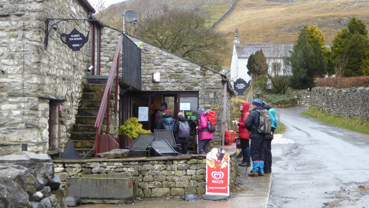
At Feizor (whose name, pronounced “Fayzer”, derives from a landowner’s name, Fech and Old Norse for upland pasture) turn right onto the Pennine Bridleway signed ‘Little Stainton’. The popular Elaine’s Tea Rooms on the left welcomes walkers.
Follow the tarmac lane uphill through a gate. Between a pair of gates turn right signed Hargreaves Barn but leave the path to the right going uphill to the left of rocky outcrops. Cross the stile which is above a bend in a wall.
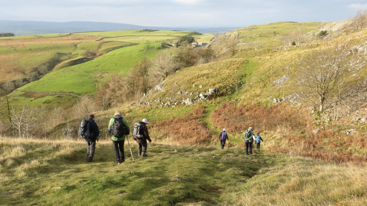
Descend, turning left away from the wall below rocks then ascend to the top of the escarpment. Feizor can be seen below on the right. Cross a ladder stile and continue up to a rock pile that marks the summit of Pot Scar.
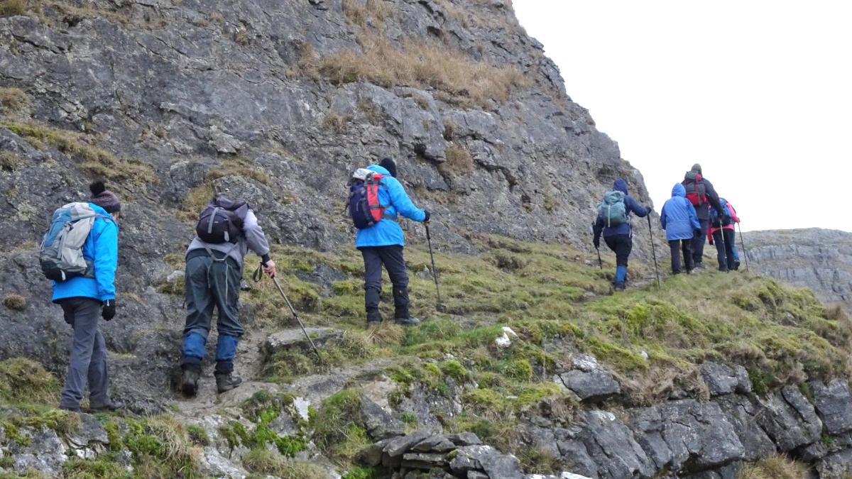
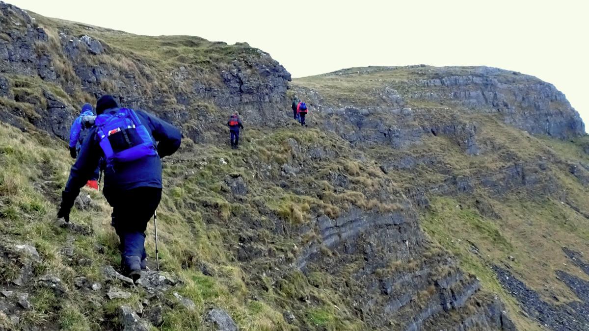
2. Cross a wall stile then follow a path along the edge of Smearsett Scar. This precarious path is an exciting feature of the walk but can be avoided by going above the Scar. The path ascends to an Ordnance Survey trig point: at only 1191 feet Smearsett Scar is one of lowest Yorkshire Dales summit. Descend steeply to the wall ahead and turn right alongside it and cross a ladder stile near the wall’s corner.
Continue alongside the wall and go around its corner to the left to meet the Dales High Way footpath. Go over a ladder stile on the left then walk alongside the wall on the right veering left to a stile on the left of a padlocked gateway. Follow the path and lane down to Little Stainforth and keep straight on at the crossroads.
Walk down the lane past a caravan site and just before the 17th century packhorse bridge over the River Ribble turn right onto the footpath signed Stackhouse.
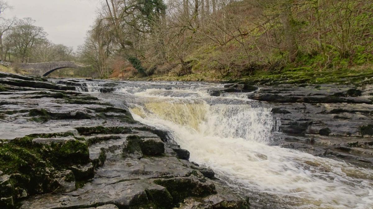
3. Pause to inspect the attractive Stainforth Force then continue along the riverside path. On reaching a weir turn right onto a walled path signed Stackhouse. Turn left onto the road, pass Stackhouse then turn right up steps to a gated stile. Turn left to keep above the road then go over three stiles into a wood. Turn right onto a stony track.
After a metal gate turn immediately right and climb uphill to merge with a wall on the right. Follow the path above the quarry, which closed in 2009. Follow the path below Giggleswick Scar.
After crossing a stile, Scar Top garage appears ahead. Cross another stile then walk up to and over a limestone pavement heading towards a wall ahead. Turn left and descend the path back to where the walk began.


Comments: Our rules
We want our comments to be a lively and valuable part of our community - a place where readers can debate and engage with the most important local issues. The ability to comment on our stories is a privilege, not a right, however, and that privilege may be withdrawn if it is abused or misused.
Please report any comments that break our rules.
Read the rules here