

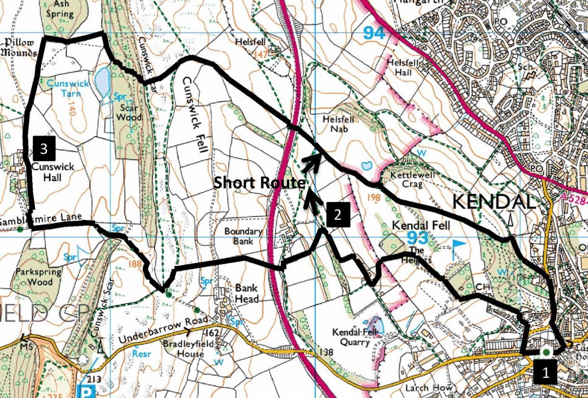
Kendal Fell and Cunswick
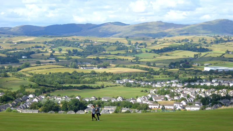
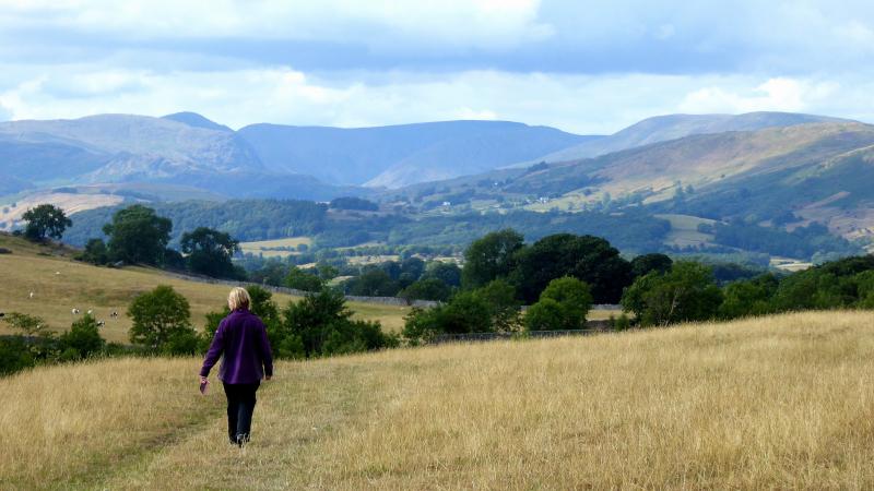
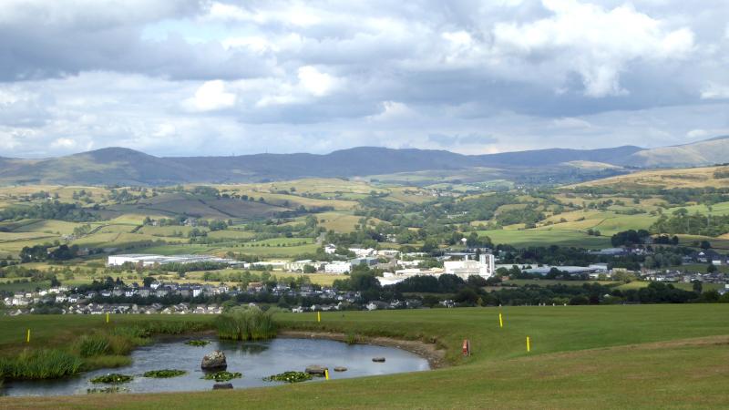
THIS short walk starts from the Rifleman’s Arms, Greenside, which is at the top of Beast Banks, a quarter of a mile from Kendal Town Hall, writes JOHN EDMONDSON. Map reference SD 511 924, postcode LA9 4LD. The walk goes via Kendal Fell over the golf course to Cunswick Hall, past Cunswick Tarn and returns via the north side of the golf course, with commanding views over Kendal.
INFORMATION
Distance: 5 miles with 900 feet of ascent or 2.5 miles with 500 feet of ascent
Time: 2.5 hours
Terrain: field footpaths and golf course
Maps: OS Explorer OL7
ROUTE
1 From the Rifleman’s Arms turn right then right again onto High Tenterfell and keep straight on the signed lane to golf course. Pass the clubhouse and follow the path signed Kendal Fell footpath to Boundary Bank. Bear right at the shed with silver doors to go through woodland and turn right onto a waymarked path. Turn left to go over a stile by a green corrugated hut and through a gate left of an octagonal building with a spire. Turn right onto the lane to reach a cattle grid with a footway on its right. For the short walk keep straight on along a grassy track with splendid views of the fells ahead. Turn right at the outside wall corner to a wall gap in the corner and follow the waymarked path over the golf course as for the longer walk.
2 For the longer walk, stay on the track for a few yards after the cattle grid then turn left through a wicket gate down to the left corner of the field. Go through a kissing gate and along a walled path. Cross Boundary Bank roadway left, then right, and go over a wall stile through woods. Cross the A591 dual carriageway to join a signed footpath, going across the field then along the wall on the right to a stile in the corner. Walk up the field and over a wall stile ahead to a fingerpost. Turn left along a grassy track then right through a gateway signed Gamblesmire Lane. Stay on the track where it bends right then turn right onto the signed field path turning left to go outside the boundary of Cunswick Hall. This recently restored house was originally a 16th Century fortified manor house. Rejoin the track after the hall.
3 After crossing a cattle grid keep straight ahead along a wall on the right then turn right over a stile into Ash Spring Woods. Leave the woods, cross a meadow to Star Wood and turn right to the end of Cunswick Tarn. The path then ascends to Cunswick Scar. At the gate bear left, heading past a tree to a wall edge and following the wall round to the right. Cross a meadow to a footbridge over the A591. Follow the yellow waymarkers or take the alternative path avoiding the golf course. Go through a wall gap into Serpentine Wood and keep left to descend to Serpentine Road. The woods were planted as a job creation scheme in 1824 and set out as walks and flowerbeds. A cottage that could be rented was built. The Summer House was built in 1833. Throughout most of its life the wood suffered damage by visitors and in 1985 Kendal Civic Society restored it. It is now maintained by South Lakeland District Council. Kendal Conservation Volunteers are working to create a Victorian woodland fern garden. Turn right then keep left and descend Mount Pleasant to Beast Banks where you turn right for the Rifleman’s Arms.
NB: restrictions on space mean that this article provides a general summary of the route. It is advisable for anyone who plans to follow the walk to take a copy of the relevant Ordnance Survey map.


Comments: Our rules
We want our comments to be a lively and valuable part of our community - a place where readers can debate and engage with the most important local issues. The ability to comment on our stories is a privilege, not a right, however, and that privilege may be withdrawn if it is abused or misused.
Please report any comments that break our rules.
Read the rules here