
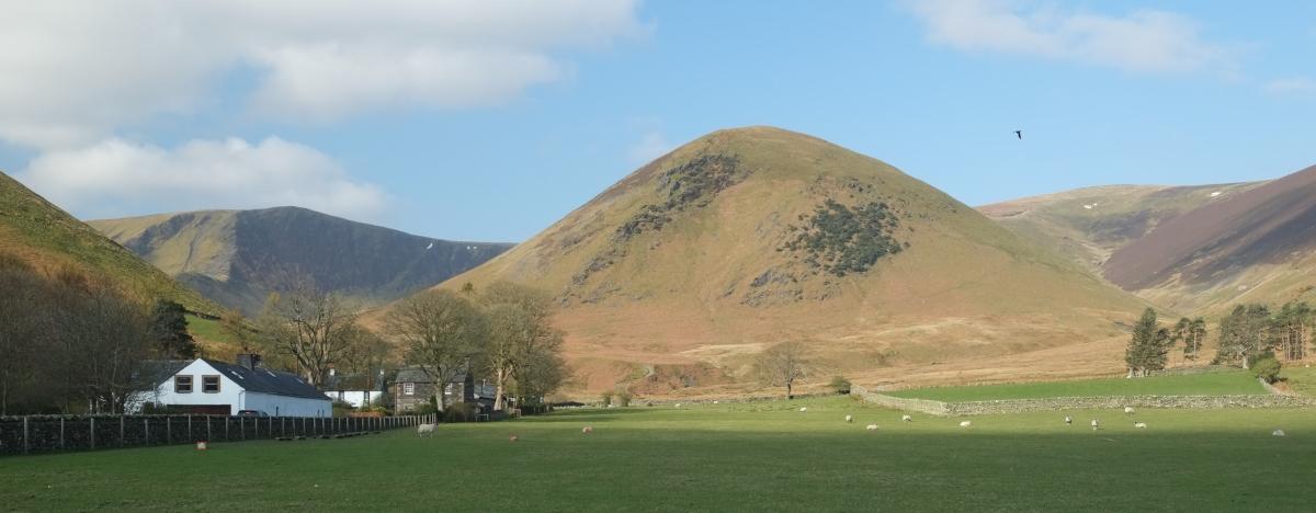
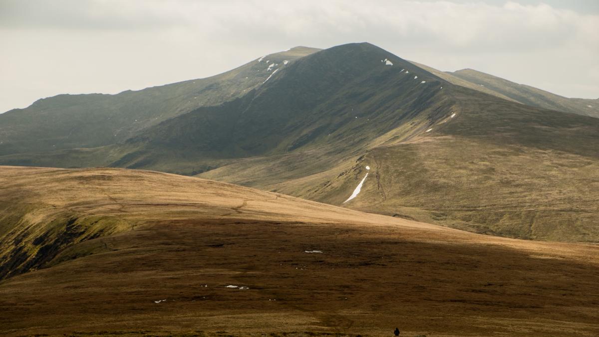
BOWSCALE Tarn sits in an amphitheatre of crags away from the busy fell walking area of the central Lake District, writes JOHN EDMONDSON. Its wild and moody setting is peaceful and quiet. Take an easy walk from Mungrisdale to the tarn then climb the 2,316-feet Wainwright of Bowscale Fell. Descend via Bannerdale then cross Bullfell Beck and bog via a new footbridge and paved path.
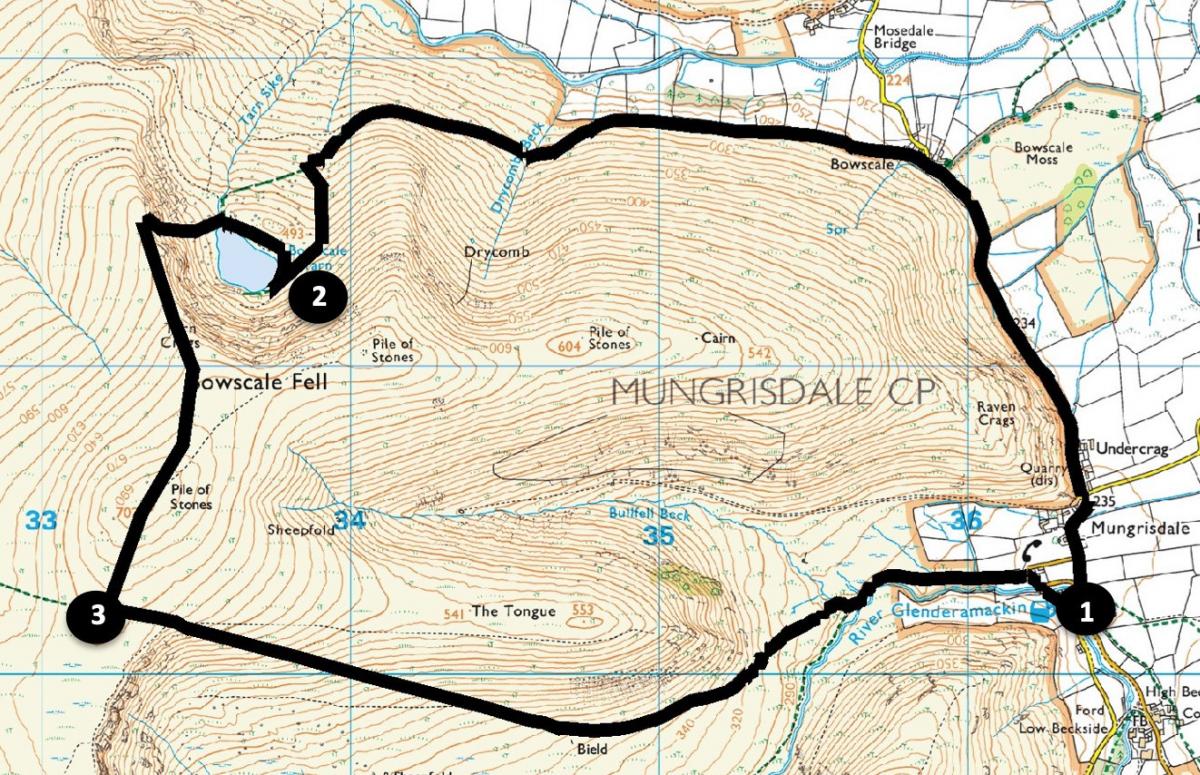
Park on Mungrisdale village green or opposite the village hall, grid reference NY 363 302, postcode CA11 0XR, each with £2 honesty boxes.
INFORMATION
Distance: 6 miles with 2,000 feet of ascent
Time: 3.5 hours
Terrain: stony tracks, fell paths (includes short easy scramble) and 1 mile of quiet road.
Maps: OS Explorer OL5
ROUTE
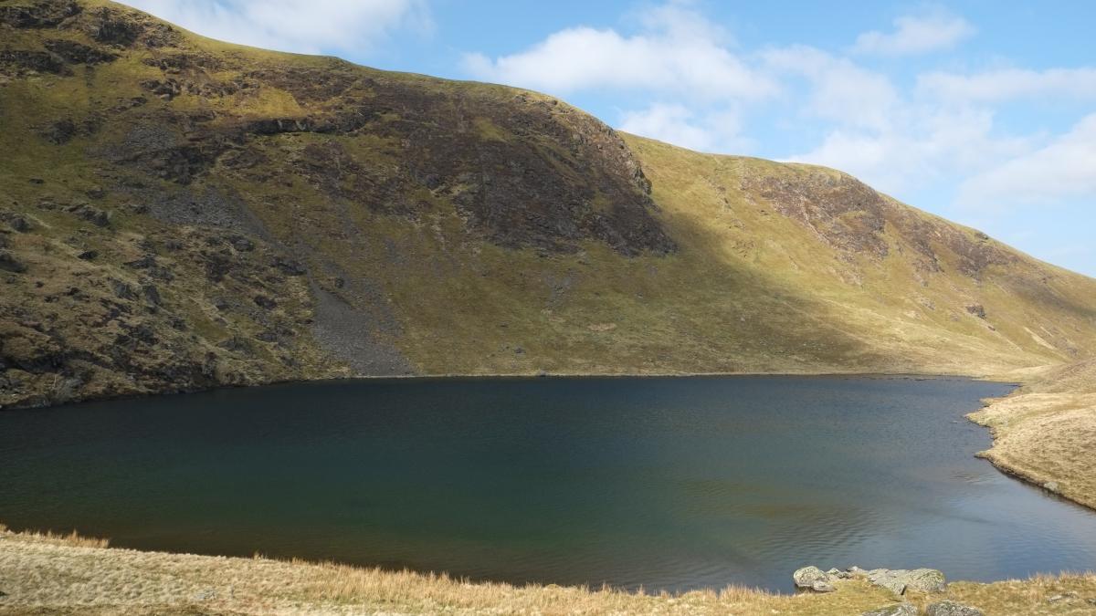
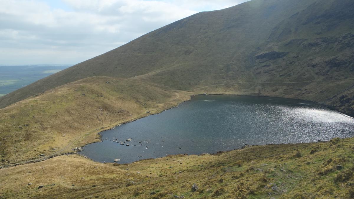
1 From the village hall follow the road for one mile to the hamlet of Bowscale. Its name may refer to the sweeping curves of the fell plus Old Norse skali, a shieling (an outlying pasture with huts). Where the road bends right at Holme Farm carry straight on the bridleway signed Bowscale Tarn. This stony track was used in Victorian times to bring visitors by pony up the Caldew valley to visit the tarn. Directly opposite the wood and houses at Roundhouse the track swings left towards the hanging valley (or corrie) containing Bowscale Tarn. The track then bends right to go below a steep hill below the tarn. This hill was formed by glacial moraine: rocks and debris deposited by the ice as it descended from the summit to join the deeper Caldew glacier. Leave the track at the bend keeping straight on to climb the steep grassy slope. Head to the left of the rise, where Bowscale Tarn suddenly appears ahead.
2 Descend towards the tarn then turn right and walk around its edge to the end of the tarn. According to legend, two immortal fish lived in this 56-feet deep tarn. Those who enjoy wild swimming here must know that the water temperature plunges alarmingly over deeper parts of the tarn. Turn left to cross its outlet (Tarn Syke) and follow a steep uphill zigzag path. Grassy steps aid ascent but note there is a short easy scramble over rocks nearer the top. Meet a main path and turn left to head directly to the stone shelter on the summit of Bowscale. Continue ahead towards Blencathra, descending to a plateau. Turn left at a path junction marked by a small (one foot high) vertical slate.
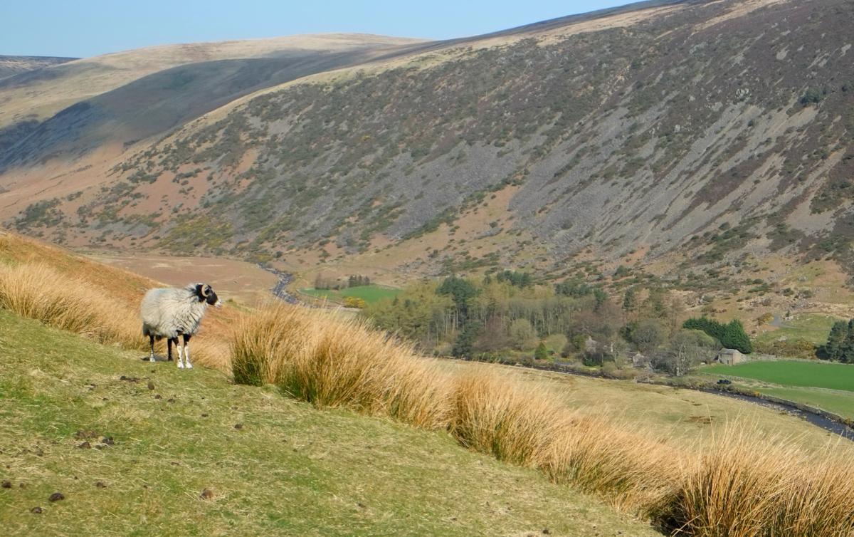
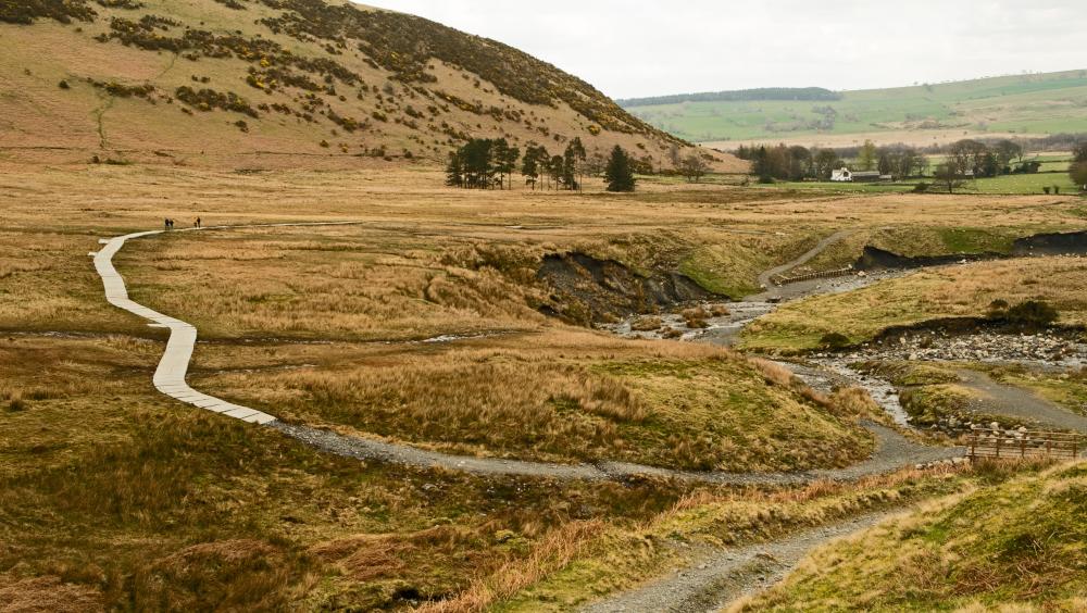
3 Follow the path down the side of Bannerdale to the right of The Tongue. Cross the footbridge over Bullfell Beck and walk along the new paved footpath. Storm Desmond destroyed the original route (now in the middle of the river) in December 2015. The new path and bridge were built by the Lake District National Park Authority alongside other agencies. To avoid damaging the peat bog, which is a Site of Special Scientific Interest, each of the 800kg Rossendale gritstone flags (which will darken in time) were flown to site by helicopter and laid with only one machine pass. Follow the path and road back into Mungrisdale. Turn right at the junction and after passing (or visiting) the Mill Inn turn left and cross the bridge to the village hall. Storm Desmond also damaged the original bridge here and this replacement, completed in November 2017, was the 50th bridge repair to that date.
Next week: Rusland Valley from Colton
NB: restrictions on space mean that this article provides a general summary of the route. It is advisable for anyone who plans to follow the walk to take a copy of the relevant Ordnance Survey map.


Comments: Our rules
We want our comments to be a lively and valuable part of our community - a place where readers can debate and engage with the most important local issues. The ability to comment on our stories is a privilege, not a right, however, and that privilege may be withdrawn if it is abused or misused.
Please report any comments that break our rules.
Read the rules here