
Ings to Outrun Nook
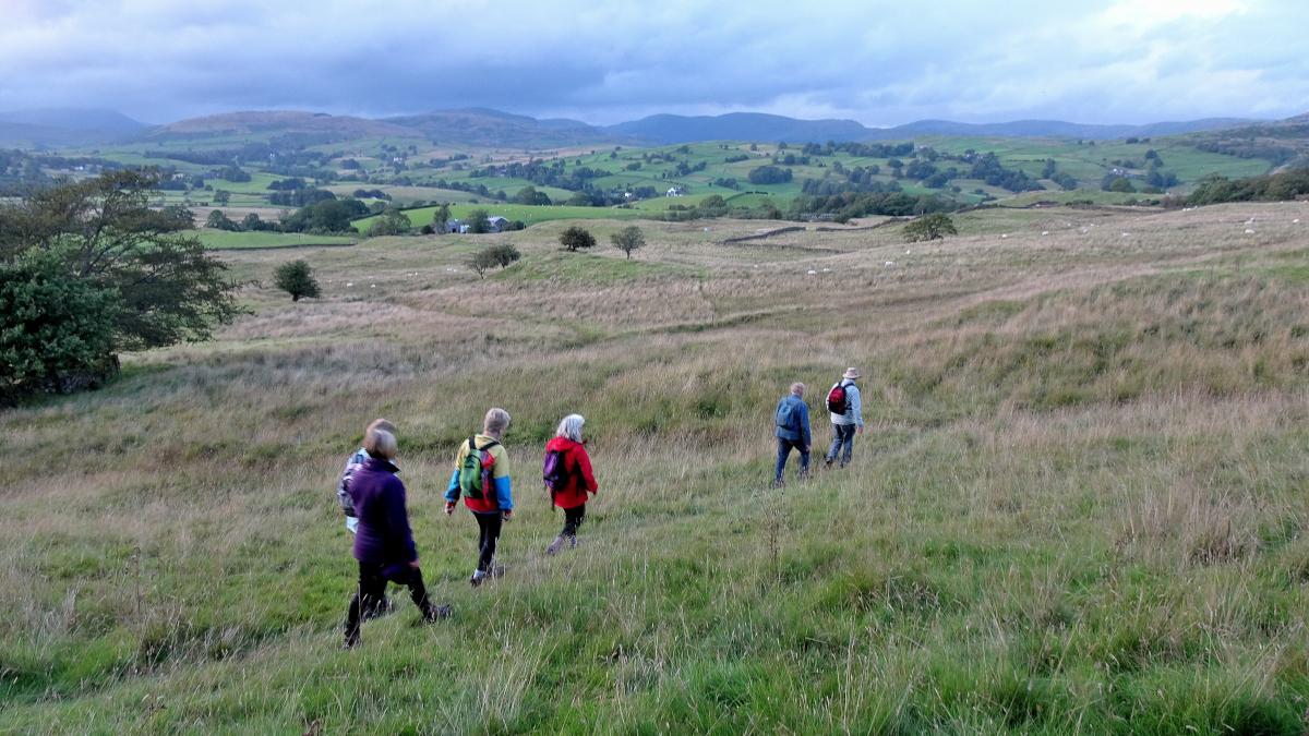
OF THE 16 million people who travel to the Lake District by road each year a high proportion pass through Ings, writes JOHN EDMONDSON. Very few stop here for a walk so it’s a good place to enjoy a peaceful stroll through our lovely countryside.
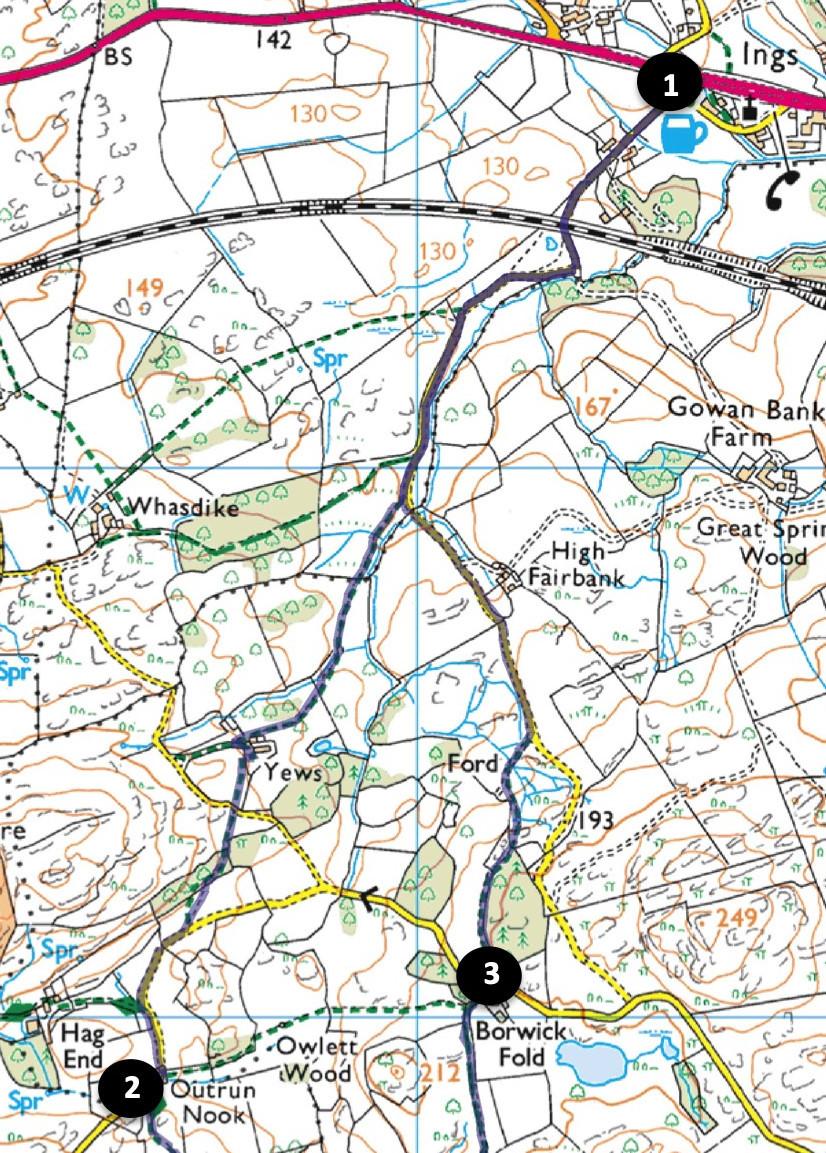
Start from the junction of minor roads south of the A591 on the west side of Ings - near a bus shelter, map reference SD 444986, postcode LA8 9PY.
INFORMATION
Distance: 4 miles with 450 feet of ascent
Time: 2 hours
Terrain: good footpaths and quiet lanes
Map: OS Explorer OL7
ROUTE
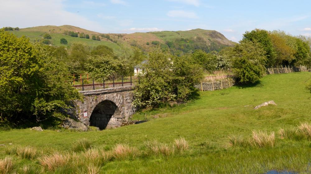
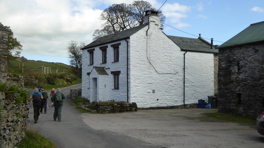
1 Walk up the minor road in a southwesterly direction for half a mile, going through a road gate and under a railway bridge. Pass two fingerposts to the right and take the third, signed Yews, prior to a second road gate. Go through a kissing gate then straight ahead to pass well to the right of a power line pole to a kissing gate on the left of oak trees. Walk up to the right of the house (Yews) and go through a kissing gate just beyond a buff coloured barn. Cross a lane via a pair of stiles/gates and continue above the fence to a kissing gate. Turn left down the road then immediately right onto a signed footpath. Cross a gated step stile then go along the lower edge of a coppice, over a fence stile on the left then bear right across a field to a road. Turn right and follow the gated road to Outrun Nook. From passing Hag End you join the Dales Way for the next three quarters of a mile.
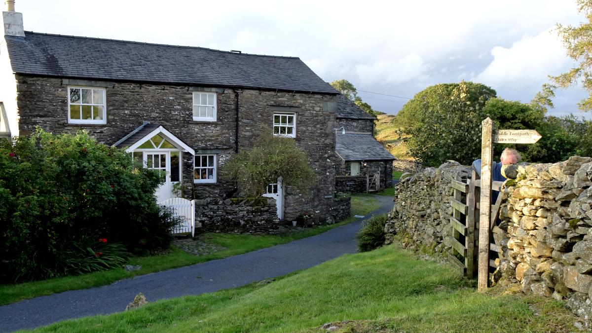
2 At Outrun Nook and take the second left footpath, which is just past the cottage. The derivation of Outrun Nook’s name is a bit like a game of Chinese Whispers played over a period of centuries. In the 12th century it was called Thoue Tarne. By the 19th century this had transformed to Towtron and the word Nook (a corner of land) was added. By then the tarn had diminished to a boggy area. Towtron then changed to Owtrun, later spelt Outrun. At the approach to Crag House farm turn left around the outside of a wall, past a fingerpost currently painted pink, then go through the middle of three gates. Descend beside the wall on the left to a gate/stile then walk up past gorse bushes. Turn left just before woodland onto the bridleway signed Borwick Fold. Fold is an Old English word for an animal pen. Go through a gate then head towards the left of the green farmhouse of Borwick Fold. The path goes beside a wall on the right and along a gated farm track to meet a minor road.
3 Turn right and after 20 yards left onto the signed footpath alongside a barn and through a gate or over the adjacent stile. Follow the path beside a wood on the right, through the corner of the wood via two gated step stiles then down a faint path to an unfenced road. Turn left and follow the gated road back down to Ings. Although the resident population of Ings is only about 150, the village is home to numerous businesses. The filling station, shop and motorhome centre are obvious but there is also a café, bike shop, inn, winery, guesthouses and the recently opened Lakeland Farm Visitor Centre. The Watermill Inn has its own brewery, whose beers’ names have a canine theme, such as Golden Retriever, Ruff Justice, Collie Wobbles and (my favourite) Isle of Dogs.
Next week: Ulverston and Bardsea
NB: restrictions on space mean that this article provides a general summary of the route. It is advisable for anyone who plans to follow the walk to take a copy of the relevant Ordnance Survey map.


Comments: Our rules
We want our comments to be a lively and valuable part of our community - a place where readers can debate and engage with the most important local issues. The ability to comment on our stories is a privilege, not a right, however, and that privilege may be withdrawn if it is abused or misused.
Please report any comments that break our rules.
Read the rules hereLast Updated:
Report this comment Cancel