
Ulverston and Bardsea
TAKE a walk out of Ulverston to the coast at Bardsea passing a Quaker Hall, a Druid’s stone circle and a Buddhist temple, writes JOHN EDMONDSON. A gentle climb up Appleby Hill is rewarded by splendid views over Morecambe Bay and the rest of the walk is practically flat.
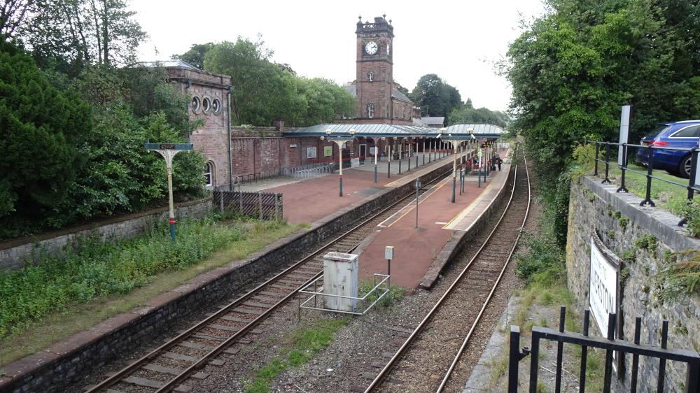
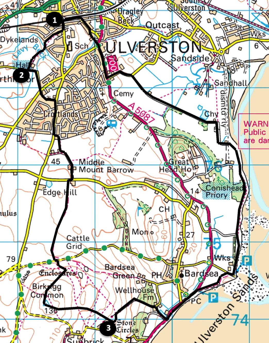
The walk goes from Ulverston railway station, map reference SD 284 778, postcode LA12 0DP.
INFORMATION
Distance: 8 miles with 500 feet of ascent.
Time: 4 hours
Terrain: good footpaths and quiet lanes.
Maps: OS Explorer OL6 and OL7
ROUTE
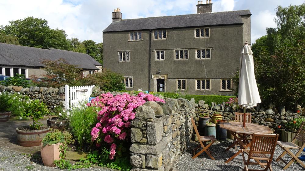
1 From the station access road turn right onto Springfield Road. At roadside railings turn right onto the footpath signed Swarthmoor Hall. Cross the footbridge over Levy Beck into fields onto a path to the hall. Swarthmoor Hall is a 16th century grade II listed building surrounded by peaceful gardens. The hall was built by lawyer George Fell and passed down to his son Thomas. The founder of the Quaker movement, George Fox, visited Swarthmoor Hall in 1652 and stayed there intermittently throughout his life. After Thomas Fell died, George married Thomas’s wife Margaret. The hall is now used for courses and retreats. There is a café and gift shop on site.
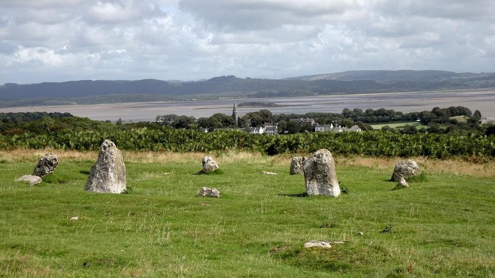
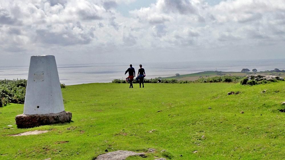
2 Turn left along the road, cross Ursworth Road onto Meeting House Lane. Turn right onto Mountbarrow Road and left at the Esso filling station onto Bigland Drive. Turn right on Park Head Road but keep straight on where it bends left. Go through a kissing gate and along the path to a house then left along a farm lane past the farm to Red Lane. Turn right then left beside a bungalow onto the path signed Bardsea Green. Follow the green lane to a stile and gate at the bottom of Birkrigg Common. At the road turn left then right onto the grassy path signed Appleby Hill. Take the best path uphill to the ordnance survey column at its summit. Keep ahead then swing left, heading in the general direction of Bardsea church. Descend the wide grassy path parallel to a road on the right to reach the Druid's stone circle. It consists of two roughly concentric stone rings. Only about 30 such circles exist in the UK, the best example being Stonehenge, with no others in Cumbria.
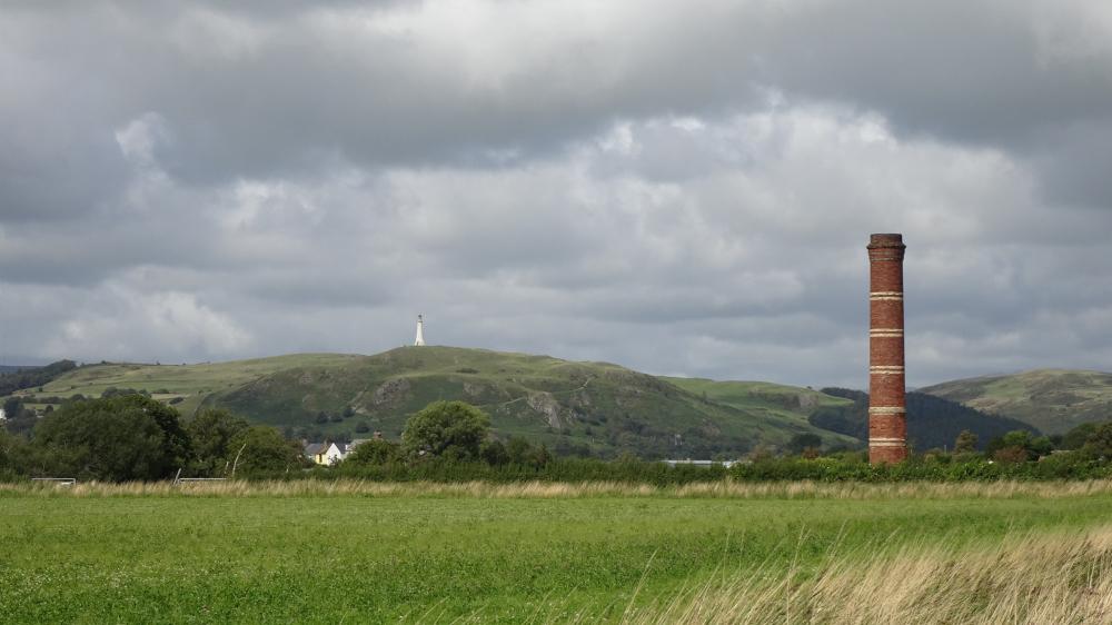
3 Turn left towards Bardsea, left at the wall then right to go through a metal gate along a stony track. Turn right onto the footpath signed The Shore. Cross the A5087, turn left, go through the car park (perhaps stopping for an ice cream) and walk along the shore. Follow the bridleway signed Cooper Lane. Turn right at the Kingfisher factory to Cooper Lane car park then follow the coastal path signed Sandhole. Pass, or take the opportunity of a six-minute excursion to the modern Buddhist Temple for World Peace at Conishead Priory. At a parking area turn left along a tarmacked lane past a house. Stay on the lane, bending left past a brickworks chimney. Brickmaking using local clay, was carried out here from the 18th century until about 1900. Follow the straight and quiet Brick Kiln Road with a view of the Hoad monument to the right. Turn left at the junction and right onto the A5087 roadside pavement. Near the scouts and air cadets building fork left onto a footpath left of the white Sir John Barrow Cottage. The Hoad Monument was built to commemorate Sir John Barrow, who as Second Secretary to the Admiralty, promoted Arctic voyages. Cross Dragley Beck, turn left and keep left on Park Road. Turn left after the Devonshire Arms before the railway bridge and walk up Conishead Road back to the station.
Next week: Sandside
NB: restrictions on space mean that this article provides a general summary of the route. It is advisable for anyone who plans to follow the walk to take a copy of the relevant Ordnance Survey map.


Comments: Our rules
We want our comments to be a lively and valuable part of our community - a place where readers can debate and engage with the most important local issues. The ability to comment on our stories is a privilege, not a right, however, and that privilege may be withdrawn if it is abused or misused.
Please report any comments that break our rules.
Read the rules here