
AROUND SKIDDAW
QUITE often, we set off with the intention of climbing a high Lakeland fell when the weather makes such a climb unwise, writes JOHN EDMONDSON. Usually, there’s a sensible alternative. In this walk, the original target was Skiddaw, but a circuit using the Cumbria Way provided a good alternative. This is a linear walk to Keswick starting from High Side at the Orthwaite junction off the A591, half a mile north of Ravenstone Manor Hotel. To get to the start use the 554 (Carlisle) bus, departing Keswick at 9.30am, Monday until Saturday, and 10.30am on Sundays.
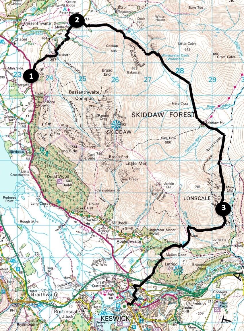
Start walking from High Side, map reference NY 234 306, postcode CA12 4QG.
INFORMATION
Distance: 11 miles with 2,000 feet of ascent
Time: 5.5 hours
Terrain: grassy paths and stony tracks
Map: OS 314 and OL4
ROUTE
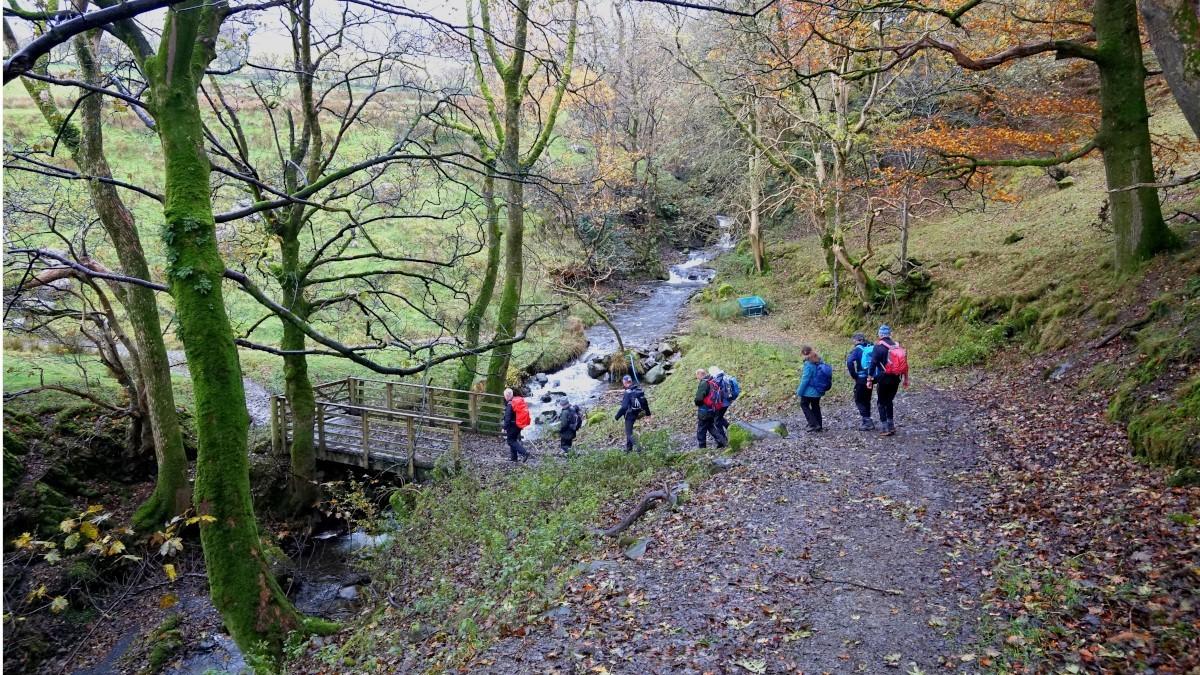
1 Walk up the road signed ‘Orthwaite 3’ for a quarter of a mile then turn right onto the bridleway signed Barkbeth. Keep left and follow the grassy path leading up to a gate. Continue ascending to the right of trees to a ladder stile next to a gate. The village of Bassenthwaite can be seen below to the left. Walk alongside a wall on the left and pass to the right of the house at Barkbeth, along a permissive path turning left through a wicket gate. The woodland path descends to a tumbled barn where you turn right onto a bridleway and cross a footbridge over the Gill. Follow the grassy track leading to woodland and cross Mill Beck via a shallow ford. On meeting a road turn right. After 600 yards you meet the Cumbria Way and turn right, signed Skiddaw House. The remaining nine miles of the walk follows this clear track all the way to Keswick.
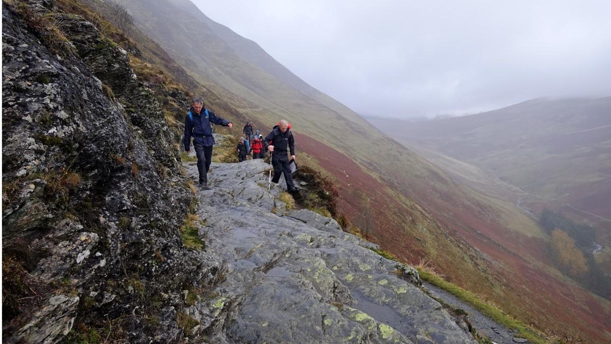
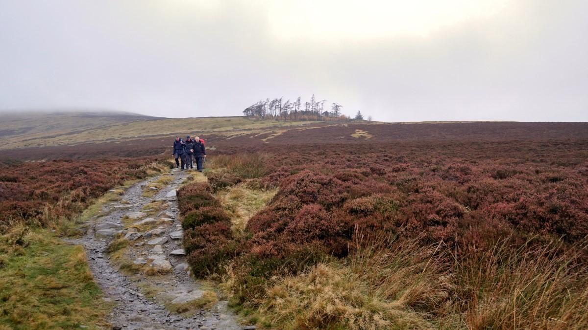
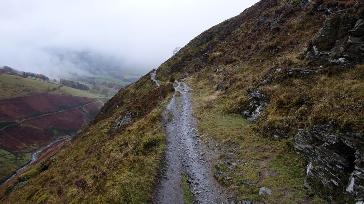
2 Walk along the tarmacked lane for 0.8 mile then fork right onto the stony track going uphill to pass Whitewater Dash waterfall. Above the falls the track goes through a gateway. At this point (if the weather is suitable) those who came prepared to tackle the lofty fells have a second chance by following the wall on the right up Birkett Edge to Bakestall and on to the summit of Skiddaw. Otherwise, continue along the track to Skiddaw House, at 1,550 feet altitude the highest hostel in Britain. The Way goes around to the left of the hostel, descends to cross Salehow Beck and goes through a gateway. Keep right at a path junction and continue along the west side of Glenderaterra valley, culminating in a dramatic ledge (perhaps a bit scary for some) around Lonscale Crags.
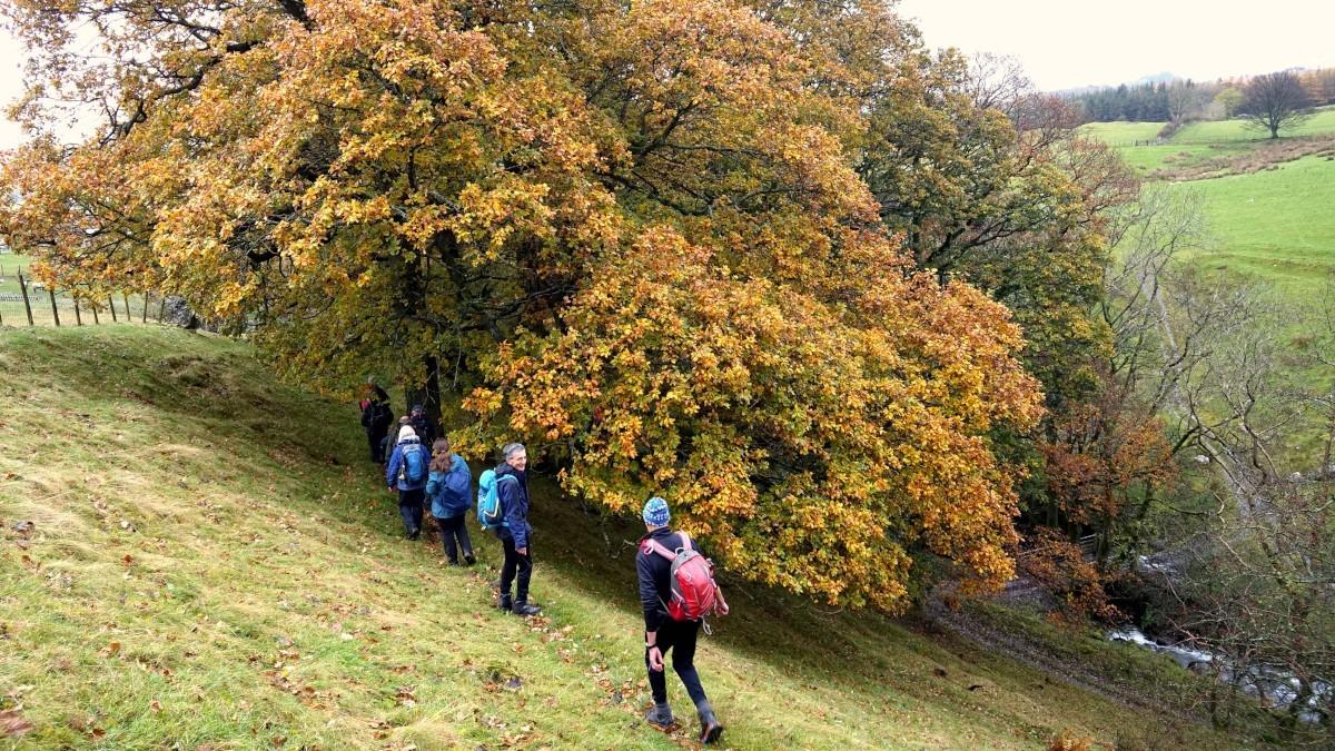
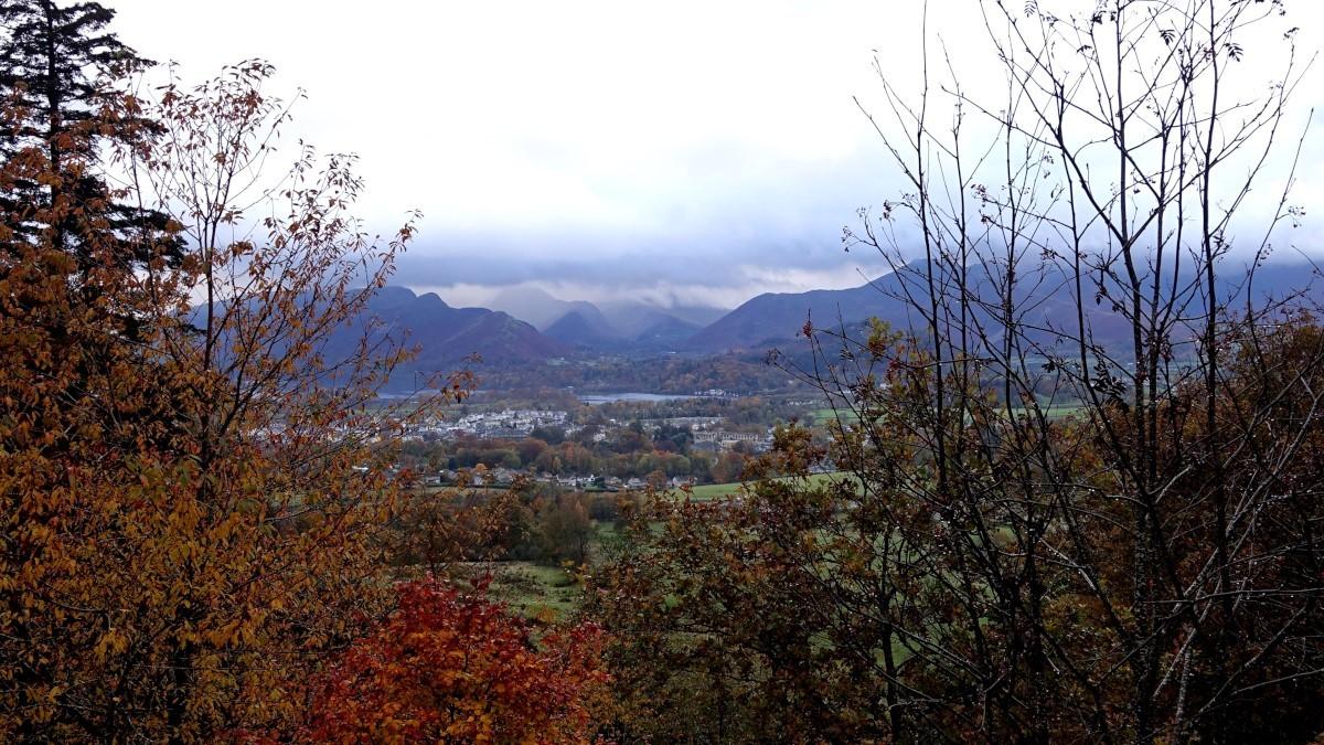
3 The Way swings right (west) and meets the Underskiddaw Car Park. Turn right to go through the car park then left, signed Keswick. The descending path offers great views over Keswick to Cat Bells, Causey Pike and the more distant fells. After crossing a high-level bridge over the A591 turn right on Brundholme Road. After 200 yards turn left into Fitz Park and follow the path past the BMX track to the River Greta. Cross the footbridge, turn left then right at Otley Road Car Park to Bank Street. To reach the bus station, turn right, right at the traffic lights onto Main Street then left at the mini roundabout to the bus station past Booths supermarket on the right.
Next week: Bethecar Moor
NB: restrictions on space mean that this article provides a general summary of the route. It is advisable for anyone who plans to follow the walk to take a copy of the relevant Ordnance Survey map.


Comments: Our rules
We want our comments to be a lively and valuable part of our community - a place where readers can debate and engage with the most important local issues. The ability to comment on our stories is a privilege, not a right, however, and that privilege may be withdrawn if it is abused or misused.
Please report any comments that break our rules.
Read the rules here