
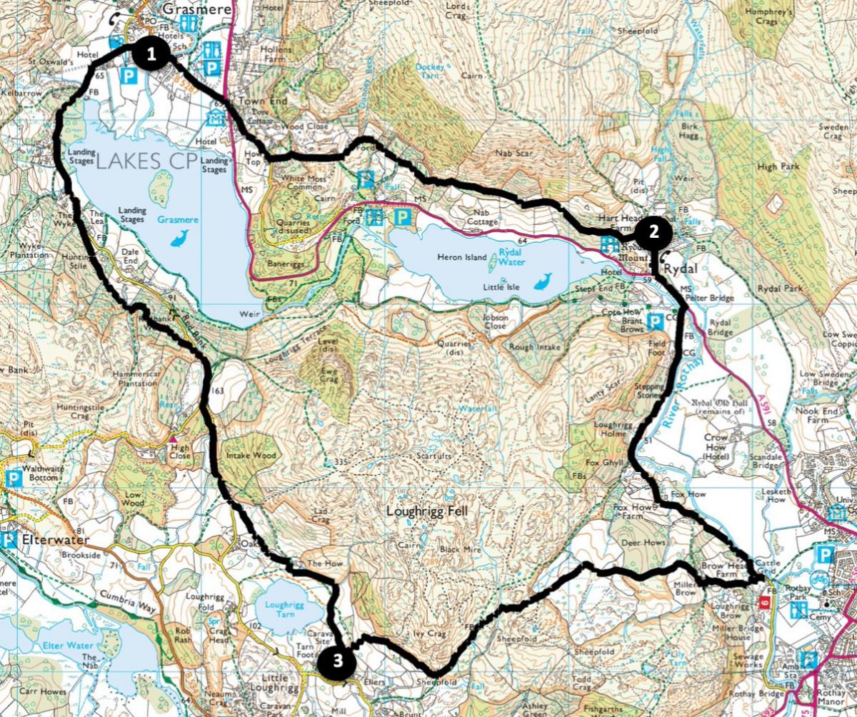
This hilly all-weather walk from the village of Grasmere is half on tarmac and the rest on stony tracks and paths although it’s not suitable for wheelchairs. With beautiful scenery, great views and Lakeland tarns, this energetic walk showcases a wonderful area that was loved by Wordsworth. Start from beside St Oswald’s church, Grasmere (grid reference NY337 073, postcode LA22 9SW, what3words: ///discloses.cute.writing).
Distance: 8.5 miles with 1800 feet of ascent
Time: 4-5 hours
Terrain: Stony tracks and tarmac roads.
Map: OS Explorer OL7
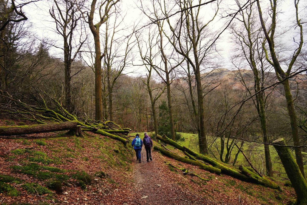
1. Walk out of Grasmere along Stock Lane past the car park. Cross the A591 via the central reservation near the mini-roundabout, turn left then bear left up the lane past Dove Cottage. Pass the first junction then turn left onto the uphill No Through Road signed ‘Coffin Route to Rydal’. The next 1.5 miles of the walk follows a path where the deceased were carried to St. Oswald’s church in Grasmere, which until the 16th century was the only parish church in the area. Pass the lily-covered Whitemoss Tarn, also called Wordsworth’s Tarn. The path ahead includes a short section that is unsuitable for wheelchairs.
After a large embankment wall (part of the Thirlmere aqueduct) take the path going beside a wall on the right to avoid an awkward rocky section. Shortly after a ‘money tree’ the path passes Nab Well, which was loved by William and Dorothy Wordsworth, who drank from it and planted flowers and ferns around it. When threatened with leaving Rydal Mount he lamented, “O pellucid Spring! Insensibly the foretaste of this parting Hath ruled my steps, and seals me to thy side…”
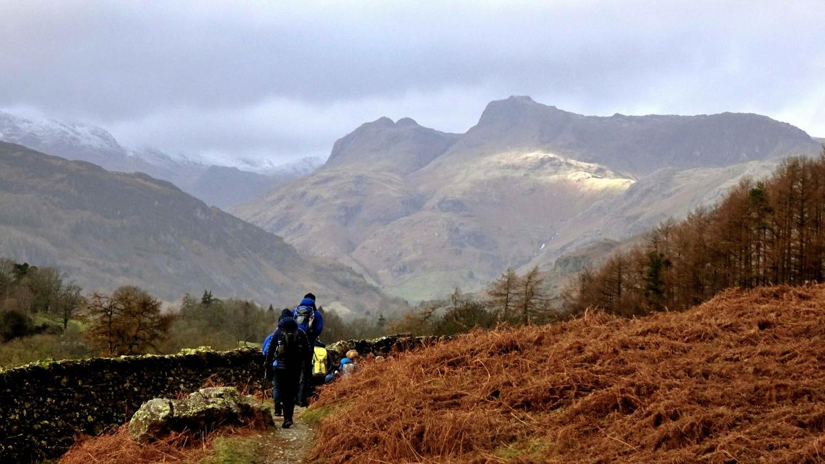
2. On reaching a tarmac lane, turn right and descend past the late 16th century house of Rydal Mount, Wordsworth’s family home from 1813 until his death in 1850. At the bottom of the hill turn left and walk alongside the A591 for 250 yards then turn right to cross Pelter Bridge. Walk along the level minor road beside the River Rothay for 1.2 miles. After 0.5 mile, at Fox Ghyll, you could shorten the walk by a mile by turning right onto the footpath signed Loughrigg Fell, but this is a rough steep path. Continue along the lane towards Ambleside but before reaching Miller Bridge turn right onto a bridleway. Follow the steep uphill lane to Browhead and Pine Rigg, bending sharp right and continue along the stony track for the next 1.5 miles. Spectacular views of the Langdale Fells appear ahead.
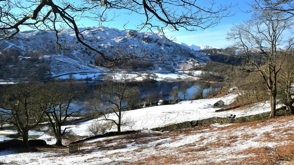
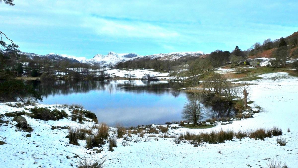
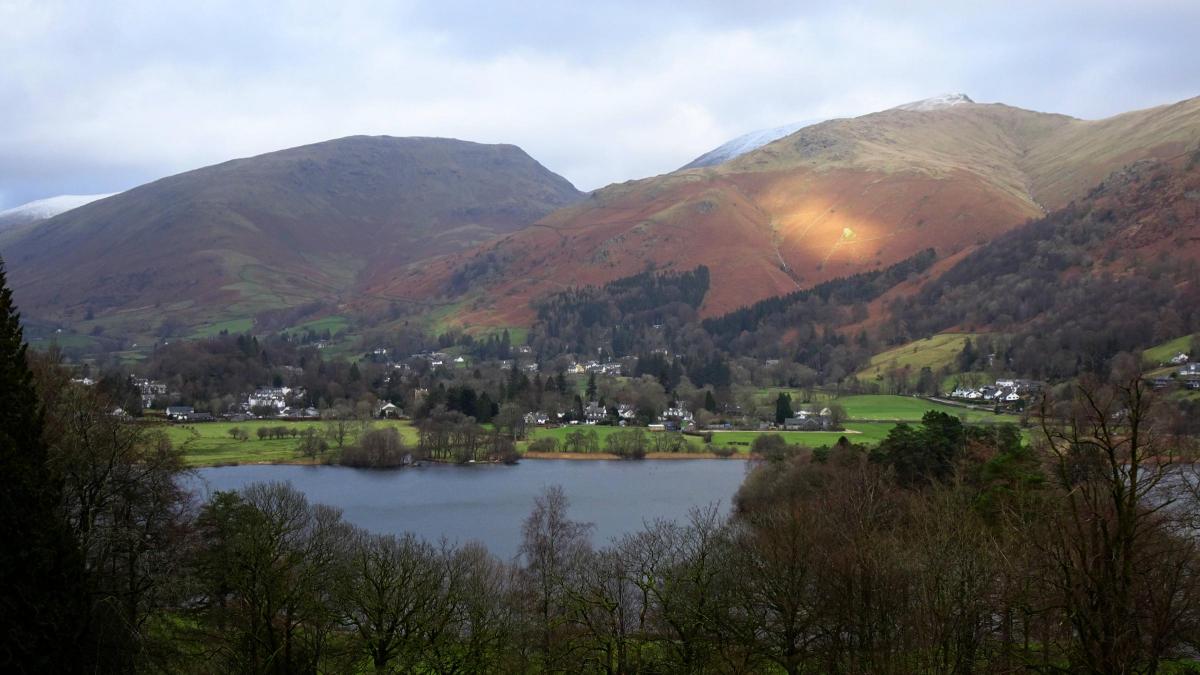
3. Go through a gate and turn sharp right to go through another gate bearing a National Trust sign for Loughrigg Tarn. Now follow this track for 0.8 mile going high above the tarn to meet a road. Turn right and walk up the road for 0.3 mile. A short section of the road can be bypassed by walking parallel to it on a path through High Close Arboretum on the left. The path emerges near a junction with a road entering from the left. Keep ahead to pass over the top of the hill (Red Bank). Bear left onto a stony path next to the ‘Low gear now’ road sign. Follow the well-made path down through Redbank Wood with good views over Grasmere Tarn to the right. Where you meet the track coming from Elterwater and Langdale continue downhill and past the entrance to Hunting Stile. The last mile of the walk is on tarmac: merge with Red Bank road and follow it downhill into Grasmere village, keeping right to go around the garden village and meet Stock Lane opposite the church where the walk began.


Comments: Our rules
We want our comments to be a lively and valuable part of our community - a place where readers can debate and engage with the most important local issues. The ability to comment on our stories is a privilege, not a right, however, and that privilege may be withdrawn if it is abused or misused.
Please report any comments that break our rules.
Read the rules hereLast Updated:
Report this comment Cancel