
Cunsey walk by John Edmondson
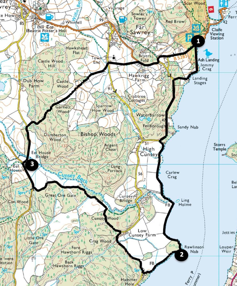
Stroll along a peaceful footpath on Windermere’s west bank, following a short section of the Windermere Way, which is a 45-mile circular walk. This walk leaves the lakeside and follows Cunsey Beck, passing the site of an historic 17th century forge. The final section goes through quiet woodlands, pretty pastures, past the superbly sited church of St Peters and then descends to the lakeside where the walk began. Start from Ash Landing National Trust Pay & Display car park (map reference SD 387 953, post code LA22 0LR, what 3 words ///toggle.irrigate.remark)
Distance: 5 miles with 700 feet of ascent.
Time: 2 - 3 hours
Terrain: Grassy paths and quiet roads
Map: OS Explorer OL7
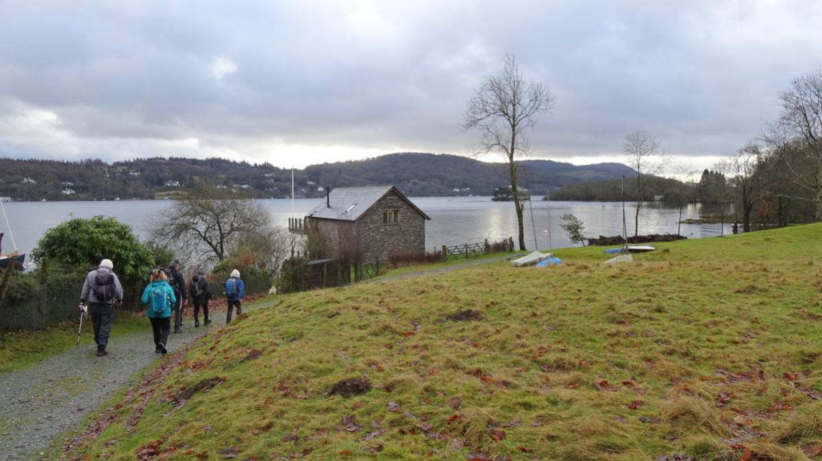
1. From the car park walk along the roadside towards Far Sawrey and where the road bends right keep straight on beside Ash Landing Nature Reserve.
The Reserve is a mosaic of different habitats showing how the landscape changes with the seasons. After passing through a gate the track bends right and becomes a tarmac lane.
Turn left onto the road and pass the place-name sign for Cunsey. Just after passing The Bield turn left onto a signed footpath. Continue along the lakeside path past neat boathouses.
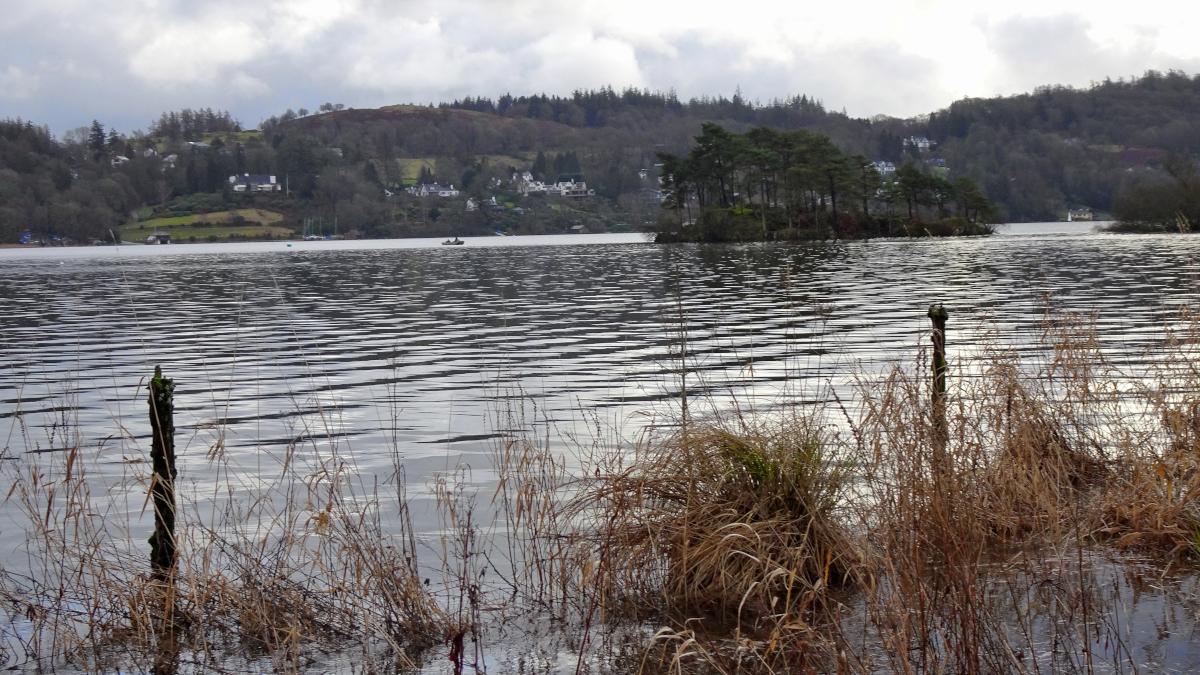
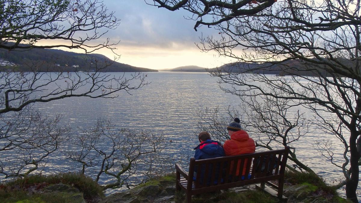
After a mile the tiny island of Ling Holme comes into view. The path continues to Rawlinson Nab, a pretty wooded peninsula where, as Thomas West pointed out in 1799, “the lake spreads out in a magnificent sheet of water”.
The same view can be seen today from a bench seat on the south side of the Nab.
2. Continue along the shore path to meet a road near a modernised stone barn. Turn right and follow the road over a beck and past Cunsey Lodge.
Turn left onto a bridleway opposite a barn and follow the woodland track through Cunsey Wood. Keep right at the first bend as indicated by a waymarker and continue along the track to go along the left side of Cunsey Beck, heading upstream. Cunsey Beck flows out of Esthwaite Water, passes through the small Out Dubs Tarn, then into Windermere: its total length is just over two miles.
Where the track divides, take the left fork, to stay on the same side of the beck. The track passes the site of an historic iron works that started in 1715, operated for 130 years and was demolished in 1800.
It is a rare example of a development from a bloomery to an eighteenth-century blast furnace.
The track crosses a shallow ford and Eel House can be seen across the field on the right.
3. At the road turn right, pass Eel House Cottage and turn right onto the single-track road immediately past Eel House. Cross Eel House bridge and at the top of the slope turn right, going through two gates onto a woodland track.
Bear right at the waymarker and follow the footpath up through the woods then out via a kissing gate onto pastures.
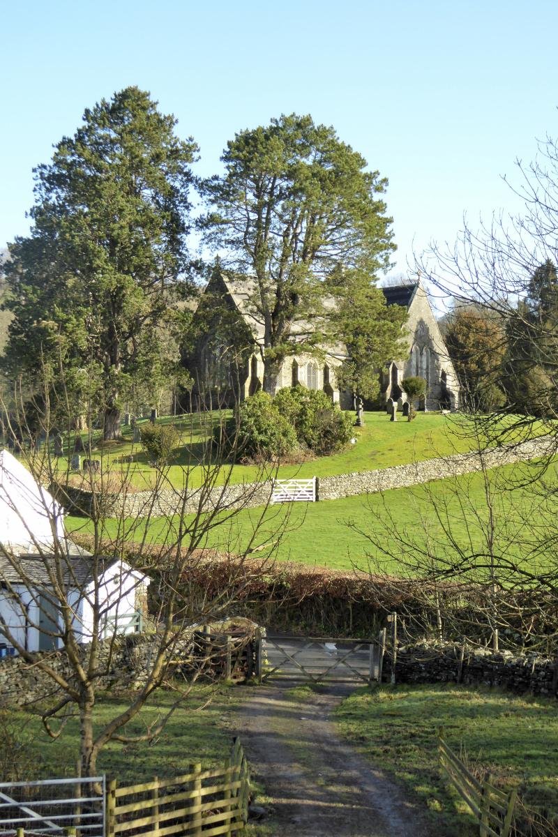
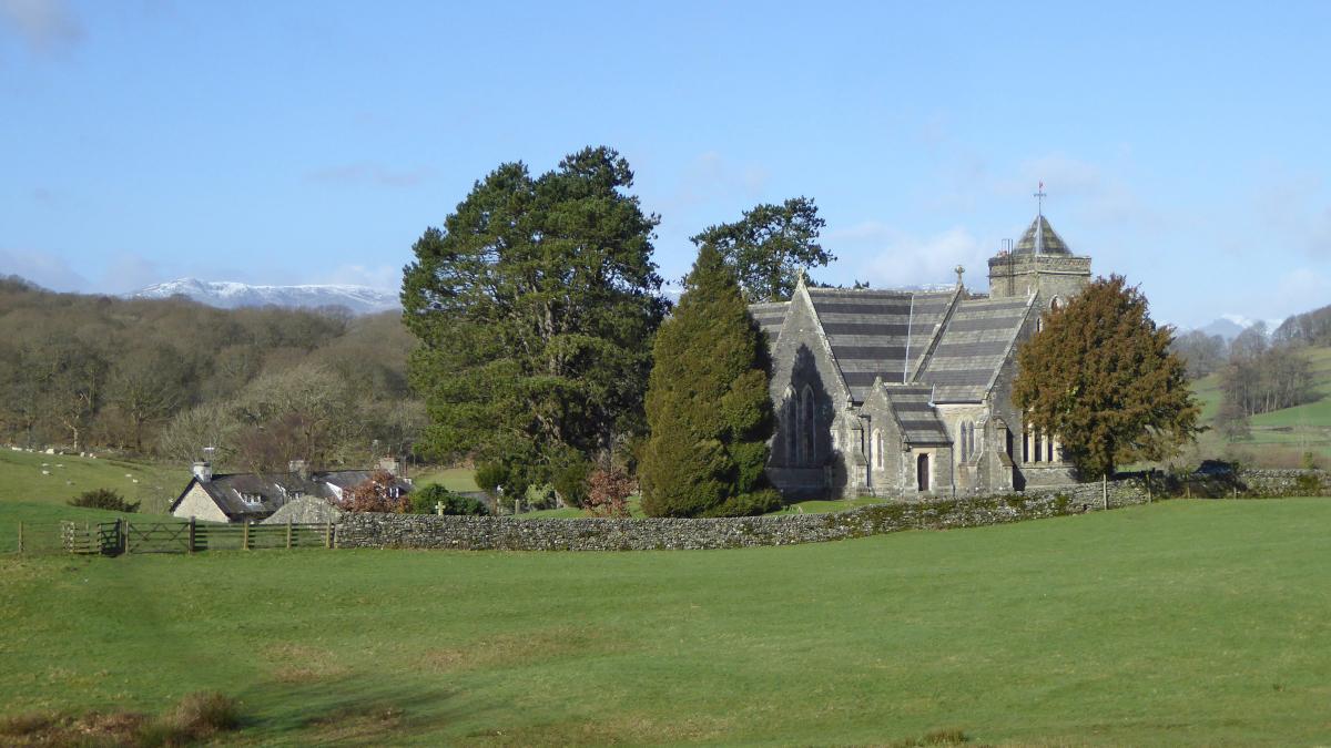
After passing through two more gates keep on the higher path close to a wood on the left descending to a road at Town End opposite St Peters church. Cross the road, turning left then right onto the footpath signed Byers Fold.
The path ascends past the church on the left, goes through two kissing gates then up to a third and along the edge of a wood to meet the B5285. Follow the road back to the car park, using the off-road footpaths after the double bend.


Comments: Our rules
We want our comments to be a lively and valuable part of our community - a place where readers can debate and engage with the most important local issues. The ability to comment on our stories is a privilege, not a right, however, and that privilege may be withdrawn if it is abused or misused.
Please report any comments that break our rules.
Read the rules here